Safety Score: 3,5 of 5.0 based on data from 9 authorites. Meaning please reconsider your need to travel to Turkey.
Travel warnings are updated daily. Source: Travel Warning Turkey. Last Update: 2024-08-13 08:21:03
Discover Paşabahçe
The district Paşabahçe of Umraniye in İstanbul is a district in Turkey about 214 mi west of Ankara, the country's capital city.
Looking for a place to stay? we compiled a list of available hotels close to the map centre further down the page.
When in this area, you might want to pay a visit to some of the following locations: UEmraniye, Mahmut Sevket Pasa, Cekmekoey, Samandira and Istanbul. To further explore this place, just scroll down and browse the available info.
Local weather forecast
Todays Local Weather Conditions & Forecast: 8°C / 46 °F
| Morning Temperature | 7°C / 44 °F |
| Evening Temperature | 7°C / 45 °F |
| Night Temperature | 6°C / 43 °F |
| Chance of rainfall | 0% |
| Air Humidity | 43% |
| Air Pressure | 1034 hPa |
| Wind Speed | Fresh Breeze with 14 km/h (9 mph) from South |
| Cloud Conditions | Scattered clouds, covering 39% of sky |
| General Conditions | Scattered clouds |
Monday, 25th of November 2024
9°C (48 °F)
8°C (47 °F)
Broken clouds, moderate breeze.
Tuesday, 26th of November 2024
10°C (50 °F)
7°C (45 °F)
Overcast clouds, light breeze.
Wednesday, 27th of November 2024
9°C (49 °F)
10°C (50 °F)
Overcast clouds, gentle breeze.
Hotels and Places to Stay
Park Inn by Radisson Istanbul Asia Kavacik
SUMAHAN ON THE WATER
Biz Cevahir Hotel Istanbul
Raffles Istanbul
Hyatt Centric Levent İstanbul
Bosphorus Palace Beylerbeyi
Crowne Plaza ISTANBUL - ORYAPARK
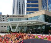
Wyndham Grand Istanbul Levent
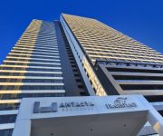
Fraser Place Antasya Istanbul
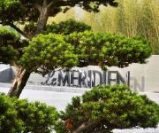
Le Meridien Istanbul Etiler
Videos from this area
These are videos related to the place based on their proximity to this place.
Transformers Oyuncak Hediyeli Dergi, Plastik Hayvanlar ve Lego Oyuncağı
Transformers robotlarının etiketlerini yapıştırabileceğimiz bir dergi, fake lego arabası ve Ali babanın çiftliği şarkısındaki plastik hayvan oyuncaklarını tanıtıyorum. Aldığım...
Istanbul Beykoz with beautiful Athan (Ezan)
Istanbul Beykoz at Summer 2010. Very beautiful Skyline with Athan.
Martilar Istanbul vapurunda, seagulls in the ferry of Istanbul, gaviotas en el ferri de Estambul
Avrupa'dan Asya'ya vapurda gidiyoruz ve çok mari bizlerle geldi. Ekmek ariyorlar From Europe to Asya we were in the ferry and a lot of seagulls came with us. They look for.
İstanbul - my place in the world
Recorded and mixed by Apple iPhone 6+ and iMovie app. November 2014 by Grzegorz Dymon.
Topkapı Palace, Blue (SultanAhmed) Mosque and HagiaSophia/Topkapı Sarayı,Sultanahmet ve Ayasofya
Eminönü - Kadıköy Vapurundan Topkapı Sarayı, Sultanahmet Camii ve Ayasofya / Topkapı Palace, Blue Mosque (Sultan Ahmed Mosque) and Hagia Sophia.
Beykoz Yeniköy Motoru ile seyahatten kısa görüntüler 2012-0468
5 Şubat 2012 Beykoz Yeniköy seyahatinden kısa görüntüler ve Bosphorus prodigy adlı yük gemisi.
Juli 2014: Mit AIDAaura durch den Bosporus-Kanal
Auf Kreuzfahrt mit AIDAaura vom 13.07. bis 27.07.2014 - Route "Schwarzes Meer 2". Die Durchquerung des Bosporus am 17.07.2014 auf dem Weg von Istanbul in Richtung schwarzes Meer. Dauert ...
TURCHIA - NAVIGAZIONE NEL BOSFORO - Bogaziçi - Tra due continenti
Il Bosforo con lo Stretto dei Dardanelli separa il Continente Europeo da quello Asiatico. La sua lunghezza è di circa 30 km, la larghezza nei punti più stretti oscilla tra i 500 e 800 m e...
Videos provided by Youtube are under the copyright of their owners.
Attractions and noteworthy things
Distances are based on the centre of the city/town and sightseeing location. This list contains brief abstracts about monuments, holiday activities, national parcs, museums, organisations and more from the area as well as interesting facts about the region itself. Where available, you'll find the corresponding homepage. Otherwise the related wikipedia article.
Bosphorus
The Bosphorus or Bosporus, also known as the Istanbul Strait, is a strait that forms part of the boundary between Europe and Asia. The Bosphorus, the Sea of Marmara, and the Dardanelles strait to the southwest together form the Turkish Straits. The world's narrowest strait used for international navigation, the Bosphorus connects the Black Sea with the Sea of Marmara (which is connected by the Dardanelles to the Aegean Sea, and thereby to the Mediterranean Sea.
Anadoluhisarı
Anadoluhisarı (Anatolian Castle) is a fortress located in Istanbul, Turkey on the Anatolian side of the Bosporus, which also gives its name to the quarter around it. It was built between 1393 and 1394 by the Ottoman sultan Bayezid I "The Thunderbolt" as part of his preparations for the Second Ottoman Siege of Constantinople, which took place in 1395.
Rumelihisarı
Rumelihisarı (Rumelian Castle) is a fortress located in the Sarıyer district of Istanbul, Turkey, on a hill at the European side of the Bosphorus. It gives the name of the quarter around it. It was built by the Ottoman Sultan Mehmed II between 1451 and 1452, before he conquered Constantinople.
Boğaziçi University
Boğaziçi University is a public university located on the European side of the Bosphorus strait in Istanbul, Turkey. It has four faculties and two schools offering undergraduate degrees, and six institutes offering graduate degrees. Founded in 1863, it is the first American higher education institution founded outside the United States, having strong ties to the American educational system through Robert College.
Fatih Sultan Mehmet Bridge
The Fatih Sultan Mehmet Bridge, also known as the Second Bosphorus Bridge, is a bridge in Istanbul, Turkey spanning the Bosphorus strait . When completed in 1988 it had the 6th longest suspension bridge span in the world; today it is 17th. The bridge is named after the 15th century Ottoman Sultan Mehmed the Conqueror, who took Constantinople in 1453 and ended the Byzantine Empire. It carries the European route E80, Asian Highway 1 and Otoyol 2 highways.
Kuleli Military High School
Kuleli Military High School is the first military high school in Turkey, located in Çengelköy, Istanbul. It was founded on September 21, 1845 by Ottoman Sultan Abdülmecid I.
İstinye
İstinye is a neighbourhood in Istanbul, on the European side of the city. It is located between Emirgan and Yeniköy on the northwestern shore of the Bosporus, within the borough of Sarıyer. It is one of the finest seashore locations on the Bosporus where people walk around during the weekends. İstinye is famous for its cafés and seafood restaurants. A small bay is also among the things that make İstinye a preferred location to visit.
Adile Sultan Palace
Adile Sultan Palace is a former royal residence, which was used later as a school building, and is a cultural centre today located in Kandilli neighbourhood of Istanbul, Turkey.
Küçüksu Palace
Küçüksu Palace or Küçüksu Pavilion, aka Göksu Pavilion, is a summer palace in Istanbul, Turkey, situated in the Küçüksu neighborhood of Beykoz district on the Asian shore of the Bosphorus between Anadoluhisarı and the Fatih Sultan Mehmet Bridge. The tiny palace was used by Ottoman sultans for short stays during country excursions and hunting.
Tarabya
Tarabya is a neighbourhood in Sarıyer district of Istanbul, Turkey. It is located on the European shores of the Bosphorus, between the neighbourhoods of Yeniköy and Kireçburnu. Besides its historical monuments, Tarabya is famous for its fish restaurants, bistros and nightclubs.
Bebek, Istanbul
Bebek is a historic Istanbul neighbourhood that falls within the boundaries and administration of the Beşiktaş district. It is located on the European shores of the Bosphorus and is surrounded by similarly affluent neighbourhoods such as Arnavutköy, Etiler and Rumeli Hisarı.
Yoros Castle
Yoros Castle is a ruined castle at the confluence of the Bosporus and the Black Sea, to the north of Joshua's Hill, in Istanbul, Turkey. It is also commonly referred to as the Genoese Castle, due to Genoa’s possession of it in the mid-15th century.
Khedive Palace
The Khedive Palace or Çubuklu Palace, Çubuklu Summer Palace, (Çubuklu Sarayı); Hidiv Mansion; located on the Asian side of the Bosporus in Istanbul, Turkey, was a former residence of Khedive Abbas II of Egypt and Sudan. The name of the residence is alternatively rendered in English as the Khedive Pavilion or the Khedive Mansion.
Joshua's Hill
Joshua's Hill (Turkish: Yuşa Tepesi or Hazreti Yuşa Tepesi), a hill located on the Asian shore of Bosporus in Beykoz district of Istanbul, Turkey is a shrine containing a mosque and a tomb dedicated to Saint Joshua. The sacred place, 180 to 195 meters (to ft) above sea level, is also an important landmark for vessels coming from the Black Sea. At the summit of the hill is a terrace with benches for the comfort of pilgrims visiting the mosque and the tomb of Saint Joshua.
2008 United States consulate in Istanbul attack
The 2008 United States consulate in Istanbul attack was a result of gunfire on the consulate resulting in six casualties; of which three were the three gunmen, and three Turkish National Police officers. The attack occurred on July 9, 2008 in the morning hours, at a time when the embassy is at full function and an attack is most likely to cause more casualties. It is the responsibility of the host state to take care of security as per Article 30 of the Vienna Convention on Diplomatic Relations.
Aşiyan Asri Cemetery
The Aşiyan Asri Cemetery (Turkish: Aşiyan Asri Mezarlığı) is a burial ground situated on Aşiyan between Bebek and Rumelihisarı neighborhoods on the European part of Istanbul, Turkey. Many renowned intellectuals, writers and artists rest in this small cemetery with a panoramic view at the Bosporus.
Emirgan Park
The Emirgan Park (Turkish: Emirgan Korusu or rarely Emirgan Parkı) is a historical urban park located in Emirgan neighborhood at the Bosphorus in Sarıyer district of Istanbul, Turkey. It is one of the largest public parks in Istanbul.
İstinye Park
Istinye Park is a shopping center in the İstinye quarter of Istanbul, Turkey with 291 stores, 85,250 sqm of retail area, and four levels of underground parking. The center features both enclosed and open air sections. The open air section has a green central park and offers street side shopping. The center includes an authentic Turkish food bazaar- a traditional market place, inspired by Turkish architecture and history.
Elmalı-2 Dam
Elmalı-2 Dam is a dam in Turkey. The development was backed by the Turkish State Hydraulic Works.
Aliuşağı
Aliuşağı (also, Əliuşağı, Aliushagy, and Alyushagy) is a village and municipality in the Samukh Rayon of Azerbaijan. It has a population of 1,672.
Balta-Liman
Balta-Liman is a bay near the European coast of Bosporus, in the city of Istanbul. The name originates from Turkish: Balta - "arch". The bay is famous for the Treaty of Balta Liman, signed between Russia and the Ottoman Empire on May 1, 1849.
Örnekköy
Örnekköy (also called Tepetarla) is a village in Beykoz district of İstanbul Province, Turkey. It is situated forests of the Anatolian (Asian) portion of İstanbul at {{#invoke:Coordinates|coord}}{{#coordinates:41|09|N|29|09|E||| | |name= }}. It is about 8 kilometres east of Beykoz. The population of Örnekköy is 3455 as of 2011.
Bosporus Water Tunnel
The Bosphorus Water Tunnel (Turkish: Boğaziçi Su Tüneli) is an under sea waterway tunnel in Istanbul, Turkey, crossing the Bosphorus strait. It was constructed in 2012 to transfer water from the Melen Creek in Düzce Province to the European side of Istanbul. The infrastructure, built by the Ministry of Forest and Water Management, is 136 m under the sea level, resisting a pressure of 14 bar .
Kandilli Observatory
Kandilli Observatory, or more formally Kandilli Observatory and Earthquake Research Institute (KOERI, Turkish: Kandilli Rasathanesi ve Deprem Araştırma Enstitüsü) is a Turkish observatory, which is also specialized on earthquake research. It is situated in Kandilli neighborhood of Üsküdar district on the Anatolian side of Istanbul, atop a hill overlooking Bosporus.
Kandilli Anatolian High School for Girls
Kandilli Anatolian High School for Girls (Turkish: Kandilli Kız Anadolu Lisesi) is a secondary educational institution located in Kandilli neighborhood of Üsküdar district in Istanbul, Turkey. Known traditionally as Kandilli Kız Lisesi, it is one of the oldest girls' high schools of the country.


