Safety Score: 3,0 of 5.0 based on data from 9 authorites. Meaning we advice caution when travelling to Tunisia.
Travel warnings are updated daily. Source: Travel Warning Tunisia. Last Update: 2024-08-13 08:21:03
Delve into Hammam-Lif
Hammam-Lif in Gouvernorat de Tunis with it's 47,760 habitants is a town located in Tunisia a little south-east of Tunis, the country's capital town.
Time in Hammam-Lif is now 01:14 AM (Monday). The local timezone is named Africa / Tunis with an UTC offset of one hour. We know of 9 airports closer to Hammam-Lif, of which two are larger airports. The closest airport in Tunisia is Tunis Carthage International Airport in a distance of 11 mi (or 17 km), North-West. Besides the airports, there are other travel options available (check left side).
There are several Unesco world heritage sites nearby. The closest heritage site in Tunisia is Archaeological Site of Carthage in a distance of 9 mi (or 14 km), North. In need of a room? We compiled a list of available hotels close to the map centre further down the page.
Since you are here already, you might want to pay a visit to some of the following locations: Ben Arous, Tunis, Ariana, Manouba and Zaghouan. To further explore this place, just scroll down and browse the available info.
Local weather forecast
Todays Local Weather Conditions & Forecast: 21°C / 70 °F
| Morning Temperature | 17°C / 63 °F |
| Evening Temperature | 20°C / 68 °F |
| Night Temperature | 18°C / 64 °F |
| Chance of rainfall | 0% |
| Air Humidity | 63% |
| Air Pressure | 1018 hPa |
| Wind Speed | Gentle Breeze with 6 km/h (4 mph) from South-East |
| Cloud Conditions | Broken clouds, covering 75% of sky |
| General Conditions | Broken clouds |
Tuesday, 19th of November 2024
22°C (72 °F)
19°C (67 °F)
Sky is clear, light breeze, clear sky.
Wednesday, 20th of November 2024
24°C (74 °F)
19°C (66 °F)
Few clouds, fresh breeze.
Thursday, 21st of November 2024
22°C (71 °F)
18°C (64 °F)
Broken clouds, fresh breeze.
Hotels and Places to Stay
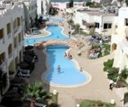
Sun Beach Resort
Videos from this area
These are videos related to the place based on their proximity to this place.
Tunisie Vs Pays-Bas, Tunisia vs Netherlands, But de Sayhi Jamal,
Mercredi le 11 février 2009 : Stade de Rades / Tunis / Tunisie Tunisie vs Pays-Bas (Hollande) Match amical : 1 - 1 La vidéo montre le but tunisien marqué par Sayhi Jamal.
Videos provided by Youtube are under the copyright of their owners.
Attractions and noteworthy things
Distances are based on the centre of the city/town and sightseeing location. This list contains brief abstracts about monuments, holiday activities, national parcs, museums, organisations and more from the area as well as interesting facts about the region itself. Where available, you'll find the corresponding homepage. Otherwise the related wikipedia article.
Hammam-Lif
Hammam-Lif is a coastal town about 20 km south-east of Tunis, the capital of Tunisia. It has been known since antiquity for its thermal springs originating in Mount Bou Kornine.
Ben Arous
Ben Arous is a coastal town in northeastern Tunisia. It is located at around {{#invoke:Coordinates|coord}}{{#coordinates:36|44|50|N|10|20|0|E| | |name= }} and is the capital of the Ben Arous Governorate.
Stade Bou Kornine
Hammam Al-Anf Municipal Stadium, also known as the Municipal Stadium of Hammam-Lif, is a multi-purpose stadium in Hammam-Lif, Tunisia. It is currently used by football team Club Sportif de Hammam-Lif. The stadium holds 8,000 people.
Ezzahra
Ezzahra(الزهراء) is a coastal town on the outskirts of Tunis located six kilometers south of the capital. Ezzahra is bounded by the Mediterranean Sea and the municipalities of Rades, Hammam Lif and El-Bou Mhel Bassatine. Administratively attached to the governorate of Ben Arous, it is the seat of a delegation and a municipality of 31,792 inhabitants in 20,041 while the city itself has a population of 6000 inhabitants.
Jebel Boukornine
Jebel Boukornine, also spelled Djebel Bou Kornine or Mount Bou Kornine is a 576-meter mountain in northern Tunisia, overlooking the Gulf of Tunis and Hammam Lif city. It consists of folded and faulted outcrops of Jurassic limestone. Its name comes from the colloquial Arabic meaning "mountain with two horns. " It owes its name to the two highlights of altitude 576 and 493 meters at the top.


