Safety Score: 2,7 of 5.0 based on data from 9 authorites. Meaning we advice caution when travelling to Thailand.
Travel warnings are updated daily. Source: Travel Warning Thailand. Last Update: 2024-08-13 08:21:03
Explore Ban Khao Tao
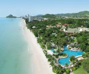
Ban Khao Tao in Changwat Prachuap Khiri Khan is located in Thailand about 96 mi (or 155 km) south of Bangkok, the country's capital.
Local time in Ban Khao Tao is now 12:36 PM (Saturday). The local timezone is named Asia / Bangkok with an UTC offset of 7 hours. We know of 8 airports in the wider vicinity of Ban Khao Tao, of which two are larger airports. The closest airport in Thailand is Hua Hin Airport in a distance of 12 mi (or 20 km), North. Besides the airports, there are other travel options available (check left side).
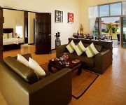
If you need a place to sleep, we compiled a list of available hotels close to the map centre further down the page.
Depending on your travel schedule, you might want to pay a visit to some of the following locations: Pran Buri, Sam Roi Yot, Cha-am, Kui Buri and Kaeng Krachan. To further explore this place, just scroll down and browse the available info.
Local weather forecast
Todays Local Weather Conditions & Forecast: 31°C / 87 °F
| Morning Temperature | 24°C / 75 °F |
| Evening Temperature | 27°C / 80 °F |
| Night Temperature | 25°C / 77 °F |
| Chance of rainfall | 0% |
| Air Humidity | 64% |
| Air Pressure | 1009 hPa |
| Wind Speed | Gentle Breeze with 7 km/h (4 mph) from North-West |
| Cloud Conditions | Few clouds, covering 14% of sky |
| General Conditions | Few clouds |
Sunday, 17th of November 2024
30°C (86 °F)
25°C (78 °F)
Light rain, light breeze, overcast clouds.
Monday, 18th of November 2024
30°C (87 °F)
25°C (78 °F)
Light rain, gentle breeze, scattered clouds.
Tuesday, 19th of November 2024
29°C (84 °F)
26°C (78 °F)
Light rain, gentle breeze, broken clouds.
Hotels and Places to Stay
Marrakesh Hua Hin Resort & Spa
Wora Bura Hua Hin Resort and Spa
CHIVA-SOM INTERNATIONAL HEALTH RESORT
Hyatt Regency Hua Hin
The Lapa Hotel
EVASON HUA HIN
Anantasila Villa by the Sea
Banyan The Resort Hua Hin
La Bua Resort
Sheraton Hua Hin Pranburi Villas
Videos from this area
These are videos related to the place based on their proximity to this place.
Ranong - Pranbury , Thailand. Couchsurf at Pak Nam Pran
More information about this episode at our blog http://greenandyellow.org/ After the visa-run in Ranong we continue to a small village Pak Nam Pran, Thailand. Stayed there for 8 days, did...
ปากน้ำปราณ ถนนเลียบชายหาด
Pak Nam Pran , Pranburi. ปากน้ำปราณบุรี ตำบลปากน้ำปราณ เดิมมีชื่อเรียกว่า "ปากคลองปร...
Kiteboarding in Pranburi ไคท์เซิร์ฟ
Travel with Asia Travel Routes http://www.asiatravelroutes.com Kiteboarding in Pak Nam Pran, Pranburi ไคท์เซิร์ฟ.
PRANNAPA CONDO FOR RENT - HUAHIN PRANBURI THAILAND
Condominium for rent; available space 90 sqm. - Location; 454 Prannapa Condominium, Soi1 Paknampran -- KhaoKaLok Road, Paknampran, District (Amphoe) Pranburi, Prachuap Khiri Khan Province ...
Pranburi Low Season Blues - Cable & Downhill Session!
just trying to survive the Low season here in Pranburi, its a hard auld life sometimes! Once again thanks to Velo Hua Hin - http://velo.com for the awesome downhill trails and Black mountain...
Videos provided by Youtube are under the copyright of their owners.
Attractions and noteworthy things
Distances are based on the centre of the city/town and sightseeing location. This list contains brief abstracts about monuments, holiday activities, national parcs, museums, organisations and more from the area as well as interesting facts about the region itself. Where available, you'll find the corresponding homepage. Otherwise the related wikipedia article.
Ko Sai
Ko Sai (เกาะทราย) is one of the West Coast Islands of Thailand. This island lies off the western side of the Gulf of Siam, about 2 km away from the shore. Ko Sai is the largest of a small group of three rocky islets also known as "Pran Rocks", located off the fishing village of Khao Takiab, just south of Hua Hin. All this area belongs administratively to the Prachuap Khiri Khan Province. Ko Sai has a maximum length of 0.4 km and its highest point reaches 35 m.


