Safety Score: 2,7 of 5.0 based on data from 9 authorites. Meaning we advice caution when travelling to Thailand.
Travel warnings are updated daily. Source: Travel Warning Thailand. Last Update: 2024-08-13 08:21:03
Touring Ban Khlong Top
Ban Khlong Top in Changwat Krabi is a town located in Thailand about 440 mi (or 708 km) south of Bangkok, the country's capital place.
Time in Ban Khlong Top is now 08:58 PM (Saturday). The local timezone is named Asia / Bangkok with an UTC offset of 7 hours. We know of 8 airports nearby Ban Khlong Top. The closest airport in Thailand is Krabi Airport in a distance of 38 mi (or 61 km), North. Besides the airports, there are other travel options available (check left side).
Need some hints on where to stay? We compiled a list of available hotels close to the map centre further down the page.
Being here already, you might want to pay a visit to some of the following locations: Sikao, Wang Wiset, Khlong Thom, Kantang and Nuea Khlong. To further explore this place, just scroll down and browse the available info.
Local weather forecast
Todays Local Weather Conditions & Forecast: 29°C / 84 °F
| Morning Temperature | 26°C / 79 °F |
| Evening Temperature | 28°C / 82 °F |
| Night Temperature | 27°C / 80 °F |
| Chance of rainfall | 11% |
| Air Humidity | 68% |
| Air Pressure | 1009 hPa |
| Wind Speed | Gentle Breeze with 8 km/h (5 mph) from West |
| Cloud Conditions | Overcast clouds, covering 100% of sky |
| General Conditions | Moderate rain |
Sunday, 17th of November 2024
30°C (86 °F)
27°C (80 °F)
Light rain, moderate breeze, scattered clouds.
Monday, 18th of November 2024
29°C (84 °F)
27°C (81 °F)
Moderate rain, moderate breeze, scattered clouds.
Tuesday, 19th of November 2024
30°C (86 °F)
27°C (81 °F)
Light rain, moderate breeze, broken clouds.
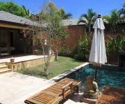
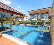
Hotels and Places to Stay
Alanta Villa
Rawi Warin Resort & Spa
Moonlight Exotic Bay Resort
Phutara Lanta Resort
Lanta New Beach Bungalows
Soontreeya Lanta
Relax Bay Resort
Lanta Marine Park View Resort
Thai House Beach Resort
Chaw Ka Cher Tropicana Lanta Resort
Videos from this area
These are videos related to the place based on their proximity to this place.
Night in the tent Brad.leah's photos around Ko Lanta Yai, Thailand (tenting krabi thailand)
Preview of Brad.leah's blog at TravelPod. Read the full blog here: http://www.travelpod.com/travel-blog-entries/brad.leah/1/1263852454/tpod.html This blog preview was made by TravelPod using...
Lions Village was build after the Thusnami in 2005, Thailand
Lions build 3 villages in Thailand after the Tsunami. Visit the one in Koh Lanta here. October 2008.
Thailand GPS Map Garmin Driving Directions Ko Lanta
7.52925 99.09470 latitude and longitude for your Garmin GPS device. Using the Thailand GPS map from http://www.gpsetravelguides.com/page/thailand-gps-map.html , we drove to Old Town, Ko Lanta ...
Snorkeling Koh Lanta Thailand
See also angelfish bits: https://www.youtube.com/watch?v=J6asdRli468 Weird framerate-looking issues, but this is snorkeling off Koh Lanta.
Scooter ride in Koh Lanta
Short video of a scooter ride around Koh Lanta from the Animal welfare towards the Old Town.
Videos provided by Youtube are under the copyright of their owners.
Attractions and noteworthy things
Distances are based on the centre of the city/town and sightseeing location. This list contains brief abstracts about monuments, holiday activities, national parcs, museums, organisations and more from the area as well as interesting facts about the region itself. Where available, you'll find the corresponding homepage. Otherwise the related wikipedia article.
Ko Lanta Yai
Ko Lanta Yai is located in the Andaman Sea off the west coast of Thailand, between the Phi Phi Islands islands and the mainland. They are politically part of Krabi Province, most of which is on the mainland. Measuring 30 km long and 6 km wide, the island forms part of the Ko Lanta archipelago, which covers an area of 170 km². The area was designated as Park No.62 of Thailand in 1990.


