Safety Score: 4,0 of 5.0 based on data from 9 authorites. Meaning please reconsider your need to travel to Switzerland.
Travel warnings are updated daily. Source: Travel Warning Switzerland. Last Update: 2024-08-13 08:21:03
Discover Dieni
The district Dieni of Ruèras in Region Surselva (Kanton Graubünden) is a subburb in Switzerland about 64 mi east of Bern, the country's capital city.
If you need a hotel, we compiled a list of available hotels close to the map centre further down the page.
While being here, you might want to pay a visit to some of the following locations: Altdorf, Flueelen, Bauen, Schwyz and Emmetten. To further explore this place, just scroll down and browse the available info.
Local weather forecast
Todays Local Weather Conditions & Forecast: 7°C / 45 °F
| Morning Temperature | -1°C / 30 °F |
| Evening Temperature | 2°C / 35 °F |
| Night Temperature | 2°C / 35 °F |
| Chance of rainfall | 0% |
| Air Humidity | 49% |
| Air Pressure | 1021 hPa |
| Wind Speed | Light breeze with 3 km/h (2 mph) from North |
| Cloud Conditions | Scattered clouds, covering 27% of sky |
| General Conditions | Scattered clouds |
Saturday, 16th of November 2024
9°C (49 °F)
2°C (35 °F)
Sky is clear, light breeze, clear sky.
Sunday, 17th of November 2024
7°C (44 °F)
1°C (34 °F)
Scattered clouds, light breeze.
Monday, 18th of November 2024
1°C (34 °F)
-3°C (28 °F)
Light snow, gentle breeze, overcast clouds.
Hotels and Places to Stay
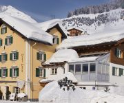
Posta
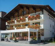
Krüzli
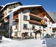
La Cruna Sporthotel
Videos from this area
These are videos related to the place based on their proximity to this place.
Bau der Sesselbahn Dieni-Milez, Sommer 1994 (Sedrun)
Skigebiet Sedrun: Der Skilift Dieni-Milez wird im Sommer 1994 durch eine Sesselbahn ersetzt. Mehr Bilder und Filme: http://www.skiliftfotos.ch.
Von Cuolm Val nach Dieni in 6 Minuten - Pisten wie ein Teppich (Sedrun, 4. April 2009) - HQ
Welch grandiose Frühlings-Sulzschnee-Verhältnisse... einfach herrlich, diese Pisten! Früh auf die Ski, am Nachmittag an der Sonne fläzen im Garten - so muss ein Frühling sein.
Schnipo im Restaurant Sudada Dieni/Sedrun - die besten Schnitzel weltweit!
Bei Renzo und Maike in Dieni gibts das beste Schnitzel-Pommes Frites der Welt. Währschaft, knusprig, unaufdringlich, günstig. Wie ein weiser Mann gesagt hat: "Das Leben müsste fritiert sein!"...
Sunchair Downhill from Las Palas to Dieni - auf dem Liegestuhl vom Las Palas nach Dieni
Waterslide Sedrun 2009 After the event downhill on the sunchair from Las Palas to Dieni crazy riders: Roland, Samuel, Andi.
Fahrt mit der MGB bei Dieni um die Ecke
Für jeden Tujetscher ein harter Abschied: In Dieni gehts scharf um die Ecke, der letzte traurige Bick auf die Tujetscher Dörfer, ein Pfiff der Lok - und ein einer engen Kurve gehts gen Oberalppas...
Voir le plus grand engouement en Chine et le plus grand pont globalement et localement
China (Country),pont,pont de normandie,pont des arts,pont aven,pont champlain,joinville le pont,charenton le pont,le pont du gard,ponts,pont de millau,pont saint esprit,mines ponts,pont de...
Skitag in Sedrun an Ostern 1989
Skifahren in Sedrun: April 1989 im Skigebiet Dieni - Milez - Alpsu (Oberalppass). Mehr Bilder und Filme: http://www.skiliftfotos.ch.
Skitag in Sedrun im Januar 1992
Skitag im Skigebiet Sedrun - Dieni - Oberalppass im Januar 1992. Mehr Bilder und Filme: http://www.skiliftfotos.ch.
San Gottardo 2020 Unterzeichnung des Memorandum of Understanding
Die Gemeinden, Tourismusorganisationen und Bergbahnen von Andermatt, Sedrun und Disentis haben zusammen mit Andermatt Swiss Alps und Programm San Gottardo 2020 am 8. April 2013 in ...
Zeitraffervideo Sedrun Winterende 2008/09 - die Schneeschmelze
Das Ende des Winters 2008/09 in einer halben Minuten: Jeden Tag vier Bilder unserer Webcam auf http://sedruncam.ch - von März bis Mai. Mehr Zeitraffervideos aus der Sedruner Gegend auf ...
Videos provided by Youtube are under the copyright of their owners.
Attractions and noteworthy things
Distances are based on the centre of the city/town and sightseeing location. This list contains brief abstracts about monuments, holiday activities, national parcs, museums, organisations and more from the area as well as interesting facts about the region itself. Where available, you'll find the corresponding homepage. Otherwise the related wikipedia article.
Gotthard Base Tunnel
The Gotthard Base Tunnel (GBT) is a railway tunnel beneath the Swiss Alps expected to open in 2016. With a route length of 57 km and a total of 151.84 km of tunnels, shafts and passages, it is the world's longest rail tunnel, surpassing the Seikan Tunnel in Japan.
Mettlen–Lavorgo powerline
The Mettlen–Lavorgo powerline, also called the Lukmanier powerline, is the 400 kV three-phase alternating current high voltage electric power transmission line over the Lukmanier Pass in Switzerland, from Mettlen to Lavorgo. Trees falling on the line in 2003 caused a major blackout in Italy.
Porta Alpina
Porta Alpina (English: Alpine Gate) was a proposed railway station to be located in the middle of the Gotthard Base Tunnel in southern Switzerland. The project was put on indefinite hold in 2007. It would have been the deepest underground train station in the world. Porta Alpina was proposed to be located near a crossover between the northbound and southbound tunnels.
Disentis Abbey
Disentis Abbey is a Benedictine monastery in the Canton of Graubünden in eastern Switzerland, around which the present town of Disentis grew up.
Lake Cadagno
Lake Cadagno is a meromictic lake in the Piora valley, Switzerland. As one of a few meromictic lakes in Europe, it is the object of numerous scientific studies. The Piora valley - located in the Gotthard massif (central Swiss Alps) in the Southern part of Switzerland near Airolo at an altitude of 2000 m above sea level - is a landlocked alpine valley whose scientific value has been recognized for more than two centuries. In the past, the lake was used as a reservoir.
Lai da Sontga Maria
Lai da Sontga Maria is a lake, located north of the Lukmanier Pass in Switzerland. It lies almost entirely in the municipality of Medel, a tiny fraction of the south-west part of the lake belonging to the municipalities of Quinto and Blenio. The reservoir has a surface area is 1.77 km². The arch dam Santa Maria was completed in 1968. The main road of the Lukmanier Pass runs along the eastern shore of the lake.
Lai da Nalps
Lai da Nalps is a reservoir in the municipality of Tujetsch, Grisons, Switzerland. It has a capacity of 45 million m³ and a surface area of 0.91 km². The reservoir is connected to Lai da Sontga Maria and Lai da Curnera in neighboring valleys.
Lai da Curnera
Lai da Curnera is a reservoir in the municipality of Tujetsch, in the Grisons, Switzerland. The reservoir is linked to Lai da Sontga Maria and Lai da Nalps in the neighboring valley. The lake's volume is 41.1 mio m³ and its surface area 0.81 km². All surrounding rivers are diverted into the reservoir, among them the Rein da Tuma, coming from Lai da Tuma, near the Oberalp Pass and known as the source of the river Rhine.
Tomasee
Tomasee is a lake at the northern face of Piz Badus, above the village of Tschamut in Grisons, Switzerland. Its surface area is 2.5 ha. It is the source of the Anterior Rhine and is deemed to be the official source of the Rhine . It is possible to reach the lake on a path from Oberalp Pass, suitable for most walkers although still a mountain trail.
Oberalpsee
Oberalpsee is a lake just below Oberalp Pass on the side of the Canton of Uri in Switzerland.
Bristensee
Bristensee is a lake in the Canton of Uri, Switzerland. It is located below the mountain Bristen and above the village of Bristen.
Upper Grindelwald Glacier
The Upper Grindelwald Glacier is one of the two valley glaciers south of Grindelwald on the northern side of the Bernese Alps, in the Canton of Berne (the other being the Lower Grindelwald Glacier). It has a length of about 6 km and covers an area of nearly 10 km . The Upper Grindelwald Glacier arises from a vast snow field south of Schreckhorn and north of Wetterhorn. The glacier tongue is currently at around 1,400 metres above sea level, making it one of the lowest glaciers in the Alps.
Golzernsee
Golzernsee or Golzerensee is a lake at Golzern in the Canton of Uri, Switzerland. Its surface area is 5.7 ha. Golzern is located in the Maderanerthal and can be reached by cable car from Bristen. The lake is a popular fishing location. Species include brown trout, rainbow trout, and perch.
Halteli
Halteli is a town in the Silenen municipality, Uri, Switzerland.
Disentis/Mustér railway station
Disentis/Mustér is the eastern terminus of the Matterhorn Gotthard Bahn line from Brig via Andermatt, and the western terminus of the Rhaetian Railway line from Landquart via Chur and Reichenau-Tamins. Every day, several Glacier Express trains pass through Disentis/Mustér in each direction. Both of the railways serving the station also operate regional services. The station currently has three platforms in use.
Sedrun railway station
Sedrun railway station is a metre gauge station serving the village of Sedrun, in the Canton of Graubünden, Switzerland. The station is at the eastern end of the Oberalp Pass. It forms part of the Furka Oberalp Bahn (FO), which connects Brig in Valais, via Andermatt in Uri, with Göschenen, Uri, and, via the Oberalp Pass, with Sedrun and Disentis/Mustér, Graubünden.
Zwing Uri Castle
Zwing Uri is the name of a ruined medieval castle north of Amsteg, today in the territory of the municipality of Silenen in the canton of Uri in Switzerland. It is a Swiss heritage site of national significance. The castle is notable for its role in Swiss historiography as the first fortress destroyed in the Burgenbruch at the beginning of the Swiss Confederacy. The slighting of Zwing Uri (Twing Üren) is mentioned in the White Book of Sarnen, a Swiss chronicle of 1470.
Hospental Castle
Hospental Castle or Langobarden Tower is a ruined medieval castle in the municipality of Hospental in the canton of Uri in Switzerland. It is a Swiss heritage site of national significance. The tower was built in the 13th century for the Hospental family, first mentioned in records at the same time, and dominates the village and is a reminder of the importance of the Urserntal valley as a link in central alpine communications for many centuries.
Meierturm
Meierturm is a medieval tower in the municipality of Silenen in the canton of Uri in Switzerland. It is a Swiss heritage site of national significance.
Rein da Tuma
The Rein da Tuma is a river in Switzerland, in the Canton of Graubünden. It rises east of the Rossbodenstock with two or three mountain streams, that flow across the Tuma Alp into the Lake Toma . Before they reach the lake, they flow through a plane and form small meanders. The Rein da Tuma flows out of Lake Toma on the north east and flows as Anterior Rhine past the village of Tschamut in the municipality of Tujetsch.
Rein da Medel
The Rein da Medel is the longest headwater of the Rhine. It is located in the Swiss cantons of Ticino and Graubünden and flows trough the valleys Val Cadlimo and Val Medel. Rein da Medel is the local Sursilvan, name in Graubünden, which is commonly used to denote the Ticino part as well. The most important places along the river are the villages Curaglia and Platta in the municipality of Medel.
Rein da Curnera
The Rein da Curnera is a right tributary of the Anterior Rhine and one of the main tributaries of the Rhine. It is fed from multiple sources and glaciers at the southern end of the valley. The river is about 8 kilometers long and flows north through the Val Curnera. Approximately in the middle of its route, a dam was constructed by Kraftwerke Vorderrhein AG (the local hydropower company). At this point, the Rein da Curnera takes up a left tributary, the Rein da Maighels.
Val Medel
The Val Medel is a righthand side valley of the Surselva valley in Graubünden, Switzerland. It is approximately 15 km long and stretches from Disentis to the south, where it ends at Lai da Sontga Maria reservoir on Lukmanier Pass (1'906 m). There is a road through the valley and over Lukmanier Pass into Ticino. In the lower three kilometers of the valley form a narrow gorge, known as theMedelserschluch or Las Ruinas, which widens to the green and fertile Trog valley at the village of Curaglia.
Rein da Maighels
The Rein da Maighels is one of the main tributaries of the Rhine and is a tributary to the Rein da Curnera. The firm Kraftwerke Vorderrhein AG has built a hydropower dam creating a reservoir, called the Lai da Curnera, into which both rivers now flow. The origin of the Rein da Maighels is the Maghels Glacier (Romansh: Glatscher da Maighels) on the Piz Ravetsch near the point where the cantons of Graubünden, Ticino and Uri meet.
Cadi (Swiss region)
The Cadi, in Switzerland, is a region within the canton of Graubunden. It straddles the Vorderrhein from the Oberalp Pass on the west to the municipality of Breil/Brigels in the east.


