Safety Score: 4,0 of 5.0 based on data from 9 authorites. Meaning please reconsider your need to travel to Switzerland.
Travel warnings are updated daily. Source: Travel Warning Switzerland. Last Update: 2024-08-13 08:21:03
Delve into Tussagn Dafora
The district Tussagn Dafora of in Region Albula (Kanton Graubünden) is a district located in Switzerland about 105 mi east of Bern, the country's capital town.
In need of a room? We compiled a list of available hotels close to the map centre further down the page.
Since you are here already, you might want to pay a visit to some of the following locations: Tiefencastel, Silvaplana, Chur, Promontogno and Domat. To further explore this place, just scroll down and browse the available info.
Local weather forecast
Todays Local Weather Conditions & Forecast: 1°C / 34 °F
| Morning Temperature | -8°C / 18 °F |
| Evening Temperature | -4°C / 24 °F |
| Night Temperature | -4°C / 25 °F |
| Chance of rainfall | 0% |
| Air Humidity | 45% |
| Air Pressure | 1023 hPa |
| Wind Speed | Light breeze with 4 km/h (3 mph) from North-West |
| Cloud Conditions | Broken clouds, covering 58% of sky |
| General Conditions | Broken clouds |
Saturday, 16th of November 2024
5°C (41 °F)
-4°C (25 °F)
Sky is clear, light breeze, clear sky.
Sunday, 17th of November 2024
1°C (34 °F)
-5°C (23 °F)
Few clouds, light breeze.
Monday, 18th of November 2024
-5°C (24 °F)
-7°C (20 °F)
Light snow, light breeze, overcast clouds.
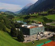
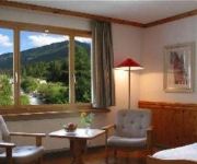
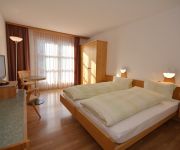
Hotels and Places to Stay
Cube Savognin
Hotel Albula & Julier
Schöntal
Videos from this area
These are videos related to the place based on their proximity to this place.
Ausblick auf Cunter, Savognin und Riom
Wandertour von Savognin über Cunter, Riom, Salouf, Mon bis Tiefencastel.
eHeinz épisode 54: Parc Ela -- joyau naturel au cœur des Gris
Le village montagnard de Savognin, sur le Col du Julier. La porte d'accès au plus grand parc régional naturel de Suisse : le parc Ela. Plus d'info sur le Parc Ela Plus d'info sur Savognin...
Savognin (GR), schneesicherer, familienfreundlicher Winterferienort
Savognin liegt im Kt. Graubünden im Surses auf 1200 MüM. Schneesichere 80 Kilometer Pisten bis auf 2700 Meter über Meer und ein breites Alternativangebot zeichnen diese familienfreundliche...
Die Schweiz: Ein Genuss für die Sinne
Video-Impressionen von mehreren Stationen im Land ! Musik:http://dennis-hart.com.
eHeinz episodio 54: Parc Ela -- Gioiello naturale nel cuore d
Il vecchio paese montano sul passo di Julier. Un portale sul grande parco regionale della Svizzera. Il Parc Ela. Più informazioni sul Parc Ela Più informazioni sul Savognin Più informazion...
Vakantie naar Zwitserland 2011 (part1/2)
Om 08:03 uur vertrokken wij uit Rotterdam naar Zwitserland. Ons doel was om zo zuinig mogelijk naar Zwitserland te rijden. In het begin zaten wij op een verbruik van 5,8 op 100 km. Bij Venlo...
Savognin-Schlittada Run 2012/2013
Ort: Savognin (CH) Musik: Schlittada (mit dem Magix Musicmaker) es sind nur Bilder aus den beiden Schlittada-Run Strecken zu sehn.
GoPro Snowbike Crash (1080p)
Kleines Video von unserm Snowbike Ausflug ;) Kamera: gopro HD Hero 2 Musik : http://www.youtube.com/watch?v=e11jm41zuti.
Videos provided by Youtube are under the copyright of their owners.
Attractions and noteworthy things
Distances are based on the centre of the city/town and sightseeing location. This list contains brief abstracts about monuments, holiday activities, national parcs, museums, organisations and more from the area as well as interesting facts about the region itself. Where available, you'll find the corresponding homepage. Otherwise the related wikipedia article.
Glacier Express
The Glacier Express is an express train connecting railway stations of the two major mountain resorts of St. Moritz and Zermatt in the Swiss Alps. The train is operated jointly by the Matterhorn Gotthard Bahn (MGB) and Rhaetian Railway (RhB). For much of its journey, it also passes along and through the World Heritage Site known as the Rhaetian Railway in the Albula / Bernina Landscapes.
Julia (river)
Julia is a river in the Grisons canton, eastern Switzerland. It is a tributary of the Albula river, which it meets in Tiefencastel. The road to the Julier Pass runs through the Julia valley.
Albula District
Albula District is one of the eleven administrative districts in the canton of Graubünden in Switzerland. It has an area of 723.13 km² and has a population of 8,160 (as of 31 December 2011). Albula District consists of four Kreise (sub-districts) Alvaschein, Belfort, Bergün and Surses, which are formed from a total of 23 municipalities
Hinterrhein District
Hinterrhein District is an administrative district in the canton of Graubünden, Switzerland. It has an area of 617.67 km and has a population of 12,774 (as of 31 December 2011). Hinterrhein District consists of five Kreise (sub-districts) and twenty-eight municipalities. This number decreased from thirty-two when the municipalities of Portein, Präz, Sarn, and Tartar merged on 1 January 2010 into Cazis.
Rona, Switzerland
Rona is situated beside the Julier river, the village consists of three parts, the old lower village (Rona), the upper village (Ruegna) and the new lower village (Rieven). There is a church in the upper village and two pubs/restaurants in the old lower village. The valley in which the village lies was chosen as the site of a hydroelectric dam but, following local protest, the village was spared and the dam moved upstream to Mamorera.
Landwasser Viaduct
The Landwasser Viaduct is a single track six-arched curved limestone railway viaduct. It spans the Landwasser River between Schmitten and Filisur, in the Canton of Graubünden, Switzerland. Designed by Alexander Acatos, it was built between 1901 and 1902 by Müller & Zeerleder for the Rhaetian Railway, which still owns and uses it today.
Parc Ela
Parc Ela is a Nature Park in the canton of Graubünden, Switzerland. It is intended to protect the regional biotope, help promote its sustainable use and give a boost to an area rich in scenery and national cultural assets, but weak economically. Unlike Switzerland's only National Park, which is reserved to nature alone, the Ela Nature Park covers the settled and cultivated territory around 21 Graubünden municipalities, notably Tiefencastel, Bergün, Savognin and Bivio.
Lai da Marmorera
Lai da Marmorera is a reservoir in the Grisons, Switzerland. It is part of the Parc Ela nature park. The lake with a surface area of 1.41 km² formed after the completion of the Marmorera dam in 1954 when the old village of Marmorera was flooded. The village was rebuilt above the lake. The lake is flanked on one side by the route of the Julier Pass.
Brienz-Surava
Brienz-Surava is a former municipality in the district of Albula in the canton of Grisons, Switzerland. It was created in 1869 as a merger between Brienz/Brinzauls and Surava. It ceased to exist in 1883, when the two municipalities were separated.
Landwasser
The Landwasser is a 30.5-kilometre river in Switzerland, canton of Graubünden. Its origin was Lake Davos before this was turned into a reservoir for a power station. Nowadays it is fed entirely by Flüelabach and changes its name near Davos. Davos is the largest town and except for the last bit the only municipitality on the river.
Lai Blos
Lai Blos or Lais Blos are two small lakes on Alp Flix, at an elevation of 1960 m, in the Grisons, Switzerland. They are located near to Lai Neir. The alp is listed in the Inventory of Mire Landscapes of Particular Beauty and National Importance.
Mons (Graubünden)
Mons is a village in Graubünden, Switzerland.
Lai Neir (Alp Flix)
Lai Neir is a small lake on Alp Flix, in the Grisons, Switzerland. It is listed in the Inventory of Raised and Transitional Bogs of National Importance. Lai Neir and Lai Blos are part of Alp Flix, a site listed in the Inventory of Mire Landscapes of Particular Beauty and National Importance.
Lai Neir
Marmels Castle
Marmels Castle German: Burg Marmels is a ruined castle in the municipality of Marmorera in the district of Albula in the canton of Graubünden in Switzerland.
Tiefencastel (Rhaetian Railway station)
Tiefencastel is a railway station in Tiefencastel, Switzerland. It is located on the Albula Railway line from Chur to St. Moritz. Hourly services operate on this section of the line.
Filisur (Rhaetian Railway station)
Filisur is a railway station in Filisur, Switzerland. It is located on the Albula Railway line from Chur to St. Moritz. Hourly services operate on this section of the line. There is also an hourly connecting service to Davos Platz. There are currently three platforms in use at Filisur station. Filisur is located very close to three of the Rhaetian Railway's major railway bridges.
Bergün/Bravuogn (Rhaetian Railway station)
Bergün/Bravuogn is a railway station in Bergün/Bravuogn, Switzerland. It is located on the Albula Railway line from Chur to St. Moritz. Hourly services operate on this section of the line.
Wiesen (Rhaetian Railway station)
Wiesen is a station on the Davos-Filisur railway line. An hourly service operates on this line.
Solis Viaduct
The Solis Viaduct is a single track eleven-arched limestone railway viaduct. It spans the Albula River east of the hamlet of Solis, in the Canton of Graubünden, Switzerland. Designed by the engineer Hans Studer, it was built in 1902 by Munari, Cayre und Marasi for the Rhaetian Railway, which still owns and uses it today. One of the most important structures on the World Heritage-listed Albula Railway, it is 89 metres high, 164 metres long, and has a main span of 42 metres .
Wiesen Viaduct
The Wiesen Viaduct (or Wiesener Viaduct; German: Wiesener Viadukt) is a single track limestone railway viaduct. It spans the Landwasser River southwest of the hamlet of Wiesen, in the Canton of Graubünden, Switzerland. Designed by the then Chief Engineer of the Rhaetian Railway, Henning Friedrich, it was built between 1906 and 1909 under the supervision of another engineer, Hans Studer. The Rhaetian Railway still owns and uses it today.
Schmittentobel Viaduct
The Schmittentobel Viaduct is a single track limestone railway viaduct. It is situated near Schmitten, in the Canton of Graubünden, Switzerland. The viaduct was opened in 1903 by the Rhaetian Railway, which still owns and uses it today. An important element of the World Heritage-listed Albula Railway, the viaduct is 35 metres high, 137 metres long, and has seven spans, each 15 metres in length.
Greifenstein Castle
Greifenstein Castle is a castle in the municipality of Filisur of the Canton of Graubünden in Switzerland. It is a Swiss heritage site of national significance.
Riom Castle
Riom Castle is a castle in the municipality of Riom-Parsonz of the Canton of Graubünden in Switzerland. It is a Swiss heritage site of national significance.
Ziteil
Ziteil is a holy pilgrimage site, located at a height of 2,429 metres above sea level, between Piz Curvér and Piz Toissa, in the canton of Graubünden.


