Safety Score: 4,0 of 5.0 based on data from 9 authorites. Meaning please reconsider your need to travel to Switzerland.
Travel warnings are updated daily. Source: Travel Warning Switzerland. Last Update: 2024-08-13 08:21:03
Discover Weiach / Weiach (Dorfkern)
The district Weiach / Weiach (Dorfkern) of Weiach in Dielsdorf (Canton of Zurich) with it's 827 citizens Weiach / Weiach (Dorfkern) is a district in Switzerland about 63 mi north-east of Bern, the country's capital city.
Looking for a place to stay? we compiled a list of available hotels close to the map centre further down the page.
When in this area, you might want to pay a visit to some of the following locations: Dielsdorf, Dettighofen, Bulach, Wutoeschingen and Lauchringen. To further explore this place, just scroll down and browse the available info.
Local weather forecast
Todays Local Weather Conditions & Forecast: 6°C / 44 °F
| Morning Temperature | -0°C / 32 °F |
| Evening Temperature | 3°C / 38 °F |
| Night Temperature | 1°C / 34 °F |
| Chance of rainfall | 0% |
| Air Humidity | 70% |
| Air Pressure | 1027 hPa |
| Wind Speed | Light breeze with 3 km/h (2 mph) from South-West |
| Cloud Conditions | Scattered clouds, covering 36% of sky |
| General Conditions | Scattered clouds |
Saturday, 16th of November 2024
8°C (46 °F)
2°C (36 °F)
Sky is clear, calm, clear sky.
Sunday, 17th of November 2024
8°C (47 °F)
6°C (42 °F)
Light rain, gentle breeze, scattered clouds.
Monday, 18th of November 2024
6°C (44 °F)
3°C (38 °F)
Light rain, gentle breeze, overcast clouds.
Hotels and Places to Stay
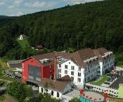
Hofgut Albführen
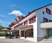
Riverside
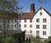
Wasserstelz
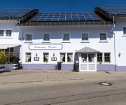
Löwen
Höri INN
Propstei Wislikofen
Hirschen Landgasthof
Videos from this area
These are videos related to the place based on their proximity to this place.
descending an observation tower
walking/running down the stairs of an observation tower in rural Switzerland.
Fasnet Umzug Hohentengen
Der größte und schönste Fasnetsumzug in ganz Hohentengen und Umgebung - 4500 Maskenträger und Musiker beim Faschings Spektakel, Ausrichter war 2014 der FHN Eichen e.V. mit dem Eichener.
Modellbahnfreunde Glattfelden - MBG - 2011 bis heute
Eine kurze Diashow zum MBG von den Jahren 2011, 2012, 2013. Ich wünsche euch viel Spass *********************** info@modellbahnfreunde.ch *********************** mbg.homepage.bluewin.ch...
Modellbahnfreunde Glattfelden - Führerstandsfahrt
Führerstandsfahrt auf der 5" Modelleisenbahn Anlage in Glattfelden.
Srbi pecu Badnjizu za Badnji dan.
Boro, Krle , Dule, Krle, Dejo, Pero - Dragana, Anka, Mica i Petra. Budva , Samac, Tuzla, Kragujevac.
Schleuse II
Eine Gruppe von über 30 Kajaks und Kanus beim Ausfahren aus der Schleuse des Kraftwerks Rheinsfelden bei Eglisau.
Srbi Pecu Badnjicu za Pravoslavni Bozic
Bjelasica Vasojevici Prijelozi i Lijeska , Ozren Petrovo Selo , Majevica Raskosnica i Posavina Gajevi Nedovic, Zejak, Simeunovic, Brkic i Ilic.
Videos provided by Youtube are under the copyright of their owners.
Attractions and noteworthy things
Distances are based on the centre of the city/town and sightseeing location. This list contains brief abstracts about monuments, holiday activities, national parcs, museums, organisations and more from the area as well as interesting facts about the region itself. Where available, you'll find the corresponding homepage. Otherwise the related wikipedia article.
Dielsdorf district
Dielsdorf District is a district in the northwestern part of the Swiss canton of Zürich. Since 1871 the administrative center of the district is located in Dielsdorf. Previously the district was named Bezirk Regensberg, and its capital was Regensdorf, the only city in the district.
Zurich Airport
Zurich Airport, also known as Kloten Airport, is Switzerland's largest international airport, and the principal hub of Swiss International Air Lines. The airport is owned by Flughafen Zürich AG, a company quoted on the SIX Swiss Exchange. Major shareholders include the canton of Zurich, with 33.33% of the shares, and the city of Zurich, with 5% of the shares. No other shareholder has a holding exceeding 5%. Skyguide is responsible for all Air Traffic Control for Zurich.
Gubrist Tunnel
The Gubrist Tunnel is a 3.2 km long motorway tunnel in Switzerland, and forms part of the A20 motorway (northern ring around Zurich). It lies west of the city of Zurich, in a hilly area. It is named after the hill of Gubrist, which is nearby. The Gubrist Tunnel carries a lot of traffic (on the Berne - St. Gall route), but is remarkably uncongested most of the time. At the moment 90,000 cars/day use this tunnel, but by 2025 this number is expected to rise to 125,000.
Crossair Flight 498
Crossair Flight LX498 (known subsequently as Crossair Flight CRX498 by officials) was a commuter flight from Zurich, Switzerland, to Dresden, Germany, that crashed two minutes after takeoff in the Swiss municipality of Niederhasli on 10 January 2000. The seven passengers and three crewmembers aboard the two-turboprop engine Saab 340 aircraft all died on impact. It was the first fatal crash for the Swiss regional airline Crossair in its 25-year history.
Katzensee
Katzensee is a lake on the border of the city of Zurich and Regensdorf in the Canton of Zurich, Switzerland. Its surface area is 0.36 km². \t\t \t\t\tKatzensee - oberer Katzensee IMG 2322. JPG \t\t\t oberer (upper) Katzensee, Zürich-Affoltern in the background (April 2009) \t\t\t \t\t \t\t \t\t\tKatzesee IMG 2234. JPG \t\t\t unterer (lower) Katzensee \t\t\t \t\t \t\t \t\t\tKatzensee IMG 2323. JPG \t\t\t Lido \t\t\t \t\t \t\t \t\t\tKatzensee-Akvarelo-de-Jakob Weidmann. gif \t\t\t Watercolour picture of Katzensee by Jakob Weidmann (1930)
Mettmenhaslisee
Mettmenhaslisee is a lake located between Niederhasli und Mettmenhasli in the Canton of Zurich, Switzerland. Its surface area is 2.5 ha.
Furttal
Furttal is the name of a valley region in Switzerland between Laegern and Altberg in the Dielsdorf district of the canton of Zurich. The area's name stems from the German word for ford, or furt, and is named after the crossing over the Limmat river in the community of Würenlos on the west side of the region. The area is bordered in the east near the community of Regensdorf by the Katzensee lakes.
Sternwarte Bülach
Sternwarte Bülach is an observatory near Bülach, Canton of Zurich, Switzerland.
Alitalia Flight 404
Alitalia Flight 404, flown by a McDonnell Douglas DC-9-32 aircraft, crashed near the Zurich-Kloten Airport, Switzerland on 14 November 1990. The airplane with 46 people on board made a controlled flight into the mountain Stadlerberg, 5 miles short of the runway, because of a faulty ILS receiver. All on board died.
Klingengraben
Klingengraben is a river of Baden-Württemberg, Germany.
Regensdorf-Watt railway station
Regensdorf-Watt is a railway station in Switzerland, situated in the municipality of Regensdorf. The station is located on the Furttal railway line and is a stop of the Zurich S-Bahn served by line S6.
Buchs-Dällikon railway station
Buchs-Dällikon is a railway station in Switzerland. The station is situated in the municipality of Buchs, but also serves the adjacent municipality of Dällikon. The station is located on the Furttal railway line and is a stop of the Zurich S-Bahn served by line S6.
Bülach railway station
Bülach is a railway station in the Swiss canton of Zurich and municipality of Bülach. It is located on the Winterthur to Koblenz line, at the point where it is joined by the Bülach branch of the Bülach-Regensberg Railway. Bülach station is served by Zurich S-Bahn lines S5, S22 and S41, as well as some long distance trains. The S5 connects Zurich and Rafz, using the Bülach-Regensberg Railway south of Bülach.
Niederglatt railway station
Niederglatt is a railway station in the Swiss canton of Zurich and municipality of Niederglatt. It is located on the Bülach branch of the Bülach-Regensberg Railway and served by Zurich S-Bahn line S5.
Niederweningen railway station
Niederweningen is a terminal railway station in the Swiss canton of Zurich and municipality of Niederweningen. The station is located close to the border of both the municipality and the canton, and serves as the terminus of Zurich S-Bahn lines S5 and S55. Niederweningen station, and the end of the line, was originally located closer to the centre of Niederweningen, at the location now occupied by Niederweningen Dorf station.
Niederweningen Dorf railway station
Niederweningen Dorf is a railway station in the Swiss canton of Zurich and municipality of Niederweningen. The station is located close to the centre of the municipality, on the Wehntal railway line, and is served by Zurich S-Bahn lines S5 and S55. Niederweningen Dorf station was opened in 1891 as the terminus of the Swiss Northeastern Railway's Wehntal line, and was originally simply known as Niederweningen station.
Zweidlen railway station
Zweidlen is a railway station in the Swiss canton of Zurich and municipality of Glattfelden. It is located on the Winterthur to Koblenz line, and is served by Zurich S-Bahn line S41. The station is also the loading point for trains carrying gravel from the nearby works of Weiacher Kies AG.
Dielsdorf railway station
Dielsdorf is a railway station in the Swiss canton of Zurich and municipality of Dielsdorf. The station is located on the Wehntal railway line, and is served by Zurich S-Bahn lines S5 and S55. The station was opened in 1865, and was initially the terminus of a branch of the Bülach-Regensberg Railway from Oberglatt. The line was extended by the Swiss Northeastern Railway as part of their Wehntal line to Niederweningen in 1891, and Dielsdorf became a through station.
Glattfelden railway station
Glattfelden is a railway station in the Swiss canton of Zurich. The station is actually situated in the municipality of Bülach but takes its name from the immediately adjacent municipality of Glattfelden. It is located on the Winterthur to Koblenz line, and is served by Zurich S-Bahn lines S5 (to Pfäffikon SZ) and Rafz and S22 (to Singen and Bülach). A local bus line (ZVV 540) connects the station with the village.
Eglisau railway station
Eglisau is a railway station in the Swiss canton of Zurich and municipality of Eglisau. The station is located on the Winterthur to Koblenz line at that line's junction with the Eglisau to Neuhausen line. It is served by Zurich S-Bahn lines S5, S22 and S41. Between Eglisau and Hüntwangen-Wil, the next station on the Eglisau to Neuhausen line, the railway crosses the Eglisau railway bridge over the Rhine.
Rafz railway station
Rafz is a railway station in the Swiss canton of Zurich and municipality of Rafz. The station is located on the Eglisau to Neuhausen line of the Swiss Federal Railway (SBB) that crosses the international border twice on its route between the Swiss cantons of Zurich and Schaffhausen. The station is operated by the SBB and is the terminus of Zurich S-Bahn line S5 from Zurich, and an intermediate stop on the S22 between Bülach and Schaffhausen.
Hüntwangen-Wil railway station
Hüntwangen-Wil is a railway station in the Swiss canton of Zurich. The station location straddles the municipalities of Eglisau and Hüntwangen, but takes its name from Hüntwangen and the adjoining municipality of Wil. In terms of railway geography, the station is on the Eglisau to Neuhausen line of the Swiss Federal Railway (SBB), which crosses the international border twice on its route between the Swiss cantons of Zurich and Schaffhausen.
Eglisau railway bridge
The Eglisau railway bridge, or Eisenbahnbrücke Eglisau, is a single-track railway bridge which carries the Eglisau to Neuhausen line across the Rhine in Switzerland. Both ends of the bridge lie within the municipality of Eglisau and the canton of Zurich. The bridge was built between the years of 1895 and 1897 by the Swiss Northeastern Railway at a cost of 980,000 Swiss francs. The bridge has a total length of 439 metres and has a height of 50 metres above river level.
Schöfflisdorf-Oberweningen railway station
Schöfflisdorf-Oberweningen is a railway station in the Swiss canton of Zurich and municipality of Schöfflisdorf. The station takes its name from the adjoining municipalities of Schöfflisdorf and Oberweningen. It is located on the Wehntal railway line, and is served by Zurich S-Bahn lines S5 and S55.
Kaiserstuhl AG railway station
Kaiserstuhl AG is a railway station in the Swiss canton of Aargau and municipality of Kaiserstuhl. The station is located on the Winterthur to Koblenz line and is served by Zurich S-Bahn line S41, which links Winterthur and Waldshut. The ZVV busline 515 connects Kaiserstuhl with Bülach as well. The station should not be confused with Kaiserstuhl OW station, on the Brünig railway line in the canton of Obwalden.


