Safety Score: 4,0 of 5.0 based on data from 9 authorites. Meaning please reconsider your need to travel to Switzerland.
Travel warnings are updated daily. Source: Travel Warning Switzerland. Last Update: 2024-08-13 08:21:03
Delve into Elgg / Neu-Elgg
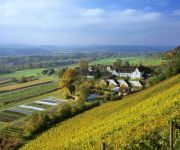
The district Elgg / Neu-Elgg of Elgg in Bezirk Winterthur (Canton of Zurich) with it's 940 habitants Elgg / Neu-Elgg is a subburb in Switzerland about 77 mi north-east of Bern, the country's capital town.
If you need a hotel, we compiled a list of available hotels close to the map centre further down the page.
While being here, you might want to pay a visit to some of the following locations: Frauenfeld, Munchwilen, Winterthur, Pfaffikon and Ohningen. To further explore this place, just scroll down and browse the available info.
Local weather forecast
Todays Local Weather Conditions & Forecast: 7°C / 45 °F
| Morning Temperature | 0°C / 32 °F |
| Evening Temperature | 3°C / 38 °F |
| Night Temperature | 1°C / 34 °F |
| Chance of rainfall | 0% |
| Air Humidity | 70% |
| Air Pressure | 1027 hPa |
| Wind Speed | Light breeze with 4 km/h (2 mph) from South-West |
| Cloud Conditions | Scattered clouds, covering 41% of sky |
| General Conditions | Scattered clouds |
Saturday, 16th of November 2024
9°C (48 °F)
3°C (37 °F)
Sky is clear, light breeze, clear sky.
Sunday, 17th of November 2024
10°C (49 °F)
6°C (42 °F)
Light rain, gentle breeze, few clouds.
Monday, 18th of November 2024
6°C (43 °F)
3°C (37 °F)
Moderate rain, gentle breeze, overcast clouds.
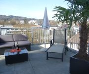
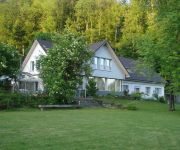
Hotels and Places to Stay
Motel Falken
Hotel Frauenfeld
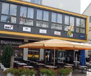
Blumenstein
Bed & Breakfast Casa Almeida
HOTEL DOMICIL SWISS Q
Kartause Ittingen
Hotel Greuterhof
Videos from this area
These are videos related to the place based on their proximity to this place.
Sido - Schlechtes Vorbild live @ Open Air Frauenfeld 2009
Sido mit schlechtem Vorbild beim Open Air Frauenfeld am 10. Juli 2009.
Zuckerfabrik Frauenfeld Nord I
Das Wetter war halb bedeckt. Habe daran gedacht dass ich viel Farben für die Zuckerfabrik in der damaligen Firma STREIT AG in Frauenfeld Junkholzstrasse / Gerlikonerstrasse entwickeln durfte....
Turbonegro - Fuck The World (F.T.W.) live @ Open Air Frauenfeld 2009
TRBNGR are fuckin the world at the Open Air in Frauenfeld 10. July 2009.
Turbonegro - The Age of Pamparius live @ Open Air Frauenfeld 2009
TRBNGR mit der ersten Zugabe beim Frauenfeld Open Air am 10. Juli 2009. Apocalypse Dudes got nothing to lose. Ächt subbr gsy.
Häuslenen oberhalb Frauenfeld, windiges Wetter 03.11.2012 ca 11:00UHR
Aufgenommen mit dem Quadro DJI 450 und der AEE19 Musik hinterlegt mit CD Beröa Verlag Zürich. http://beroea.ch/katalog/cd.html.
Quadcopterflug über Elgg ZH - Entfernung bis 1800 Meter !!
Quadcopterflug über Elgg ZH am 16.07.2013 inkl. Durchfahrt eines ICN sowie Güterzuges. Entfernung gemäss Google Maps bis zu 1,8km (1800 Meter). Ausrüstung: Bumblebee Quadcopter Kamera:...
Videos provided by Youtube are under the copyright of their owners.
Attractions and noteworthy things
Distances are based on the centre of the city/town and sightseeing location. This list contains brief abstracts about monuments, holiday activities, national parcs, museums, organisations and more from the area as well as interesting facts about the region itself. Where available, you'll find the corresponding homepage. Otherwise the related wikipedia article.
Frauenfeld District
Frauenfeld District is one of the five districts of the canton of Thurgau, Switzerland. It has a population of 62,950 (as of 31 December 2012). Its capital, and the capital of Thurgau, is the city of Frauenfeld. The district contains the following municipalities:
Bichelsee
Bichelsee is a village and former municipality in the canton of Thurgau, Switzerland. It takes its name from the nearby lake, Bichelsee. The municipality also contained the villages Höfli, Niederhofen am Bichelsee and Itaslen.
Balterswil
Balterswil is a village and former municipality in the canton of Thurgau, Switzerland. The municipality also contained the villages Lützelmurg, Zielwies, Ifwil and Lochwies.
Wittenwil
Wittenwil is a village and former municipality in the district of Frauenfeld in the canton of Thurgau, Switzerland. In 1996 the municipality was incorporated into the larger, neighboring municipality Aadorf.
Schauenberg
Schauenberg is a hill and ruined castle near Turbenthal, canton of Zurich, at 892m. There were fortifications since the Iron Age, and since the early 13th century, there was a wooden structure, in the 1250s extended to a massive keep. The fortress was destroyed in 1344.
Bichelsee (lake)
Bichelsee is a lake in the canton of Thurgau, Switzerland. The village of Bichelsee in the municipality Bichelsee-Balterswil is named after the lake. Of the surface of 0.092 km², 5/6 are located in the canton of Thurgau, the reminder in the canton of Zurich.
Eidberg
Eidberg is a quarter in the district 3 of Winterthur. It was formerly a part of Seen municipality, which was incorporated into Winterthur in 1922.
Ricketwil
Ricketwil is a quarter and an hamlet with 91 inhabitants (2007) in the district 2 of Winterthur. It was formerly a part of Oberwinterthur municipality, which was incorporated into Winterthur in 1922. {{#invoke:Coordinates|coord}}{{#coordinates:47|29|8|N|8|48|4|E|region:CH |primary |name= }} 19px This Canton of Zurich location article is a stub. You can help Wikipedia by expanding it. vte Template:Portal:Switzerland/Stub
Iberg (Winterthur)
Iberg is a quarter in the district 3 of Winterthur. It was formerly a part of Seen municipality, which was incorporated into Winterthur in 1922.
Blumenau (Winterthur)
Blumenau is a quarter in the district 5 of Winterthur. It was formerly a part of Veltheim municipality, which was incorporated into Winterthur in 1922. {{#invoke:Coordinates|coord}}{{#coordinates:47|29|43|N|8|48|29|E|region:CH |primary |name= }} 19px This Canton of Zurich location article is a stub. You can help Wikipedia by expanding it. vte Template:Portal:Switzerland/Stub
Iselisberg
Iselisberg is a village in the canton of Thurgau, Switzerland. It is located just north of Uesslingen. In 1995 Uesslingen municipality merged with its neighbor to form a new and larger municipality Uesslingen-Buch. It used to be a centre of wine production.
Uesslingen
Uesslingen is a village and former municipality in the canton of Thurgau, Switzerland. In 1995 the municipality was merged with the neighboring municipality Buch bei Frauenfeld to form a new and larger municipality Uesslingen-Buch.
Ettenhausen
Ettenhausen is a village and former municipality in the district of Frauenfeld in the canton of Thurgau, Switzerland. It was first recorded in 1278 as Oetenhusen. The municipality also contained the village Iltishausen. It had 321 inhabitants in 1850, which increased to 395 in 1950 and 941 in 1990. In 1996 the municipality was incorporated into the larger, neighboring municipality Aadorf.
Guntershausen bei Aadorf
Guntershausen bei Aadorf is a village and former municipality in the district of Frauenfeld in the canton of Thurgau, Switzerland. It was first recorded in 1282 as Gundolthuser tal. The municipality also contained the villages Maischhausen, Tänikon and Wittershausen. It had 473 inhabitants in 1850, which increased to 400 in 1870, 656 in 1960, 1051 in 1990 and 1392 in 2008. In 1996 the municipality was incorporated into the larger, neighboring municipality Aadorf.
Aawangen
Aawangen is a village and former municipality in the district of Frauenfeld in the canton of Thurgau, Switzerland. It was probably first recorded in 844 as Oninwanc. The municipality also contained the villages Bürg, Friedtal, Huzenwil, Moos and Häuslenen. It had 473 inhabitants in 1850, which increased to 400 in 1870, 656 in 1960 and 1051 in 1990. In 1996 the municipality was incorporated into the larger, neighboring municipality Aadorf.
Ittingen Charterhouse
Ittingen Charterhouse (Kartause Ittingen) is a former Carthusian monastery near Warth, Canton Thurgau, Switzerland. It is now used as an education and seminar centre with two museums and a farm.
Tibet Institute Rikon
The Tibet Institute Rikon is a Tibetan monastery located in Zell-Rikon im Tösstal in the Töss Valley in Switzerland. It is a established as a non-profit foundation because Swiss laws resulting from the 19th century secularization movement do not allow for the establishment of new monasteries.
Elgg Castle
Elgg Castle is a castle in the municipality of municipality of Elgg in the Swiss canton of Zurich. It is a Swiss heritage site of national significance.
Frauenfeld Castle
Frauenfeld Castle is a castle in the municipality of Frauenfeld of the Canton of Thurgau in Switzerland. It is a Swiss heritage site of national significance.
Rikon railway station
Rikon is a railway station in the Swiss canton of Zurich. The station is situated in the village of Rikon im Tösstal within the municipality of Zell. It is located on the Tösstalbahn between Winterthur and Rapperswil, and is served by Zurich S-Bahn line S26.
Elgg railway station
Elgg is a railway station in the Swiss canton of Zurich and municipality of Elgg. The station is located on the Winterthur–Wil line and is served by trains on the Zurich S-Bahn line S35.
Schottikon railway station
Schottikon is a railway station in the Swiss canton of Zurich and municipality of Elsau. The station is located on the Winterthur–Wil line and is served by trains on the Zurich S-Bahn line S35.
Räterschen railway station
Räterschen is a railway station in the Swiss canton of Zurich and municipality of Elsau. The station is located on the Winterthur–Wil line and is served by trains on the Zurich S-Bahn line S35.
Wila railway station
Wila is a railway station in the Swiss canton of Zurich and municipality of Wila. The station is located on the Tösstal railway line and is served by Zurich S-Bahn line S26, which links Winterthur and Rüti.
Tänikon monastery
Tänikon monastery is a former Cistercian monastery in the village of Ettenhausen in the municipality of Aadorf in the canton of Thurgau in Switzerland. The former monastery church and the monastery buildings, now Agrotechnorama Tänikon, are both Swiss heritage site of national significance.






!['Monster [XXL KMG] Maier - Frühlingsfest 2010 Frauenfeld' preview picture of video 'Monster [XXL KMG] Maier - Frühlingsfest 2010 Frauenfeld'](https://img.youtube.com/vi/kXzZgvb1x7o/mqdefault.jpg)


