Safety Score: 4,0 of 5.0 based on data from 9 authorites. Meaning please reconsider your need to travel to Switzerland.
Travel warnings are updated daily. Source: Travel Warning Switzerland. Last Update: 2024-08-13 08:21:03
Delve into Chämleten
Chämleten in Uri (Canton of Uri) is a town located in Switzerland about 58 mi (or 93 km) south-east of Bern, the country's capital town.
Time in Chämleten is now 11:55 AM (Friday). The local timezone is named Europe / Zurich with an UTC offset of one hour. We know of 10 airports closer to Chämleten, of which 4 are larger airports. The closest airport in Switzerland is Buochs Airport in a distance of 26 mi (or 42 km), North. Besides the airports, there are other travel options available (check left side).
There are several Unesco world heritage sites nearby. The closest heritage site in Switzerland is Swiss Alps Jungfrau-Aletsch in a distance of 27 mi (or 43 km), West. We saw 1 points of interest near this location. In need of a room? We compiled a list of available hotels close to the map centre further down the page.
Since you are here already, you might want to pay a visit to some of the following locations: Formazza, Altdorf, Flueelen, Bauen and Emmetten. To further explore this place, just scroll down and browse the available info.
Local weather forecast
Todays Local Weather Conditions & Forecast: 9°C / 48 °F
| Morning Temperature | 1°C / 34 °F |
| Evening Temperature | 3°C / 38 °F |
| Night Temperature | 4°C / 39 °F |
| Chance of rainfall | 0% |
| Air Humidity | 56% |
| Air Pressure | 1022 hPa |
| Wind Speed | Light breeze with 5 km/h (3 mph) from North |
| Cloud Conditions | Scattered clouds, covering 34% of sky |
| General Conditions | Scattered clouds |
Saturday, 16th of November 2024
11°C (52 °F)
3°C (38 °F)
Sky is clear, light breeze, clear sky.
Sunday, 17th of November 2024
8°C (46 °F)
3°C (38 °F)
Light snow, light breeze, scattered clouds.
Monday, 18th of November 2024
3°C (37 °F)
-1°C (30 °F)
Snow, light breeze, overcast clouds.
Hotels and Places to Stay
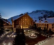
The Chedi Andermatt
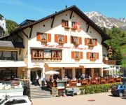
Drei Könige & Post
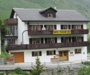
Pension Egg
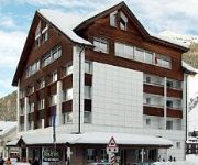
Badus
Sust Lodge am Gotthard
THE RIVER HOUSE BOUTIQUE HOTEL
Videos from this area
These are videos related to the place based on their proximity to this place.
Tour of Andermatt
A video tour of the Chedi Andermatt Hotel and penthouses, the newly completed Andermatt Swiss Alps apartments, the Chedi Residences and scenes around the picturesque alpine village and resort....
Snowboarding Gemsstock in Andermatt | Switzerland
Snowboarding in Andermatt, Switzerland. For more info and printable maps of Andermatt snowboarding, visit http://www.snowboardguides.com/scripts/four.asp?ID=17502&TYPE=SNOWBOARDING Don't...
andermatt-sedrun 06.01.2014
Uscita sci andermatt 06.01.2014 si ringrazia Ponti Bici Sport di Grancia Per la preparazione del materiale sci.
The Freeride Experience in Andermatt
Freeriding im Off-Piste Paradies Andermatt Im Februar 2013 ging es bei der Freeride Experience zum erstenmal in die Schweiz. Nicht irgendwohin, sondern in das schweizerische Andermatt. Der...
A Ride Through Andermatt in Switzerland
Subscribe for the love of motorcycles and the great outdoors: http://www.youtube.com/subscription_center?add_user=wiltshirebyways Please click 'S H O W M O R E' for route info: ↓↓↓↓↓↓...
Apartmenthouse Biber in Andermatt
Das Apartmenthaus Biber ist von der traditionellen Engadiner Architektur inspiriert, die im benachbarten Kanton Graubünden zu finden ist. Typisch dafür sind der Steinsockel, die Putzfassade...
09 MGB Glacier Express-Andermatt Oberalppass
Von Andermatt (1436 m) im Kanton Uri klettert der Zug auf der Zahnradstrecke (Spurweite 1000 mm) auf einer Strecke von ca 4,5 km bis Nätschen zunächst auf 1843 m (Höhenunterschied 407 m)...
Matterhorn Gotthard Bahn (Railway) Andermatt
Some Trains rolling into and leaving the station of Andermatt, Switzerland. Including the famous Clacier Express. The line is operated by the Matterhorn Gotthard Railway (MGB) and part of the...
Videos provided by Youtube are under the copyright of their owners.
Attractions and noteworthy things
Distances are based on the centre of the city/town and sightseeing location. This list contains brief abstracts about monuments, holiday activities, national parcs, museums, organisations and more from the area as well as interesting facts about the region itself. Where available, you'll find the corresponding homepage. Otherwise the related wikipedia article.
Schöllenen Gorge
Schöllenen Gorge is a gorge located in the Swiss canton of Uri between the towns of Göschenen to the north and Andermatt to the south. It is 5 km long along the Reuss River in central Switzerland, and provides access to the St. Gotthard Pass. Enclosed by sheer granite walls, its road and railway require several spectacular bridges and tunnels, of which the most famous is a stone bridge known as the Teufelsbrücke.
Urserental
The Urserental (also Urseren) is the valley of the upper Reuss River in Uri, Switzerland, running southwest to northeast, from Realp to Hospental and Andermatt. Separated from the main valley of Uri, it connects to the Valais via the Furkapass, to the Grisons via the Oberalppass and to the Ticino via the Gotthard Pass. The valley was in possession of Disentis Abbey from 800. It was colonized by Walser settlers prior to the 12th century.
Teufelsbrücke
The Teufelsbrücke ('Devil's Bridge') is a bridge over the Schöllenen Gorge in the Swiss canton of Uri. The bridge provides access to the St. Gotthard Pass by crossing the gorge and the Reuss River below. It is named for an old local legend regarding its construction by the Devil, one of many old European Devil's Bridges with similar creation myths.
Naetschen
Nätschen is a mountain and ski area located in Andermatt, in the Canton of Uri, Switzerland. Higher up on Nätschen the mountain is known as Gütsch. Its highest point is 2,344 m . It is one of the mountains in the Gotthard Oberalp Arena, as is Gemsstock, which is on the other side of Andermatt. It has 11 ski runs, totaling approximately 21 km of ski pistes, and 4 ski lifts, including a Detachable 4-man Chairlift.
Andermatt railway station
Andermatt railway station is an important railway junction on the metre gauge Furka Oberalp Bahn (FO). It serves the municipality of Andermatt, in the Canton of Uri, Switzerland. Since 2003, the FO, including Andermatt station and the lines and trains serving it, has been owned and operated by the Matterhorn Gotthard Bahn (MGB).


