Safety Score: 4,0 of 5.0 based on data from 9 authorites. Meaning please reconsider your need to travel to Switzerland.
Travel warnings are updated daily. Source: Travel Warning Switzerland. Last Update: 2024-08-13 08:21:03
Discover Atzmännig
Atzmännig in Wahlkreis See-Gaster (Canton of St. Gallen) is a town in Switzerland about 76 mi (or 123 km) east of Bern, the country's capital city.
Current time in Atzmännig is now 11:41 AM (Friday). The local timezone is named Europe / Zurich with an UTC offset of one hour. We know of 12 airports near Atzmännig, of which 5 are larger airports. The closest airport in Switzerland is Zürich Airport in a distance of 24 mi (or 39 km), North-West. Besides the airports, there are other travel options available (check left side).
There are several Unesco world heritage sites nearby. The closest heritage site in Switzerland is Abbey of St Gall in a distance of 20 mi (or 33 km), North-East. We discovered 7 points of interest in the vicinity of this place. Looking for a place to stay? we compiled a list of available hotels close to the map centre further down the page.
When in this area, you might want to pay a visit to some of the following locations: Schmerikon, Hinwil, Lachen, Munchwilen and Amden. To further explore this place, just scroll down and browse the available info.
Local weather forecast
Todays Local Weather Conditions & Forecast: 7°C / 44 °F
| Morning Temperature | -1°C / 31 °F |
| Evening Temperature | 1°C / 34 °F |
| Night Temperature | 0°C / 33 °F |
| Chance of rainfall | 0% |
| Air Humidity | 55% |
| Air Pressure | 1027 hPa |
| Wind Speed | Light breeze with 3 km/h (2 mph) from North-West |
| Cloud Conditions | Scattered clouds, covering 28% of sky |
| General Conditions | Scattered clouds |
Saturday, 16th of November 2024
9°C (49 °F)
3°C (37 °F)
Sky is clear, light breeze, clear sky.
Sunday, 17th of November 2024
10°C (49 °F)
5°C (42 °F)
Light rain, gentle breeze, few clouds.
Monday, 18th of November 2024
5°C (40 °F)
2°C (35 °F)
Moderate rain, light breeze, overcast clouds.
Hotels and Places to Stay
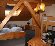
Gasthaus Hulftegg
Videos from this area
These are videos related to the place based on their proximity to this place.
Flug über Kloster Sion, Gommiswald
2. Flugstunde mit der DJI Phantom 2 Vision. No Crash, Video leicht stabilisiert, Magic Bullet Videoeffekte.
Supermoto Eschenbach 2010 Grass-Videoproduktionen - Supermoto Eschenbach 2010 - Impressionen.wmv
Grass Video Produktion, 8783 Linthal. Supermotto Eschenbach 2010, Samstag Zeittraining, 1/4 Final Kids. MFC Eschenbach. Impressionen, Ausschnitte von den Vorläufen. www.video-productions.org.
Super tux 07 Nexus (47)
Super Tux Part 07 Nexus FREE DOWN-LOAD AT: http://www.sendspace.com/filegroup/PU%2BrBXhZg20%2Fekb50YpA3zdYYcen1jL%2FbUtgveLibKjqVb2Nkk37XsyIZIiDQdJ7.
Openair Uznach 2010
http://openair-uznach.ch/ Es wird legendär. Schon am Freitag 27. August startet das Openair Uznach, wieder präsentiert von Schützengarten, zum dritten Mal durch. In diesem Jahr sind zwei...
Videos provided by Youtube are under the copyright of their owners.
Attractions and noteworthy things
Distances are based on the centre of the city/town and sightseeing location. This list contains brief abstracts about monuments, holiday activities, national parcs, museums, organisations and more from the area as well as interesting facts about the region itself. Where available, you'll find the corresponding homepage. Otherwise the related wikipedia article.
Töss (river)
The Töss is a river of the Canton of Zürich. It rises in the Zürcher Oberland, flows along the Töss Valley (Tösstal) past Winterthur, and joins the Rhine at Tössegg near Teufen.
Oberricken Pass
Oberricken Pass (el. 906 m. ) is a mountain pass in the canton of St. Gallen in Switzerland. It connects the lower Ricken Pass with the villages Walde and Rüeterswil, in the municipality St. Gallenkappel.
Mount Zion Abbey
Mount Zion Abbey is a Premonstratensian nuns' abbey in the municipality of Gommiswald in the canton of St. Gallen in Switzerland. It is designated as part of the Inventory of Swiss Heritage Sites. The Abbey was built on scenic rocky spur above the Gaster valley in 1761 by the priest Joseph Helg. It was built along a pilgrimage route from the churches on Lake Constance to Einsiedeln Abbey. The Loretto Chapel was built in 1763-65.


