Safety Score: 4,0 of 5.0 based on data from 9 authorites. Meaning please reconsider your need to travel to Switzerland.
Travel warnings are updated daily. Source: Travel Warning Switzerland. Last Update: 2024-08-13 08:21:03
Discover Vorder Hammer
The district Vorder Hammer of in Canton of Solothurn is a district in Switzerland about 25 mi north of Bern, the country's capital city.
Looking for a place to stay? we compiled a list of available hotels close to the map centre further down the page.
When in this area, you might want to pay a visit to some of the following locations: Solothurn, Wangen an der Aare, Laufen, Waldenburg and Arlesheim. To further explore this place, just scroll down and browse the available info.
Local weather forecast
Todays Local Weather Conditions & Forecast: 9°C / 48 °F
| Morning Temperature | 2°C / 35 °F |
| Evening Temperature | 4°C / 40 °F |
| Night Temperature | 4°C / 39 °F |
| Chance of rainfall | 0% |
| Air Humidity | 65% |
| Air Pressure | 1018 hPa |
| Wind Speed | Light breeze with 4 km/h (2 mph) from East |
| Cloud Conditions | Broken clouds, covering 70% of sky |
| General Conditions | Broken clouds |
Monday, 18th of November 2024
9°C (48 °F)
4°C (39 °F)
Overcast clouds, gentle breeze.
Tuesday, 19th of November 2024
6°C (44 °F)
8°C (46 °F)
Moderate rain, fresh breeze, overcast clouds.
Wednesday, 20th of November 2024
2°C (36 °F)
-3°C (26 °F)
Rain and snow, fresh breeze, overcast clouds.
Hotels and Places to Stay
Park Forum Wylihof
La Couronne Hotel Restaurant
Kreuz
Bären Gasthof
Al Ponte
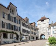
Baseltor
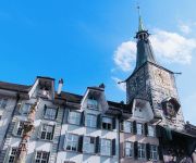
Roter Turm
Zunfthaus zu Wirthen
Alpenblick
Bären
Videos from this area
These are videos related to the place based on their proximity to this place.
Reisefieber 8 (2)
Reisefieber Scheltenpass (Schweiz) Deko: Himmel: Bast-Art 23 & Grille (Camp A) Bühne & Seite: ADRENOCROM.
Auf der Suche nach einem Startplatz in 4717 Mümliswil (2015-03-14)
Restaurant Bergwirtschaft Güggel Güggel 68 4717 Mümliswil.
Skilift Hohe Winde 21. Februar 2009 (Beinwil SO / Passwang) HQ
Ein einsamer, kleiner Skilift in der Jurakette, der eine grosse Anzahl abswechslungsreicher Pisten erschliesst! Mehr Fotos und Video in besserer Qualität auf http://www.jacomet.ch/themen/skilift/a...
Gåte - Springleik
Norwegian folk rock Taken from Gåte's album Jygri. Better sound quality ;) All rights reserved by the respective owner.
Videos provided by Youtube are under the copyright of their owners.
Attractions and noteworthy things
Distances are based on the centre of the city/town and sightseeing location. This list contains brief abstracts about monuments, holiday activities, national parcs, museums, organisations and more from the area as well as interesting facts about the region itself. Where available, you'll find the corresponding homepage. Otherwise the related wikipedia article.
Emme (river)
The Emme is a river in Switzerland. It rises in the Alps between the peaks of Hohgant and Augstmatthorn in the canton of Bern. The Emme is 80 km long and flows through the Emmental and into the Aar below Solothurn. The drainage area is 983 km². The average discharge at the mouth is approximately 20 cubic metres per second. The maximum discharge can be up to 500 cubic metres per second. The Emme is known for its sudden variations in water discharge.
Wangen District
Wangen District was one of the 26 administrative districts in the canton of Bern, Switzerland. Its capital was the municipality of Wangen an der Aare. The district had an area of 129 km² and consisted of 23 municipalities: ^a In 2009, the municipalities of Wanzwil and Röthenbach bei Herzogenbuchsee became part of the municipality of Heimenhausen ^b In 2008 Oberönz became part of Herzogenbuchsee
Beinwil Abbey
Beinwil Abbey (Kloster Beinwil) was a Benedictine monastery in Beinwil in the Canton of Solothurn in Switzerland.
Thal District
Thal District is one of the ten districts of the canton of Solothurn in Switzerland, situated in the centre of the canton. Together with the Gäu District, it forms the Amtei (electoral district) of Thal-Gäu. It has a population of 14,244 (as of 31 December 2012).
Gäu District
Gäu District is one of the ten districts of the canton of Solothurn in Switzerland, situated in the centre of the canton. It has a population of 19,086 (as of 31 December 2012). Together with Thal District, it forms the Amtei (electoral district) of Thal-Gäu.
Wasseramt District
Wasseramt District is one of the ten districts of the canton of Solothurn in Switzerland, situated to the south of the canton. Together with the Bucheggberg District, it forms the Amtei (electoral district) of Wasseramt-Bucheggberg. It has a population of 49,093 (as of 31 December 2012).
Thierstein District
Thierstein District is one of the ten districts of the canton of Solothurn in Switzerland, situated to the north of the canton. Together with the Dorneck District, it forms the Amtei (electoral district) of Dorneck-Thierstein. It has a population of 14,043 (as of 31 December 2012).
Laufen District
Laufen District or Laufental District (French: District de Laufon) is one of the five districts of the largely German-speaking canton of Basel-Country, Switzerland. Its capital is the town of Laufen. Prior to 1994 it was a district of the canton of Bern, one of the seven historical districts of the Bernese Jura. In 1979, three neighbouring French-speaking districts of Bern seceded to form the new canton of Jura.
Burgäschisee
Burgäschisee is a lake near Aeschi in Switzerland, on the border of the cantons of Berne and Solothurn. The lake has a surface of 21 ha and a maximum depth of 36 m. In 1941 and 1943, the waterlevel was lowered by 2 m. The current surface elevation is 465 m.
Inkwilersee
Inkwilersee is a small lake on the border of the municipalities of Inkwil, Canton of Berne, and Bolken, Canton of Solothurn, Switzerland. Its surface area is 0.1016 km².
Baslerweiher
Baslerweiher (literally "Pond of Basel") is an artificial pond in Seewen, Canton of Solothurn, Switzerland. Its dam was built in 1870 to supply water to Basel.
Bellacher Weiher
Bellacher Weiher (also spelt Bellacherweiher, Bellacher-Weiher, or Weier) is a small lake at Bellach in the Canton of Solothurn, Switzerland. Its surface area is 3.3 ha. The pond was formed in 1548. Lake and surroundings are a nature preserve.
Flumenthal Dam
The Flumenthal Dam is a regulating dam at Flumenthal, Switzerland, which was erected as the most important element of all the works of the Second Jura water correction. It was built to regulate the outflow of Seeland's three-lake hydrologic system as far downstream as Solothurn and the confluence with the river Emme River. It works in conjunction with the Regulating Dam Port at Seeland.
Balm ruins
The Balm ruins are the remains of a fortified cave dwelling at the foot of Balmfluh in the Jura Mountains, in the municipality of Balm bei Günsberg in the Canton of Solothurn. It is that canton's only cave stronghold and one of the few in Switzerland. It is a Swiss heritage site of national significance.
Neu-Thierstein Castle
Neu-Thierstein Castle is a ruined castle in the Swiss municipality of Büsserach in the canton of Solothurn, Switzerland.
Kantonsschule Solothurn
The Kantonsschule Solothurn is a gymnasium in the Swiss municipality of Solothurn. With approximately 1,800 students it is among the biggest schools in Switzerland. The current Pprincipal is Stefan Zumbrunn-Würsch.
Solothurn railway station
Solothurn railway station serves the municipality of Solothurn, the capital city of the Canton of Solothurn, Switzerland.
Neu-Falkenstein Castle
Neu-Falkenstein Castle is a castle in the municipality of Balsthal of the Canton of Solothurn in Switzerland. It is a Swiss heritage site of national significance.
Waldegg Castle
Waldegg Castle is a castle in the municipality of Feldbrunnen-St. Niklaus of the Canton of Solothurn in Switzerland. It is a Swiss heritage site of national significance.
Neu-Bechburg Castle
Neu Bechburg Castle is a castle in the municipality of Oensingen of the Canton of Solothurn in Switzerland. It is a Swiss heritage site of national significance.
Blumenstein Castle
Blumenstein Castle is a castle in the municipality of Solothurn of the Canton of Solothurn in Switzerland. It is a Swiss heritage site of national significance.
Steinbrugg Castle
Steinbrugg Castle is a castle in the municipality of Solothurn of the Canton of Solothurn in Switzerland. It is a Swiss heritage site of national significance.
Wangen an der Aare Castle
Wangen an der Aare Castle is a castle in the municipality of Wangen an der Aare of the Canton of Bern in Switzerland. It is a Swiss heritage site of national significance.
Kunstmuseum Solothurn
The Kunstmuseum Solothurn or Art Museum Solothurn is an art museum in the Swiss city Solothurn.
Raymontpierre Castle
Raymontpierre Castle is a castle in the municipality of Vermes of the Canton of Jura in Switzerland. The castle is situated on a spur on the north slope of Mont Raimeux. The castle was built around 1594/96 by Georges Hugué de Raymontpierre, the châtelain of Delémont. His father had received the land as a fief from the Bishop of Basel in 1576. Between 1623 and 1809 it was owned by the Staal family, a noble family from Solothurn. The fortified mansion was eventually converted into a farmhouse.


