Safety Score: 4,0 of 5.0 based on data from 9 authorites. Meaning please reconsider your need to travel to Switzerland.
Travel warnings are updated daily. Source: Travel Warning Switzerland. Last Update: 2024-08-13 08:21:03
Discover Nesselboden
The district Nesselboden of Weissenstein in Bezirk Lebern (Canton of Solothurn) is a subburb in Switzerland about 21 mi north of Bern, the country's capital city.
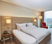
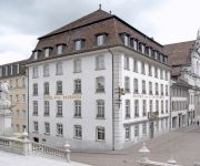
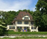
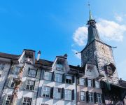
If you need a hotel, we compiled a list of available hotels close to the map centre further down the page.
While being here, you might want to pay a visit to some of the following locations: Solothurn, Wangen an der Aare, Laufen, Delemont and Arlesheim. To further explore this place, just scroll down and browse the available info.
Local weather forecast
Todays Local Weather Conditions & Forecast: 8°C / 46 °F
| Morning Temperature | 1°C / 33 °F |
| Evening Temperature | 3°C / 37 °F |
| Night Temperature | 1°C / 34 °F |
| Chance of rainfall | 0% |
| Air Humidity | 65% |
| Air Pressure | 1025 hPa |
| Wind Speed | Light breeze with 4 km/h (2 mph) from West |
| Cloud Conditions | Few clouds, covering 12% of sky |
| General Conditions | Few clouds |
Saturday, 16th of November 2024
11°C (51 °F)
4°C (39 °F)
Sky is clear, light breeze, clear sky.
Sunday, 17th of November 2024
10°C (51 °F)
6°C (42 °F)
Light rain, gentle breeze, broken clouds.
Monday, 18th of November 2024
8°C (46 °F)
5°C (40 °F)
Light rain, light breeze, overcast clouds.
Hotels and Places to Stay
H4 Hotel Solothurn
La Couronne Hotel Restaurant
Park Forum Wylihof
Kreuz
Roter Turm
Zunfthaus zu Wirthen
Baseltor
Hotel an der Aare Swiss Quality
Hotel Roter Ochsen
Ambassador
Videos from this area
These are videos related to the place based on their proximity to this place.
Die Verenaschlucht , Solothurn
Die Verenaschlucht (Einsiedelei) In Solothurn , Schweiz DIE LEGENDE: Im 4 Jahrhundert nach Christus wurden die beiden Stadtpatrone von Solothurn, Urs und Viktor enthauptet. Verena, die...
REGA EC145 Startup and Start at Solothurn
Start einer Rega EC145 nach einem schweren Verkehrsunfall auf der Straße rauf zum Weissenstein bei Solothurn. Videos und Bilder.
Weissenstein 23-04-2011
Schweizer Liga startet am Weissenstein. Wir (4 Piloten) sind wieder runtergefahren, und wir sind keine Weicheier. Beim Runterfahren hält uns ein Liga-Pilot an (an der einzigen Wiese weit...
Endloslinien Alpenpanorama Weissenstein - Dritte Aufrichtung
Das Kundstwerk von Theo Furrer wurde mehrfach vom Sturm zerstört. Dieses Video dokumentiert die dirtte Aufrichtung mit einer Vorrichtung um das Bild aufzurollen und somit vor weiteren ...
Sesselbahn Weissenstein: Durchfahrt Mittelstation (VR-101)
Die Mittelstation der guten alten Von-Roll-Sesselbahn (VR-101) am 12. Oktober 2003. Mehr Bilder / more images: http://jacomet.ch/themen/skilift/album/thumbnails.php?album=8.
Sesselbahn Weissenstein: Berg- und Talfahrt, Januar 2008
Die Von-Roll-Sesselbahn des legendären Typs VR-101 existiert wohl nur noch wenige Monate - sie ist mit der Bahn zum Oeschinensee die letzte Bahn dieses Typs in der Schweiz und sollte dringend...
Weissenstein mit Nebelmeer, 12. Oktober 2003
Über dem Nebel ists im Herbst am schönsten - Weissenstein mit Nebelmeer, 12. Oktober 2003.
Videos provided by Youtube are under the copyright of their owners.
Attractions and noteworthy things
Distances are based on the centre of the city/town and sightseeing location. This list contains brief abstracts about monuments, holiday activities, national parcs, museums, organisations and more from the area as well as interesting facts about the region itself. Where available, you'll find the corresponding homepage. Otherwise the related wikipedia article.
Emme (river)
The Emme is a river in Switzerland. It rises in the Alps between the peaks of Hohgant and Augstmatthorn in the canton of Bern. The Emme is 80 km long and flows through the Emmental and into the Aar below Solothurn. The drainage area is 983 km². The average discharge at the mouth is approximately 20 cubic metres per second. The maximum discharge can be up to 500 cubic metres per second. The Emme is known for its sudden variations in water discharge.
Moutier District
Moutier District was one of the 3 French-speaking districts of the Bernese Jura in the canton of Bern with the seat being Moutier. It had a population of about 23'098 in 2004.
Fraubrunnen District
Fraubrunnen District was one of the 26 administrative districts in the canton of Bern, Switzerland. Its capital was the municipality of Fraubrunnen. The district has an area of 124 km² and consists of 27 municipalities: ^a Population is as of December 2007, includes population and area of Ballmoos which merged into Jegenstorf in 2010
Wangen District
Wangen District was one of the 26 administrative districts in the canton of Bern, Switzerland. Its capital was the municipality of Wangen an der Aare. The district had an area of 129 km² and consisted of 23 municipalities: ^a In 2009, the municipalities of Wanzwil and Röthenbach bei Herzogenbuchsee became part of the municipality of Heimenhausen ^b In 2008 Oberönz became part of Herzogenbuchsee
Beinwil Abbey
Beinwil Abbey (Kloster Beinwil) was a Benedictine monastery in Beinwil in the Canton of Solothurn in Switzerland.
Bucheggberg District
Bucheggberg District is one of the ten districts of the canton of Solothurn in Switzerland, situated to the southwest of the canton. Together with the Wasseramt District, it forms the Amtei (electoral district) of Wasseramt-Bucheggberg. It has a population of 7,565 (as of 31 December 2012).
Wasseramt District
Wasseramt District is one of the ten districts of the canton of Solothurn in Switzerland, situated to the south of the canton. Together with the Bucheggberg District, it forms the Amtei (electoral district) of Wasseramt-Bucheggberg. It has a population of 49,093 (as of 31 December 2012).
Lebern District
Lebern District is one of the ten districts of the canton of Solothurn, Switzerland, situated to the west of the canton. Together with the city of Solothurn, it forms the Amtei (electoral district) of Solothurn-Lebern. It has a population of 43,803 (as of 31 December 2012).
Bellacher Weiher
Bellacher Weiher (also spelt Bellacherweiher, Bellacher-Weiher, or Weier) is a small lake at Bellach in the Canton of Solothurn, Switzerland. Its surface area is 3.3 ha. The pond was formed in 1548. Lake and surroundings are a nature preserve.
Jura Observatory
Observatoire astronomique jurassien (Jura Observatory) is an astronomical observatory owned and operated by Société Jurassienne d'Astronomie. Built in 1993/1998, it is located near Vicques in the Canton of Jura, Switzerland. Its IAU observatory code is 185. On August 28, 2008, Michel Ory discovered the periodic comet P/2008 Q2 (Ory) at the observatory.
Jura-Sternwarte Grenchen
Jura-Sternwarte Grenchen (Jura Observatory Grenchen) is an astronomical observatory owned and operated by Stiftung Jura-Sternwarte. Built in 1976, it is located near Grenchen in the Canton of Solothurn, Switzerland.
Stadion Brühl
Stadion Brühl is a football stadium at Grenchen in the Canton of Solothurn, Switzerland. It is the home ground of FC Grenchen since 1927. Its maximum capacity is 15,100. The annual Uhrencup tournament is held there.
Flumenthal Dam
The Flumenthal Dam is a regulating dam at Flumenthal, Switzerland, which was erected as the most important element of all the works of the Second Jura water correction. It was built to regulate the outflow of Seeland's three-lake hydrologic system as far downstream as Solothurn and the confluence with the river Emme River. It works in conjunction with the Regulating Dam Port at Seeland.
Grenchen Airport
Grenchen Airport is an airport serving Grenchen, a municipality in the district of Lebern in the canton of Solothurn in Switzerland.
Balm ruins
The Balm ruins are the remains of a fortified cave dwelling at the foot of Balmfluh in the Jura Mountains, in the municipality of Balm bei Günsberg in the Canton of Solothurn. It is that canton's only cave stronghold and one of the few in Switzerland. It is a Swiss heritage site of national significance.
Buchegg Castle
Buchegg Castle is a castle in the Swiss municipality of Kyburg-Buchegg in the canton of Solothurn, Switzerland. Today's castle stands on the site of the former castle of the Counts of Buchegg. The original castle, first mentioned in 1267 as sub castro Buhecke, was burned by the Counts of Kyburg in 1383. In 1546, Solothurn built a square tower with a high hipped roof, on the site of the original castle. Until the 18th Century, it served as a prison. It was privatized in 1863.
Neu-Thierstein Castle
Neu-Thierstein Castle is a ruined castle in the Swiss municipality of Büsserach in the canton of Solothurn, Switzerland.
Kantonsschule Solothurn
The Kantonsschule Solothurn is a gymnasium in the Swiss municipality of Solothurn. With approximately 1,800 students it is among the biggest schools in Switzerland. The current Pprincipal is Stefan Zumbrunn-Würsch.
Solothurn railway station
Solothurn railway station serves the municipality of Solothurn, the capital city of the Canton of Solothurn, Switzerland.
Waldegg Castle
Waldegg Castle is a castle in the municipality of Feldbrunnen-St. Niklaus of the Canton of Solothurn in Switzerland. It is a Swiss heritage site of national significance.
Blumenstein Castle
Blumenstein Castle is a castle in the municipality of Solothurn of the Canton of Solothurn in Switzerland. It is a Swiss heritage site of national significance.
Steinbrugg Castle
Steinbrugg Castle is a castle in the municipality of Solothurn of the Canton of Solothurn in Switzerland. It is a Swiss heritage site of national significance.
Kunstmuseum Solothurn
The Kunstmuseum Solothurn or Art Museum Solothurn is an art museum in the Swiss city Solothurn.
Raymontpierre Castle
Raymontpierre Castle is a castle in the municipality of Vermes of the Canton of Jura in Switzerland. The castle is situated on a spur on the north slope of Mont Raimeux. The castle was built around 1594/96 by Georges Hugué de Raymontpierre, the châtelain of Delémont. His father had received the land as a fief from the Bishop of Basel in 1576. Between 1623 and 1809 it was owned by the Staal family, a noble family from Solothurn. The fortified mansion was eventually converted into a farmhouse.
Moutier-Grandval Abbey
Moutier-Grandval Abbey was a Benedictine abbey near the villages of Moutier and Grandval in the Jura bernois administrative district in the canton of Bern in Switzerland. It was founded around 640, when Grandval already existed; Moutier grew up around the abbey.


