Safety Score: 4,0 of 5.0 based on data from 9 authorites. Meaning please reconsider your need to travel to Switzerland.
Travel warnings are updated daily. Source: Travel Warning Switzerland. Last Update: 2024-08-13 08:21:03
Delve into Friedau
Friedau in Bezirk Gäu (Canton of Solothurn) is located in Switzerland about 31 mi (or 50 km) north-east of Bern, the country's capital town.
Current time in Friedau is now 07:41 AM (Friday). The local timezone is named Europe / Zurich with an UTC offset of one hour. We know of 12 airports close to Friedau, of which 5 are larger airports. The closest airport in Switzerland is Grenchen Airport in a distance of 21 mi (or 33 km), South-West. Besides the airports, there are other travel options available (check left side).
There are several Unesco world heritage sites nearby. The closest heritage site is Prehistoric Pile dwellings around the Alps in Austria at a distance of 19 mi (or 31 km). The closest in Switzerland is Old City of Berne in a distance of 31 mi (or 31 km), East. We encountered 10 points of interest near this location. If you need a hotel, we compiled a list of available hotels close to the map centre further down the page.
While being here, you might want to pay a visit to some of the following locations: Waldenburg, Kaenerkinden, Olten, Tenniken and Zunzgen. To further explore this place, just scroll down and browse the available info.
Local weather forecast
Todays Local Weather Conditions & Forecast: 6°C / 42 °F
| Morning Temperature | -1°C / 29 °F |
| Evening Temperature | 1°C / 34 °F |
| Night Temperature | -1°C / 31 °F |
| Chance of rainfall | 0% |
| Air Humidity | 70% |
| Air Pressure | 1027 hPa |
| Wind Speed | Light breeze with 4 km/h (2 mph) from West |
| Cloud Conditions | Few clouds, covering 15% of sky |
| General Conditions | Few clouds |
Saturday, 16th of November 2024
8°C (46 °F)
1°C (34 °F)
Sky is clear, light breeze, clear sky.
Sunday, 17th of November 2024
9°C (48 °F)
5°C (41 °F)
Light rain, gentle breeze, scattered clouds.
Monday, 18th of November 2024
6°C (42 °F)
1°C (34 °F)
Light rain, light breeze, overcast clouds.
Hotels and Places to Stay
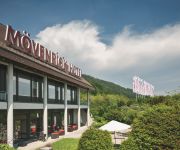
Moevenpick
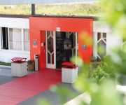
Comfort Hotel Egerkingen
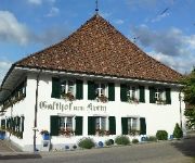
Zum Kreuz Gasthof
Landgasthof Kreuz
Bad Eptingen
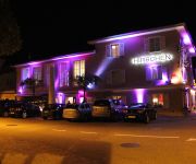
Landgasthof Hirschen
Videos from this area
These are videos related to the place based on their proximity to this place.
fun & fit for kids - outdoor fitness
Swissfunfit Geräte fördern spielerisch den natürlichen Bewegungstrieb und ermöglichen gleichzeitig ein Training für den ganzen Körper. Geeignet für Indoor und Outdoor - keine Installation...
Feuerwehr Gunzgen - Hauptübung 2014
Hauptübung 20. Sept. 2014 Thema: Vorführung von verschiedenen Branderreignissen und Einsatzzeiten.
swissfunfit - Spiel und Bewegung für Kinder und Jugendliche
Swissfunfit Geräte fördern spielerisch den natürlichen Bewegungstrieb und ermöglichen gleichzeitig ein Training für den ganzen Körper. Geeignet für Indoor und Outdoor - keine Installation...
swissfunfit for kids and adults - outdoor fitness
Swissfunfit Geräte fördern spielerisch den natürlichen Bewegungstrieb und ermöglichen gleichzeitig ein Training für den ganzen Körper. Geeignet für Indoor und Outdoor - keine Installation...
'Solarbob' Alpine Slide - Langenbruck (no brakes run)
A ride on the 'Solarbob' alpine slide in Langenbruck, Switzerland. While it is not spectacular or super-fast, it has a decent length and some nice elements. Riding down without braking poses...
Videos provided by Youtube are under the copyright of their owners.
Attractions and noteworthy things
Distances are based on the centre of the city/town and sightseeing location. This list contains brief abstracts about monuments, holiday activities, national parcs, museums, organisations and more from the area as well as interesting facts about the region itself. Where available, you'll find the corresponding homepage. Otherwise the related wikipedia article.
Belchen Tunnel
The Belchen Tunnel is a motorway tunnel in Switzerland, and forms part of the A2 motorway from Basel to Chiasso. It is 3.2 km long, and lies in the northern (slightly northwestern) part of Switzerland. It links Eptingen in the canton of Basel-Country with Hägendorf in the Canton of Solothurn. The tunnel was built in the mid-1960s. It was completely renovated in 2003.
Chilchzimmersattel
Chilchzimmersattel (el. 991 m. ) is a mountain pass in the Jura Mountains in the canton of Basel-Country in Switzerland. It connects Eptingen and Langenbruck. The pass road has a maximum grade of 7,35 percent. The pass is open all year round, even though it is not cleared after snowstorms. Numerous fortifications can be seen near the pass, dating from World War I and before.
Oberer Hauenstein Pass
Oberer Hauenstein Pass (el. 731 m. ) is a mountain pass in the Jura Mountains on the border between the cantons of Basel-Country and Solothurn in Switzerland. It connects Balsthal and Waldenburg.
Santelhöchi Pass
Santelhöchi Pass is a mountain pass in the canton of Solothurn in Switzerland. It connects Egerkingen and Bärenwil. The pass is the shortest route from the Autobahn intersection at Egerkingen to Langenbruck, Waldenburg, Liestal, and Basel. The Jurahöhenweg trail crosses the pass road between Hauenstein und Roggen.
Alt-Bechburg Castle
Alt-Bechburg Castle is a castle in the municipality of Holderbank of the Canton of Solothurn in Switzerland. It is a Swiss heritage site of national significance.


