Safety Score: 4,0 of 5.0 based on data from 9 authorites. Meaning please reconsider your need to travel to Switzerland.
Travel warnings are updated daily. Source: Travel Warning Switzerland. Last Update: 2024-08-13 08:21:03
Delve into Nägeliberg
Nägeliberg in Canton of Schwyz is a city located in Switzerland about 58 mi (or 93 km) east of Bern, the country's capital town.
Current time in Nägeliberg is now 11:07 AM (Sunday). The local timezone is named Europe / Zurich with an UTC offset of one hour. We know of 12 airports closer to Nägeliberg, of which 5 are larger airports. The closest airport in Switzerland is Buochs Airport in a distance of 15 mi (or 24 km), South-West. Besides the airports, there are other travel options available (check left side).
There are several Unesco world heritage sites nearby. The closest heritage site is Prehistoric Pile dwellings around the Alps in Austria at a distance of 25 mi (or 40 km). The closest in Switzerland is Swiss Tectonic Arena Sardona in a distance of 30 mi (or 40 km), North-West. We saw 10 points of interest near this location. In need of a room? We compiled a list of available hotels close to the map centre further down the page.
Since you are here already, you might want to pay a visit to some of the following locations: Schwyz, Einsiedeln, Arth, Zug and Gersau. To further explore this place, just scroll down and browse the available info.
Local weather forecast
Todays Local Weather Conditions & Forecast: 11°C / 52 °F
| Morning Temperature | 5°C / 40 °F |
| Evening Temperature | 4°C / 40 °F |
| Night Temperature | 4°C / 38 °F |
| Chance of rainfall | 0% |
| Air Humidity | 87% |
| Air Pressure | 1022 hPa |
| Wind Speed | Moderate breeze with 9 km/h (6 mph) from North-West |
| Cloud Conditions | Broken clouds, covering 68% of sky |
| General Conditions | Broken clouds |
Monday, 25th of November 2024
10°C (50 °F)
6°C (42 °F)
Sky is clear, moderate breeze, clear sky.
Tuesday, 26th of November 2024
7°C (45 °F)
2°C (35 °F)
Rain and snow, light breeze, overcast clouds.
Wednesday, 27th of November 2024
9°C (48 °F)
6°C (42 °F)
Light rain, light breeze, overcast clouds.
Hotels and Places to Stay
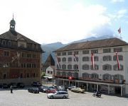
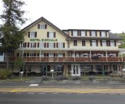
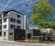
SeminarHotel am Ägerisee
Hotel Wysses Rössli
Holiday Inn SCHINDELLEGI - ZURICHSEE
Eierhals Royal am Ägerisee
Freihof
Videos from this area
These are videos related to the place based on their proximity to this place.
Longest foot suspension bridge in Europe (Mostelberg, Switzerland)
Opened in 2010, the "Skywalk" suspension bridge located in Central Switzerland provides an extraordinary experience for adults, children and families. The entrance to the suspension bridge...
ARNOLD Tiefbau AG 2014
ARNOLD Tiefbau AG 6440 Brunnen Ein kurzer Zusammenschnitt von Aufnahmen mit meinem Quadrocopter und GoPro Hero3, währen Arbeiten bei einem Haus-Abriss. Musik: Jorisma Titel: Sexto ...
Sattel-Hochstuckli, Mostelberg, Raiffeisen Skywalk
Stuckli Rondo Die erste Drehgondelbahn der Welt bringt uns in ca. 8 Minuten von der Talstation in Sattel zum Mostelberg. Wir geniessen das Panorama, während sich die Gondel ganz langsam...
Hängebrücke Sattel - Hochstuckli 2010 SkyPromenade.com
Die längste aller Fussgänerhängebrücken in Sattel SZ CH müssen Sie einfach erlebt haben. Unglaubliches Gefühl durch die Baumwipfel und über den Wald zu gehen, während die Brücke sanft...
Honda CB1000RA, Sattel SZ, first ride season 2012
first ride 2012 with my cb1000r black, sunny day easy drive.
Swiss Harley Davidson Day - Impressions from the Parade (Mount Sattel)
Tausende Harley's waren am 7. Juli 2012 rund um die Rigi unterwegs. The Pictures are not best (Smartphone), but listen to the Sound ;-)
Downhill Run
Easy blue run at Sattel-Hochstuckli, filmed with a GoPro Hero 3. Terrible skiing technique!
Kran ja mal passieren... Crane what happened?
Ein Baukran steht schon sehr lange in unserem Quartier. Die Verlockung ist gross, mit dem Modellflugzeug den Kran zu befliegen und wenn man mit seinen Gedanken spielt, kommen immer neue zum.
Excavator Nadelöhr Winter 2012
Kleiner Bagger (Excavator) steht im Schnee. Passt da mein EasyStar-Tuning durch? Aufnahmen sind noch vom vergangenen Winter mit der GoPro Hero aufgenommen.
Videos provided by Youtube are under the copyright of their owners.
Attractions and noteworthy things
Distances are based on the centre of the city/town and sightseeing location. This list contains brief abstracts about monuments, holiday activities, national parcs, museums, organisations and more from the area as well as interesting facts about the region itself. Where available, you'll find the corresponding homepage. Otherwise the related wikipedia article.
Ägerisee
Ägerisee (or Lake Aegeri) is a glacial lake in the Canton of Zug, Switzerland. The two municipalities along its shore are Oberägeri and Unterägeri. The main tributary is the Hüribach; the Lorze river drains the Ägerisee. Since 1992 the lake is used as a water reservoir. The Battle of Morgarten took place in 1315 on the shores of the Ägerisee.
Sattel Pass
Sattel Pass (el. 932 m. ) is a mountain pass in the canton of Schwyz in Switzerland. It connects Pfäffikon and Seewen. The pass was in use as early as the 13th century as an access route to the St. Gotthard Pass. The road was built in 1860, and along with the railway line to Arth it has become one of the most important east-west arteries in central Switzerland.
Mostelberg
Mostelberg (also known simply as Mostel) is a resort in the Swiss Alps, located in the canton of Schwyz. The village is situated in the region between Lake Ägeri and Lake Lauerz, above Sattel, at a height of 1,191 metres above sea level. It belongs to the municipality of Sattel. Mostelberg can be reached via a gondola lift from Sattel. In winter the resort includes a ski area culminating near the Hochstuckli. Near the gondola station is located a 374 metre-long foot suspension bridge.


