Safety Score: 4,0 of 5.0 based on data from 9 authorites. Meaning please reconsider your need to travel to Switzerland.
Travel warnings are updated daily. Source: Travel Warning Switzerland. Last Update: 2024-08-13 08:21:03
Delve into Handgruobi
The district Handgruobi of Ibergeregg in Bezirk Schwyz (Canton of Schwyz) is a subburb in Switzerland about 60 mi east of Bern, the country's capital town.
If you need a hotel, we compiled a list of available hotels close to the map centre further down the page.
While being here, you might want to pay a visit to some of the following locations: Schwyz, Einsiedeln, Flueelen, Altdorf and Bauen. To further explore this place, just scroll down and browse the available info.
Local weather forecast
Todays Local Weather Conditions & Forecast: 9°C / 49 °F
| Morning Temperature | 2°C / 36 °F |
| Evening Temperature | 4°C / 39 °F |
| Night Temperature | 5°C / 40 °F |
| Chance of rainfall | 0% |
| Air Humidity | 58% |
| Air Pressure | 1025 hPa |
| Wind Speed | Light breeze with 3 km/h (2 mph) from North-West |
| Cloud Conditions | Scattered clouds, covering 34% of sky |
| General Conditions | Scattered clouds |
Saturday, 16th of November 2024
13°C (55 °F)
6°C (42 °F)
Sky is clear, light breeze, clear sky.
Sunday, 17th of November 2024
12°C (53 °F)
7°C (45 °F)
Light rain, light breeze, clear sky.
Monday, 18th of November 2024
6°C (43 °F)
3°C (37 °F)
Moderate rain, light breeze, overcast clouds.
Hotels and Places to Stay
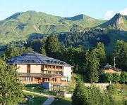
Seminar & Wellnesshotel Stoos
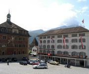
Hotel Wysses Rössli
Videos from this area
These are videos related to the place based on their proximity to this place.
Schneemobil im Brunni, Kanton Schwyz
On a walk with snowshoes in Brunni/Alpthal, Kanton Schwyz, I meet a snowmobile.
Oxy 1.5 SingleSkin RC Paraglider Region March Zürichsee
http://www.karorace.de Oxy 1.5 mit BackPack S , Opale Paramodels, auf der Ibergeregg Region March am Zürichsee.
Funny Ski day with Friends (GoProHero3)
Just a shortedit about 1 funny ski day with friends in the Mythenpark!
Ibergeregg - Riders on the storm
Ibergeregg 4.12.2012 The Doors - Riders on the storm GoPro Hero3 - Silver Edition.
Ibergeregg 1406m
DE: Fahrt über das Ibergeregg von Oberiberg (O) nach Schwyz/Rickenbach (W) mit Ausblicken über den Vierwaldstätter See. Kanton Schyz / Schweiz ENG: Ride over the Ibergeregg coming from ...
Videos provided by Youtube are under the copyright of their owners.
Attractions and noteworthy things
Distances are based on the centre of the city/town and sightseeing location. This list contains brief abstracts about monuments, holiday activities, national parcs, museums, organisations and more from the area as well as interesting facts about the region itself. Where available, you'll find the corresponding homepage. Otherwise the related wikipedia article.
Einsiedeln Abbey
Einsiedeln Abbey is a Benedictine monastery in the town of Einsiedeln in the Canton of Schwyz, Switzerland. The abbey is dedicated to Our Lady of the Hermits, the title being derived from the circumstances of its foundation, for the first inhabitant of the region was Saint Meinrad, an hermit. It is a territorial abbacy and, therefore, not part of a diocese.
Sihlsee
The Sihlsee (in English sometimes called Lake Sihl) is an artificial lake near Einsiedeln in the Canton of Schwyz, Switzerland.
Rütli
Rütli or Grütli is a mountain meadow on Lake Lucerne, in the Seelisberg municipality of the Swiss canton of Uri. Here the legendary oath of the Rütlischwur first occurred and is remembered as the turning-point in the pursuit of independence. Every August 1, on the Swiss National Day, the oath is re-enacted to commemorate the forming of the Old Swiss Confederacy.
Schwyz District
Schwyz District is a district of the canton of Schwyz, Switzerland. It is both the largest and most populous of the six districts of the canton of Schwyz, accounting for around half its surface area, and 40% of the population. It has a population of 52,097 (as of 31 December 2011). The district contains a total of 15 municipalities, of which the town of Schwyz is the capital.
Hölloch Cave
Hölloch Cave is a 198.19 kilometres long cave situated between the river Muota and the area of the Pragelpass in the Valley of Muotha in Switzerland. It is also notable for having a depth of 938.6 metres and being the second longest cave in Europe. The initial exploration started in 1875 and was led by Alois Ulrich. A large part of the exploration of this cave was led by Alfred Bögli.
Brunnen
Brunnen is a resort on Lake Lucerne in Switzerland, part of the municipality Ingenbohl, at {{#invoke:Coordinates|coord}}{{#coordinates:46|59|44|N|8|36|17|E|type:city_region:CH-SZ |primary |name= }}. Brunnen railway station, on the Gotthard railway, is served by hourly InterRegio trains, and by lines S2 of the Stadtbahn Zug, which operates hourly between Zug, Arth-Goldau and Erstfeld, and S3 of the S-Bahn Luzern, which operates hourly to Lucerne.
Sattel Pass
Sattel Pass (el. 932 m. ) is a mountain pass in the canton of Schwyz in Switzerland. It connects Pfäffikon and Seewen. The pass was in use as early as the 13th century as an access route to the St. Gotthard Pass. The road was built in 1860, and along with the railway line to Arth it has become one of the most important east-west arteries in central Switzerland.
Alplersee
Alplersee is a lake on the slopes of the Rophaien mountain near Riemenstalden and Sisikon in the Canton of Uri, Switzerland. There is another lake in the canton of Uri with the same name near Unterschächen.
Lake Lauerz
Lake Lauerz is a lake in the Canton of Schwyz, Switzerland. Its area is about 3 km² and its maximum depth is 13 m. There are two small islands in the lake (the Schwanau and the Roggenburg). In 1806, a landslide into the lake caused a tsunami 20 metres high.
Hoch-Ybrig
Hoch-Ybrig is a skiing and hiking area in Canton of Schwyz in Switzerland. Hoch-Ybrig is dominated by the mountain range Forstberg - Druesberg (2282 metres) - Twäriberg. These mountains form a boundary between Hoch-Ybrig on one side and Muotathal valley and Canton of Glarus on the other side.
Spilauersee
Spilauersee is a lake in the Canton of Uri, Switzerland, below Rossstock. The lake can be reached by foot in half an hour from the Chäppeliberg–Lidernen aerial tramway.
Brunni
Brunni is a place in Switzerland. It belongs to the town Alpthal in the canton of Schwyz. Brunni is a popular ski resort. The place is located at the foot of the Mythen mountains.
Mosi Tunnel
The Mosi Tunnel is a motorway tunnel in Switzerland which opened in 1964. It is situated on the A4 and also the main part of the bypass of Brunnen SZ which leads between Brunnen North and Brunnen South. The two lane tunnel (one lane for each direction) is 1100 metres long and links the motorway A4 with the Axenstrasse. It is the longest road tunnel in the Canton of Schwyz and will be until the Morschacher Tunnel opens in 2020 between Brunnen North and Sisikon.
Stoos
Stoos is a village located in the municipality of Morschach. It lies at 1,300 metres in the Swiss canton of Schwyz, and has about 100 inhabitants. It is used as a small ski resort with a cable car leading to the Fronalpstock. The village itself is car-free and is accessible via a funicular.
Ibach, Switzerland
Ibach is a town in the municipality of Schwyz, Schwyz District, Canton of Schwyz, Switzerland.
Schanzen Einsiedeln
The ski jumping venue in Eschbach, Einsiedeln was built in 2001. In 2010 the venue became the Nationale Sprunganlage (National Ski jumping venue) of Switzerland. The venue includes four hills, K-105, K-70, K-45 and K-25. Schanzen Einsiedeln is located in Eschbach Sports Centrum and many other events take place in this area.
Tellskapelle
The Tellskapelle ("Tell's chapel") is located on the Tellsplatte or Tellenplatte ("Tell's slab") on the shore of Lake Lucerne at the foot of the Axenberg cliffs (an offshoot ridge of Glärnisch, 1,022 m), in the Sisikon municipality, canton of Uri, Switzerland. It is across the Bay of Uri (Urnersee) from the Rütli, some 4.3 km away.
Castle of Rudenz
The castle of Rudenz exists from the early 13th Century and stands in the Flüelen municipality in the canton of Uri in Switzerland. The building was built originally as a fortified tower controlling the Gotthard road and as an Imperial customs post. The Imperial customs in the 1300s was owned by the lords of Attinghausen.
Rudenz Castle
Rudenz Castle is a medieval castle in the municipality of Flüelen in the canton of Uri in Switzerland.
Schwyz railway station
Schwyz railway station is a railway station in the municipality of Schwyz, the capital of the canton of Schwyz in Switzerland. Opened in 1882, it is owned and operated by the Swiss Federal Railways, and forms part of the Gotthard railway, which links northern Switzerland and Immensee with Chiasso and Italy, via the Gotthard Tunnel.
Flüelen railway station
Flüelen is a railway station in the Swiss canton of Uri and municipality of Flüelen. It is located on the Gotthard railway. The station is situated between the parallel Axenstrasse, the main road through Flüelen, and Bahnhofstrasse, with the main station buildings on Bahnhofstrasse.
Treib–Seelisberg railway
The Treib–Seelisberg railway is a funicular railway in the canton of Uri, Switzerland. The line links Treib, on Lake Lucerne, with Seelisberg on the mountain above. At Treib the funicular connects with regular passenger boats of the Schifffahrtsgesellschaft des Vierwaldstättersees, which connect it to Lucerne and other lakeside communities. The line was granted its concession in 1910, with construction starting in 1914 and the line was opened in 1916.
Treib
Treib is a small lakeside community and landing stage on the shore of Lake Lucerne and in the Swiss canton of Uri. It forms part of the municipality of Seelisberg, to the centre of which it is linked by the Treib–Seelisberg funicular. The landing stage is a regular calling point of the passenger boats of Schifffahrtsgesellschaft des Vierwaldstättersees, which provide links to the city of Lucerne and many other lakeside communities.
Sisikon railway station
Sisikon is a railway station in the Swiss canton of Uri and municipality of Sisikon. The station is situated on the Gotthard railway between Arth-Goldau and Erstfeld. The station is served by line S2 of the Stadtbahn Zug, which operates hourly between Zug, Arth-Goldau and Erstfeld.
Mostelberg
Mostelberg (also known simply as Mostel) is a resort in the Swiss Alps, located in the canton of Schwyz. The village is situated in the region between Lake Ägeri and Lake Lauerz, above Sattel, at a height of 1,191 metres above sea level. It belongs to the municipality of Sattel. Mostelberg can be reached via a gondola lift from Sattel. In winter the resort includes a ski area culminating near the Hochstuckli. Near the gondola station is located a 374 metre-long foot suspension bridge.


