Safety Score: 4,0 of 5.0 based on data from 9 authorites. Meaning please reconsider your need to travel to Switzerland.
Travel warnings are updated daily. Source: Travel Warning Switzerland. Last Update: 2024-08-13 08:21:03
Discover Wilchingen, Osterfingen
The district Wilchingen, Osterfingen of Wilchingen in Bezirk Unterklettgau (Canton of Schaffhausen) is a district in Switzerland about 69 mi north-east of Bern, the country's capital city.
Looking for a place to stay? we compiled a list of available hotels close to the map centre further down the page.
When in this area, you might want to pay a visit to some of the following locations: Dettighofen, Jestetten, Schleitheim, Lottstetten and Eggingen. To further explore this place, just scroll down and browse the available info.
Local weather forecast
Todays Local Weather Conditions & Forecast: 7°C / 45 °F
| Morning Temperature | 1°C / 33 °F |
| Evening Temperature | 4°C / 39 °F |
| Night Temperature | 2°C / 35 °F |
| Chance of rainfall | 0% |
| Air Humidity | 72% |
| Air Pressure | 1027 hPa |
| Wind Speed | Light breeze with 3 km/h (2 mph) from South-West |
| Cloud Conditions | Scattered clouds, covering 44% of sky |
| General Conditions | Scattered clouds |
Saturday, 16th of November 2024
8°C (46 °F)
2°C (36 °F)
Sky is clear, calm, clear sky.
Sunday, 17th of November 2024
8°C (47 °F)
6°C (43 °F)
Light rain, gentle breeze, scattered clouds.
Monday, 18th of November 2024
7°C (44 °F)
3°C (38 °F)
Light rain, gentle breeze, overcast clouds.
Hotels and Places to Stay
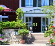
Hofgut Albführen
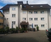
Shanghai Garten Hotel & Restaurant
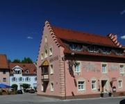
Hotel Löwen
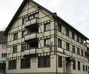
Rebstock
Krone
Wasserstelz
Videos from this area
These are videos related to the place based on their proximity to this place.
Bohnerzspur, Osterfingen
Ein Lehrpfad, der daran erinnert, dass aus den alten Bohnerzgruben wertvolle Biotope geworden sind. Der Bohnerzabbau war in der Region um Osterfingen von grosser Bedeutung. Die vielen...
Fauna & Flora Wangental See
Der Herbst hat Einzug genommen, die Blätter fallen und die Tiere bereiten sich auf den Winter vor. Dazu gehört der Biber, der einen Nahrungsvorrat vor der Insel anlegt, aber auch die Vögel...
Suzanne Klee trainiert auf Power Plate
Die Zürcher Pop- und Country-Queen Suzanne Klee steht seit über 30 Jahren auf der Bühne. Seit neustem bewegt sie sich auch auf der POWER PLATE®. Im neusten TV-Spot verrät sie den ...
Bergrennen Oberhallau 2013 Onboard 1. Trainingslauf Christian Balmer
Christian Balmer Wilderswil, Tatuus Formula Master 2.0, Onboard Bergrennen Oberhallau 2013.
Rehbock auf der Bohnerzspur
Die Idylle in den Wäldern im Klettgau rund um Osterfingen und Wilchingen ist beeindruckend. Die Möglichkeiten für Naturfreunde sind unzählig. Wandern und dabei seltene Pflanzen und eine...
CD - Taufe Alphornliebe am 10.Juli 2011 in der Bergtrotte Osterfingen
Trio Eugster als Götti für CD "
Kleinod im Klettgau (Wangental Natur Pur)
Das schöne Wangental liegt im Südranden (Kanton Schaffhausen) und ist im BLN Inventar 1110 (Bundesinventar der Landschaften und Naturdenkmäler von nationaler Bedeutung) aufgeführt. Der...
Die Biberfamilie vom Wangental
Das Wangental ist wohl eines der schönsten Täler im schaffhausischen Südranden. Im von Wangental Natur Pur (www.wangental.ch) angelegten Feuchtgebiet ist eine Biberfamilie eingezogen. Der...
Videos provided by Youtube are under the copyright of their owners.
Attractions and noteworthy things
Distances are based on the centre of the city/town and sightseeing location. This list contains brief abstracts about monuments, holiday activities, national parcs, museums, organisations and more from the area as well as interesting facts about the region itself. Where available, you'll find the corresponding homepage. Otherwise the related wikipedia article.
Rhine Falls
The Rhine Falls is the largest plain waterfall in Europe. The falls are located on the Upper Rhine between the municipalities of Neuhausen am Rheinfall and Laufen-Uhwiesen, near the town of Schaffhausen in northern Switzerland, between the cantons of Schaffhausen and Zürich. They are 150 m (450 ft) wide and 23 m (75 ft) high. In the winter months, the average water flow is 250 m³/s, while in the summer, the average water flow is 700 m³/s.
Cholfirst Tunnel
The Cholfirst Tunnel is a tunnel in Switzerland, and forms part of the Autostrasse A4. The tunnel is 1.26 km long and has three lanes (two heading for Zurich, and one heading for Schaffhausen). There is no central reservation. It lies in the northern canton of Zuerich. Construction of the tunnel was completed in 1996.
Thur (Switzerland)
Thur is a 131 km long river in north-eastern Switzerland. Its source is near the mountain Säntis in the south-east of the canton of St. Gallen. In this canton it flows through the Toggenburg region and the town Wil. After Wil it flows through the canton of Thurgau and its capital Frauenfeld. The final 19 km of the river Thur are in the canton of Zürich. It flows into the river Rhine on the border with Germany, south of Schaffhausen.
Fürstenberg-Stühlingen
Fürstenberg-Stühlingen was a German county during the Middle Ages. It was located in the territorial Landgraviate of Stühlingen. It emerged as a partition of Fürstenberg-Blomberg in 1614. It was partitioned in 1704 between the sons of Count Prosper Ferdinand, with Fürstenberg-Fürstenberg going to Joseph William Ernest and Fürstenberg-Weitra going to his posthumous son, Louis Augustus Egon.
Stadion Breite
Stadion Breite is a multi-purpose stadium in Schaffhausen, Switzerland. It is currently used mostly for football matches and is the home ground of FC Schaffhausen. The current capacity of the stadium is 7,300. The stadium has 1,028 covered seats, 262 uncovered seats and 6,010 standing places.
Rheinau Abbey
Rheinau Abbey (Kloster Rheinau) was a Benedictine monastery in Rheinau in the Canton of Zürich, Switzerland, founded in about 778 and suppressed in 1862. It is located on a island in the Rhine.
High Rhine
The High Rhine is the name used in Germany for the part of the Rhine River that flows westbound from Lake Constance to Basel. The High Rhine begins at the outflow of the Rhine from the Untersee in Stein am Rhein and turns into the Upper Rhine in Basel. In contrast to the Alpine Rhine and Upper Rhine, the High Rhine flows mostly to the west. The section is marked by Rhine-kilometers 0 to 165, measurements beginning at the outflow of the Obersee at the Old Rhine Bridge in Constance.
Bülach District
Bülach District (Bezirk Bülach) is one of 12 districts of the Canton of Zürich in Switzerland, with some 117,000 inhabitants the third largest in the canton. Its administrative capital is Bülach, the largest municipality is Kloten, the location of Zurich Airport. It includes the Rafzerfeld north of the Rhine, with Rafz, Wil, Hüntwangen and Wasterkingen.
Alitalia Flight 404
Alitalia Flight 404, flown by a McDonnell Douglas DC-9-32 aircraft, crashed near the Zurich-Kloten Airport, Switzerland on 14 November 1990. The airplane with 46 people on board made a controlled flight into the mountain Stadlerberg, 5 miles short of the runway, because of a faulty ILS receiver. All on board died.
Klingengraben
Klingengraben is a river of Baden-Württemberg, Germany.
Flaach Castle
Flaach Castle is a castle in the municipality of Flaach in the Swiss canton of Zurich. It is a Swiss heritage site of national significance.
Schloss Laufen am Rheinfall railway station
Schloss Laufen am Rheinfall is a railway station in the Swiss canton of Zurich and municipality of Laufen-Uhwiesen. The station is overlooked by Schloss Laufen ("Laufen Castle") and in turn overlooks the famous Rhine Falls, from which it derives its name. It is located on the Swiss Federal Railway's Rheinfall line and is served by Zurich S-Bahn line S33. The station is situated to the west of Schloss Laufen and its single platform overlooks the Rhine immediately below the falls.
Dachsen railway station
Dachsen is a railway station in the Swiss canton of Zurich and municipality of Dachsen. It is located on the Rheinfall line and is served by Zurich S-Bahn line S33.
Neuhausen railway station
Neuhausen is a railway station in the Swiss canton of Schaffhausen and municipality of Neuhausen am Rheinfall.
Bülach railway station
Bülach is a railway station in the Swiss canton of Zurich and municipality of Bülach. It is located on the Winterthur to Koblenz line, at the point where it is joined by the Bülach branch of the Bülach-Regensberg Railway. Bülach station is served by Zurich S-Bahn lines S5, S22 and S41, as well as some long distance trains. The S5 connects Zurich and Rafz, using the Bülach-Regensberg Railway south of Bülach.
Zweidlen railway station
Zweidlen is a railway station in the Swiss canton of Zurich and municipality of Glattfelden. It is located on the Winterthur to Koblenz line, and is served by Zurich S-Bahn line S41. The station is also the loading point for trains carrying gravel from the nearby works of Weiacher Kies AG.
Glattfelden railway station
Glattfelden is a railway station in the Swiss canton of Zurich. The station is actually situated in the municipality of Bülach but takes its name from the immediately adjacent municipality of Glattfelden. It is located on the Winterthur to Koblenz line, and is served by Zurich S-Bahn lines S5 (to Pfäffikon SZ) and Rafz and S22 (to Singen and Bülach). A local bus line (ZVV 540) connects the station with the village.
Eglisau railway station
Eglisau is a railway station in the Swiss canton of Zurich and municipality of Eglisau. The station is located on the Winterthur to Koblenz line at that line's junction with the Eglisau to Neuhausen line. It is served by Zurich S-Bahn lines S5, S22 and S41. Between Eglisau and Hüntwangen-Wil, the next station on the Eglisau to Neuhausen line, the railway crosses the Eglisau railway bridge over the Rhine.
Lottstetten railway station
Lottstetten is a railway station in the German state of Baden-Württemberg and municipality of Lottstetten. Despite its location in Germany, the station is located on the Eglisau to Neuhausen line of the Swiss Federal Railway (SBB) that crosses the international border twice on its route between the Swiss cantons of Zurich and Schaffhausen. The station is operated by the SBB and is served by Zurich S-Bahn line S22.
Jestetten railway station
Jestetten is a railway station in the German state of Baden-Württemberg and municipality of Jestetten. Despite its location in Germany, the station is located on the Eglisau to Neuhausen line of the Swiss Federal Railway (SBB) that crosses the international border twice on its route between the Swiss cantons of Zurich and Schaffhausen. The station is operated by the SBB and is served by Zurich S-Bahn line S22.
Rafz railway station
Rafz is a railway station in the Swiss canton of Zurich and municipality of Rafz. The station is located on the Eglisau to Neuhausen line of the Swiss Federal Railway (SBB) that crosses the international border twice on its route between the Swiss cantons of Zurich and Schaffhausen. The station is operated by the SBB and is the terminus of Zurich S-Bahn line S5 from Zurich, and an intermediate stop on the S22 between Bülach and Schaffhausen.
Hüntwangen-Wil railway station
Hüntwangen-Wil is a railway station in the Swiss canton of Zurich. The station location straddles the municipalities of Eglisau and Hüntwangen, but takes its name from Hüntwangen and the adjoining municipality of Wil. In terms of railway geography, the station is on the Eglisau to Neuhausen line of the Swiss Federal Railway (SBB), which crosses the international border twice on its route between the Swiss cantons of Zurich and Schaffhausen.
Eglisau railway bridge
The Eglisau railway bridge, or Eisenbahnbrücke Eglisau, is a single-track railway bridge which carries the Eglisau to Neuhausen line across the Rhine in Switzerland. Both ends of the bridge lie within the municipality of Eglisau and the canton of Zurich. The bridge was built between the years of 1895 and 1897 by the Swiss Northeastern Railway at a cost of 980,000 Swiss francs. The bridge has a total length of 439 metres and has a height of 50 metres above river level.
Kaiserstuhl AG railway station
Kaiserstuhl AG is a railway station in the Swiss canton of Aargau and municipality of Kaiserstuhl. The station is located on the Winterthur to Koblenz line and is served by Zurich S-Bahn line S41, which links Winterthur and Waldshut. The ZVV busline 515 connects Kaiserstuhl with Bülach as well. The station should not be confused with Kaiserstuhl OW station, on the Brünig railway line in the canton of Obwalden.
Randen (hill range)
The Randen are a small hill range located between the Jura and the Swabian Jura, north of the Rhine. Predominantly located in the Swiss canton of Schaffhausen, they culminate in the German state of Baden-Württemberg. The Randen are situated north of Schaffhausen and south of Blumberg. The highest hill is the Hoher Randen (930 m). Other important summits are the Hagen (912 m), the Lang Randen (900 m) and the Schlossranden (896 m).


