Safety Score: 4,0 of 5.0 based on data from 9 authorites. Meaning please reconsider your need to travel to Switzerland.
Travel warnings are updated daily. Source: Travel Warning Switzerland. Last Update: 2024-08-13 08:21:03
Explore Buch, Hard
The district Buch, Hard of Buch in Bezirk Stein (Canton of Schaffhausen) is located in Switzerland about 82 mi north-east of Bern, the country's capital.
If you need a place to sleep, we compiled a list of available hotels close to the map centre further down the page.
Depending on your travel schedule, you might want to pay a visit to some of the following locations: Gottmadingen, Hilzingen, Diessenhofen, Rielasingen-Worblingen and Muhlhausen-Ehingen. To further explore this place, just scroll down and browse the available info.
Local weather forecast
Todays Local Weather Conditions & Forecast: 8°C / 46 °F
| Morning Temperature | 0°C / 33 °F |
| Evening Temperature | 5°C / 42 °F |
| Night Temperature | 1°C / 34 °F |
| Chance of rainfall | 0% |
| Air Humidity | 72% |
| Air Pressure | 1026 hPa |
| Wind Speed | Light breeze with 3 km/h (2 mph) from South-West |
| Cloud Conditions | Scattered clouds, covering 31% of sky |
| General Conditions | Scattered clouds |
Saturday, 16th of November 2024
7°C (45 °F)
1°C (34 °F)
Sky is clear, light breeze, clear sky.
Sunday, 17th of November 2024
7°C (45 °F)
5°C (41 °F)
Light rain, moderate breeze, broken clouds.
Monday, 18th of November 2024
7°C (45 °F)
4°C (39 °F)
Light rain, gentle breeze, overcast clouds.
Hotels and Places to Stay
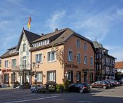
Best Western Hotel Lamm
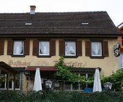
Fischerkeller Pension
Rheingold
Am Kellhof
Löwen
Krone
Alte Mühle
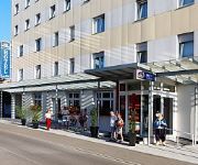
Holiday Inn Express SINGEN
Hegau Tower
Victoria
Videos from this area
These are videos related to the place based on their proximity to this place.
GasWarrior mit OBD
Zeigt eine kurze Demonstration und spezifische Details des GasWarriors in einem Fahrzeug mit OBD. Weitere Informationen: http://www.progile.ch/gaswarrior.
Ramsen(CH) - Moskau(CH) - Rielasingen(D)
Fahrt Ramsen(CH) - Moskau(CH) - Rielasingen(D) Moskau ist ein kleiner Weiler der Gemeinde Ramsen im östlichen Teil des Kantons Schaffhausen in der Schweiz: ...
Ebringen-Gottmadingen (Heilsberg) (MTB/DH)
Fahrrad: Merida One-Forty XT-Edition Trail: Von Ebringer Berg (Heilsberg) im Hegau (BW) nach Gottmadingen. Kamera: GoPro Hero 2.
REC Konstanz vs RRV Gottmadingen
Ein Zusammenschnitt des Spiels REC Konstanz gegen den RRV Gottmadingen im Rahmen der Süddeutschen Meisterschaft. Leider hat es den ganzen Tag geregnet wodurch der Spielverlauf ...
Harlem Shake Wedding Hochzeit Gottmadingen Original
This video was taken during/after our civil wedding. Thanks to our family and friends for that wonderful day. Dieses Video wurde während/nach unserer standesamtlichen Trauung erstellt. Vielen...
Zahnarztpraxis Michael H. Baron Zahnarzt in 78244 Gottmadingen
http://zahnarzt-baron.de/ Entspannen Sie sich! Sie haben unsere Zahnarztpraxis gefunden. Herzlich Willkommen ;-) Bei Herrn Michael H. Baron Zahnarzt in 78244 Gottmadingen sind Sie in guten...
Videos provided by Youtube are under the copyright of their owners.
Attractions and noteworthy things
Distances are based on the centre of the city/town and sightseeing location. This list contains brief abstracts about monuments, holiday activities, national parcs, museums, organisations and more from the area as well as interesting facts about the region itself. Where available, you'll find the corresponding homepage. Otherwise the related wikipedia article.
Diessenhofen District
Diessenhofen District is a former district of the canton of Thurgau in Switzerland. It had a population of 6,621 (as of 2009). Its capital was the town of Diessenhofen. The former district contained the following municipalities:
Hegau
The Hegau is a formerly volcanic landscape in southern Germany extending around the industrial city of Singen (Hohentwiel), between Lake Constance in the east, the Rhine River in the south, the Danube River in the north and the Randen—as the southwestern mountains of the Swabian Jura are called—in the west. The most famous sight of the Hegau is the Hohentwiel, a volcanic stub. On top of the mountain lies Hohentwiel fortress.
Hüttwilersee
Hüttwilersee is a lake in the Canton of Thurgau, Switzerland. It is located near two other lakes, Nussbaumersee and Hasensee, on the border of the municipalities of Hüttwilen und Uesslingen-Buch.
St. George's Abbey, Stein am Rhein
St. George's Abbey, Stein am Rhein (Kloster Sankt Georgen, Stein am Rhein) was a Benedictine monastery in Stein am Rhein, Switzerland.
Hasensee
Hasensee is a lake in the canton of Thurgau, Switzerland. It is located in the same valley as Nussbaumersee and Hüttwilersee. Its surface area is 0.11 km² and the surface elevation is 434.16 m, after being lowered by 1.5 m in World War II. Hasensee is or was also known as Buchemer See or oberer See (upper lake).
Nussbaumersee
Nussbaumersee is a small lake between Nussbaumen and Uerschhausen, both in the municipality of Hüttwilen in the Canton of Thurgau, Switzerland. Its surface area is 0.252 km². Hüttwilersee and Hasensee are located in the same valley. Nussbaumer See is or was also known as Werdsee or Wertsee, Uerschhauser See or unterer See (lower lake). Together with Hasensee they formed the Helfenberger Seen or Ittinger Seen.
Basadingen
Basadingen is a village and former municipality in the canton of Thurgau, Switzerland. In 1999 the municipality was merged with the neighboring municipality Schlattingen to form a new and larger municipality Basadingen-Schlattingen.
Schlattingen
Schlattingen is a village and former municipality in the canton of Thurgau, Switzerland. In 1999 the municipality was merged with the neighboring municipality Basadingen to form a new and larger municipality Basadingen-Schlattingen.
Trüttlikon
Trüttlikon is a village in the canton of Thurgau, Switzerland. It was first recorded in year 1155 as Truchtelincofen. Trüttlikon is located in the former municipality Buch bei Frauenfeld. In 1995 Buch bei Frauenfeld municipality merged with its neighbor to form a new and larger municipality Uesslingen-Buch.
Husemersee
Husemersee (or Hausersee) is a lake at Ossingen in the Canton of Zurich, Switzerland. Its surface area is 8 ha.
Morgetshofsee
Morgetshofsee is a kettle lake at Thayngen in the canton of Schaffhausen, Switzerland. The lake and its surroundings are listed in the Federal Inventory of Amphibian Spawning Areas as a site of national importance.
Hohenhewen
Hohenhewen is a mountain of Baden-Württemberg, Germany.
Hohenkrähen
Hohenkrähen is a mountain of Baden-Württemberg, Germany.
Hohenstoffeln
Hohenstoffeln is a mountain of Baden-Württemberg, Germany.
Mägdeberg
Mägdeberg is a mountain of Baden-Württemberg, Germany.
Rosenegg (mountain)
Rosenegg is a mountain of Baden-Württemberg, Germany.
Alemannenring
The Alemannenring was an auto racing circuit in Southern Germany. The circuit was located on public roads around in the industrial area of Singen in Baden-Württemberg. It hosted its final motor race in 1995.
Werd (Lake Constance)
Werd Island is the main island of the small island group Werd Islands in the westernmost part of the Lower Lake of Lake Constance just before the High Rhine leaves the part of the lake known as Rheinsee. It is located on Swiss territory between Stein am Rhein and Eschenz.
Biber (Rhine)
The Biber is a small river on the border between Germany and Switzerland. The source is located at Watterdingen in the municipality Tengen, district of Constance in Baden-Wuerttemberg. After about 24 km the Biber river flows into the Rhine at the Biber Mill west of Hemishofen in the Canton of Schaffhausen. The Biber is the largest tributary of the High Rhine on the stretch between Stein am Rhein and Schaffhausen.
Unterhof Castle
Unterhof Castle is a castle in the municipality of Diessenhofen of the Canton of Thurgau in Switzerland. It is a Swiss heritage site of national significance.
Hohenklingen Castle
Hohenklingen Castle is a castle in the municipality of Stein am Rhein of the Canton of Schaffhausen in Switzerland. It is a Swiss heritage site of national significance.
Herblingen Castle
Herblingen Castle is a castle in the municipality of Stetten of the Canton of Schaffhausen in Switzerland. It is a Swiss heritage site of national significance.
Stammheim railway station
Stammheim is a railway station in the Swiss canton of Zurich and municipality of Unterstammheim. The station is located on the Winterthur to Etzwilen line and is served by Zurich S-Bahn line S29, which links Winterthur and Stein am Rhein.
Etzwilen railway station
Etzwilen is a railway station in the Swiss canton of Thurgau and municipality of Wagenhausen. It takes its name from the nearby settlement of Etzwilen. The station is located on the Seelinie railway line, which links Schaffhausen with Konstanz, at its junction with the Winterthur to Etzwilen line and the Etzwilen to Singen freight line.
Ossingen railway station
Ossingen is a railway station in the Swiss canton of Zurich and municipality of Ossingen. The station is located on the Winterthur to Etzwilen line and is served by Zurich S-Bahn line S29, which links Winterthur and Stein am Rhein.


