Safety Score: 4,0 of 5.0 based on data from 9 authorites. Meaning please reconsider your need to travel to Switzerland.
Travel warnings are updated daily. Source: Travel Warning Switzerland. Last Update: 2024-08-13 08:21:03
Delve into Obsee
Obsee in Obwalden (Canton of Obwalden) is located in Switzerland about 35 mi (or 57 km) east of Bern, the country's capital town.
Current time in Obsee is now 03:25 AM (Friday). The local timezone is named Europe / Zurich with an UTC offset of one hour. We know of 12 airports close to Obsee, of which 5 are larger airports. The closest airport in Switzerland is Buochs Airport in a distance of 17 mi (or 28 km), North-East. Besides the airports, there are other travel options available (check left side).
There are several Unesco world heritage sites nearby. The closest heritage site in Switzerland is Swiss Alps Jungfrau-Aletsch in a distance of 20 mi (or 33 km), South. We encountered 8 points of interest near this location. If you need a hotel, we compiled a list of available hotels close to the map centre further down the page.
While being here, you might want to pay a visit to some of the following locations: Sarnen, Schuepfheim, Stans, Interlaken and Luzern. To further explore this place, just scroll down and browse the available info.
Local weather forecast
Todays Local Weather Conditions & Forecast: 12°C / 53 °F
| Morning Temperature | 5°C / 40 °F |
| Evening Temperature | 6°C / 43 °F |
| Night Temperature | 7°C / 44 °F |
| Chance of rainfall | 0% |
| Air Humidity | 50% |
| Air Pressure | 1024 hPa |
| Wind Speed | Light breeze with 5 km/h (3 mph) from North |
| Cloud Conditions | Scattered clouds, covering 38% of sky |
| General Conditions | Scattered clouds |
Saturday, 16th of November 2024
15°C (59 °F)
7°C (45 °F)
Sky is clear, light breeze, clear sky.
Sunday, 17th of November 2024
14°C (57 °F)
9°C (48 °F)
Light rain, light breeze, clear sky.
Monday, 18th of November 2024
8°C (46 °F)
4°C (39 °F)
Light rain, light breeze, overcast clouds.
Hotels and Places to Stay
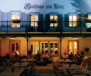
Kreuz Sachseln
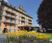
Parkhotel du Sauvage Meiringen
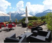
Gletscherblick Hotel
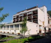
Sherlock Holmes Das Hotel
Reuti
Panorama
Wasserwendi
Alpenrose
Chalet Silvana
Videos from this area
These are videos related to the place based on their proximity to this place.
Autofahrt von Hüttstett nach Lungern
He!nz Zenger fährt mit dem Subaru Impreza 2.0 GT Turbo am Karfreitagnachmittag, 2. April 2010 von Hüttstett nach Lungern (Teil 2).
The Brunig line - Lucerne to Interlaken aboard the Golden Pass train.
Travel on one of Switzerland's most spectacular narrow gauge railway lines, as we follow the route of the Golden Pass trains between Lucerne and Interlaken.
GoldenPass scenic train ride
ZB (Zentralbahn) train riding from Interlaken to Lucerne on Brünigbahn. Firslty along Brienz lake and Aare river, then ascending to Brünig pass and down to Lungern lake.
Stuntman
Freestyle Ski und Snowboard von einem jungen 8 köpfigen Team aus Lungern. Schaut doch mal bei www.freestyle-ow.ch nach.
Steam Train over the Brünig Pass, Switzerland (3/5): Up to Brünig Pass
The Brünig Pass Railway was opened 1888 and is celebrating its 125 year anniversary this year (2013). We had the opportunity to travel like it was 125 years ago from Alpnachstad over the Brünig...
Switzerland, Alps above Grindelwald
Our last day in Switzerland we hike to the Bachalpsee, an alpine lake at 7200 ft. It has been a wonderful trip to Northern Italy and Switzerland.
Steam Train over the Brünig Pass, Switzerland (4/5): Down from Brünig Pass
The Brünig Pass Railway was opened 1888 and is celebrating its 125 year anniversary this year (2013). We had the opportunity to travel like it was 125 years ago from Alpnachstad over the Brünig...
Brünigpass towards Brienzer See Schweiz in 1997
My very first motorhome camera cast in 21.november 1997 ! GPS 46.74786 8.12278.
10 Jahre Brünig Indoor: Unterirdischer Biathlon (Trailer)
10 Jahre Brünig Indoor - Schiess-Sport-Zentrum: Unterirdischer Biathlon im Sommer 2012 zum Jubiläum Weiter Informationen: http://www.bruenigindoor.ch/index.php?page=1029.
Videos provided by Youtube are under the copyright of their owners.
Attractions and noteworthy things
Distances are based on the centre of the city/town and sightseeing location. This list contains brief abstracts about monuments, holiday activities, national parcs, museums, organisations and more from the area as well as interesting facts about the region itself. Where available, you'll find the corresponding homepage. Otherwise the related wikipedia article.
Lake Lungern
Lake Lungern (German: Lungerersee, also spelled Lungernsee or Lungerensee) is a small natural lake in Obwalden, Switzerland which is named after the town Lungern on its shore. The lake is drained by the Sarner Aa river, which flows through the Sarnersee and into Lake Lucerne. The lake was originally much larger, and covered a large part of the valley it is situated in. Starting in 1836, its level was lowered by 36 metres through an artificial drainage tunnel of 380 m length.
Brünig-Hasliberg railway station
Brünig-Hasliberg is a Swiss railway station located at the highest point of the Brünig Pass, on the Brünig line, owned by the Zentralbahn, that links Interlaken and Lucerne. The station takes its name from the name of the pass, and the resort area of Hasliberg, which lies to its east. Politically, the station is in the municipality of Meiringen in the canton of Bern, albeit 5 km horizontally and 400 m vertically from the village centre.
Kaiserstuhl OW railway station
Kaiserstuhl OW is a Swiss railway station on the Brünig line, owned by the Zentralbahn, that links Interlaken and Lucerne. The station is located by the hamlet of Kaiserstuhl, in the municipality of Lungern and the canton of Obwalden. The station is served by the following passenger trains: The station should not be confused with Kaiserstuhl AG station, on the Winterthur to Koblenz line in the canton of Aargau.
Lungern railway station
Lungern is a Swiss railway station on the Brünig line, owned by the Zentralbahn, that links Interlaken and Lucerne. The station is located in the municipality of Lungern and the canton of Obwalden. The station is served by the following passenger trains:


