Safety Score: 4,0 of 5.0 based on data from 9 authorites. Meaning please reconsider your need to travel to Switzerland.
Travel warnings are updated daily. Source: Travel Warning Switzerland. Last Update: 2024-08-13 08:21:03
Discover Unterwisstanne
The district Unterwisstanne of in Canton of Lucerne is a subburb in Switzerland about 34 mi east of Bern, the country's capital city.
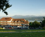
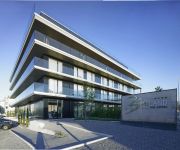
If you need a hotel, we compiled a list of available hotels close to the map centre further down the page.
While being here, you might want to pay a visit to some of the following locations: Schenkon, Sursee, Willisau, Hochdorf and Luzern. To further explore this place, just scroll down and browse the available info.
Local weather forecast
Todays Local Weather Conditions & Forecast: 5°C / 41 °F
| Morning Temperature | 0°C / 33 °F |
| Evening Temperature | 3°C / 37 °F |
| Night Temperature | -1°C / 30 °F |
| Chance of rainfall | 0% |
| Air Humidity | 73% |
| Air Pressure | 1028 hPa |
| Wind Speed | Light breeze with 3 km/h (2 mph) from South-West |
| Cloud Conditions | Broken clouds, covering 78% of sky |
| General Conditions | Broken clouds |
Friday, 15th of November 2024
6°C (42 °F)
-0°C (31 °F)
Few clouds, light breeze.
Saturday, 16th of November 2024
9°C (48 °F)
2°C (35 °F)
Sky is clear, light breeze, clear sky.
Sunday, 17th of November 2024
10°C (49 °F)
5°C (41 °F)
Light rain, gentle breeze, few clouds.
Hotels and Places to Stay
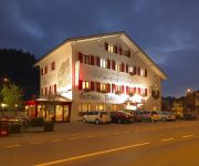
Vogelsang
Birdland The Hotel
Aquafit Wellness & Spa
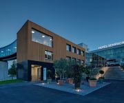
Hotel Sempachersee Swiss Quality
Sonne Seehotel
Rebstock
Feld Hotel Restaurant
CAMPUS SURSEE
Central
Kreuz
Videos from this area
These are videos related to the place based on their proximity to this place.
In and around Church of Ruswil, Switzerland
On a one-day trip with the car around our home-town Luzern, Siwtzerland, my wife and me came accross the village of Ruswil. The village has around 6.500 inhabitants, more than 80% being Catholic...
Duo HAUTNAH - Partyband, LIVE Oktoberfest 2014 (1.TEIL) in Ruswil (SCHWEIZ)
OKTOBERFEST mit Duo HAUTNAH - Partyband 1.TEIL, LIVE in Ruswil (SCHWEIZ). Das Duo spielt aktuelle Partymusik und ist als Tanzmusik für Hochzeit, Geburtstagsfeier, Firmenfeier, Ball, Fasching,.
Alectron Solar AG, Ruswil - Imagefilm
Alectron Solar AG, 6017 Ruswil Kurzer Imagefilm über das Gesamtangebot der Firma Alectron Solar AG am Beispiel einer Komplettinstallation einer Pferdedressur-Halle.
2014-02-01 Fides Ruswil Volleyball - VB Therwil
Damen Nationalliga B Aufstiegsrunde 2014: Fides Ruswil Volleyball - Volleyball Therwil 3-1 (25-15, 25-15, 24-26, 25-23) Highlights und Slow Motions.
Raupenmaishäcksler Maisernte 2014
Hier ein Video von diesjährigen Maisernte im Einsatz war das LU Bucher Ernte Technik und Wangeler Josef jun. Lohnunternehmen und Lisibach Maschinenbau. Im gesammten wurden 6 Ha ...
Semec Mechanik AG
Imagefilm der Firma Semec Mechanik AG in Ruswil. Informationen unter: Semec Mechanik AG Schützeberg 1 Ch - 6017 Ruswil www.semec.ch Produziert durch format4D.ch www.format4D.ch ...
Videos provided by Youtube are under the copyright of their owners.
Attractions and noteworthy things
Distances are based on the centre of the city/town and sightseeing location. This list contains brief abstracts about monuments, holiday activities, national parcs, museums, organisations and more from the area as well as interesting facts about the region itself. Where available, you'll find the corresponding homepage. Otherwise the related wikipedia article.
Battle of Sempach
The Battle of Sempach was fought on July 9, 1386, between Leopold III, Duke of Austria, and the Old Swiss Confederacy. The battle was a decisive Swiss victory in which Duke Leopold and numerous Austrian nobles died. The victory helped turn the loosely allied Swiss Confederation into a more unified nation and is seen as a turning point in the growth of Switzerland.
Blosenbergturm
The Blosenbergturm is a former radio transmission tower built for the German-language radio station DRS at Beromünster in the Canton of Lucerne, Switzerland, in 1937. It radiated at 531 kHz, the lowest officially allocated frequency in the European medium-wave band. The Blosenbergturm is a self-radiating tower insulated against ground, i.e. the entire tower structure is used as an antenna. Its total height of 217 m makes it Switzerland's third-highest tower structure.
Hochdorf District
Hochdorf District is one of the five Ämtern, or districts, of the German-speaking Canton of Lucerne, Switzerland. Its capital is the town of Hochdorf. It has a population of 67,073 (as of 31 December 2011). Hochdorf District consists of the following fourteen municipalities: ^a 1992/97 survey gives a total area of 177.50 km without including certain large lakes, while the 2000 survey includes lakes and gives the higher value.
Lucerne District
Lucerne District is an Amt (administrative district) of the Canton of Lucerne, Switzerland. It has a population of 174,718 (as of 31 December 2011) and consists of 18 municipalities, of which the city of Lucerne is the largest and the district capital: ^a 1992/97 survey gives a total area of 216.65 km without including certain large lakes, while the 2000 survey includes lakes and gives the higher value. ^b Includes the area of Littau which merged into Luzern on 1 January 2010.
Sursee Stadthalle
Sursee Stadthalle is an indoor sporting arena located in Sursee, Switzerland. The capacity of the arena is 3,500 people. It hosted some matches at the 2006 European Men's Handball Championship.
Lake Sempach
Lake Sempach is a lake in the Canton of Lucerne, Switzerland. Its area is about 14.5 km² and its maximum depth is 87 m. A 50 metre-large island named Gamma Insel is located east of Sursee.
Lake Baldegg
Lake Baldegg is a lake in the Canton of Lucerne, Switzerland. Its area is about 5.2 km² and its maximum depth is 66 m.
Sursee District
Sursee District is one of the five Ämtern, or districts, of the German-speaking Canton of Lucerne, Switzerland. Its capital is the town of Sursee. It has a population of 71,658 (as of 31 December 2011). Sursee District consists of the following municipalities: ^a 1992/97 survey gives a total area of 287.50 km without including certain large lakes, while the 2000 survey includes lakes and gives the higher value.
Willisau District
Willisau District is one of the five districts, of the German-speaking Canton of Lucerne, Switzerland. Its capital is the town of Willisau. It has a population of 49,880 (as of 31 December 2011). Willisau District consists of the following municipalities: ^a 1992/97 survey gives a total area of 337.45 km without including certain large lakes, while the 2000 survey includes lakes but due to other changes is slightly lower.
Sonnenberg Tunnel
The Sonnenberg Tunnel is a 1,550m long motorway tunnel, constructed between 1971 and 1976 and located near Lucerne, Switzerland. At its completion it was also the world's largest civilian nuclear fallout shelter, designed to protect 20,000 civilians in the eventuality of war or disaster.
Mauensee
Mauensee is a lake in the canton of Lucerne, Switzerland, near the town Mauensee. Mauensee Castle is built on an islet in the 0.55 km² large lake. It was built in 1605 for the Pfyffer family.
Rengg Pass
Rengg Pass is a mountain pass between the cantons of Nidwalden and Obwalden in Switzerland. It connects Hergiswil and Alpnach.
Soppensee
Soppensee is a lake in Canton of Lucerne, Switzerland. The surface area is 0.227 km². The lake and its surroundings are located in the municipalities of Buttisholz, Menznau and Ruswil.
Rengg
Rengg (el. 959 m. ) is a mountain pass in the canton Lucerne in Switzerland. It connects Schachen, part of Werthenstein, and Entlebuch. It lies partially in the district of Entlebuch which is a biosphere preserve recognized by UNESCO.
Tuetenseeli
Tuetenseeli (Tuetesee) is a lake in Menznau, Canton of Lucerne, Switzerland. Its surface area is 2.15 ha. The lake and its surrounding bogs are a nature preserve.
Steinibühlweiher
Steinibühlweiher is a pond at Sempach in the Canton of Lucerne, Switzerland. The artificial reservoir has a surface area of 3 ha.
Suhre
The river Suhre (also Sure) is a 34 kilometer long tributary of the river Aare in the Swiss cantons of Lucerne and Aargau. The river sources in Lake Sempach at an altitude of 504 meters above sea level, and joins the Aare east of the town Aarau at an altitude of 362 meters. The most important side valley is the Ruedertal, which joins the Suhre valley at Schöftland. In medieval age, the river had several different names: Suron (1036), Suranum flumen (1210), Sure (1241).
Stadion Gersag
Stadion Gersag is a stadium in Emmenbrücke, Luzern, Switzerland. It is currently used for football matches and is the home ground of FC Emmenbrücke. The stadium has 3,195 covered seats and 4,785 standing places. It is the home stadium of FC Emmenbrücke and from 2009-2011 has been the temporary stadium of FC Luzern whilst their home stadium, the Swissporarena, is built.
Schlachtkapelle
Schlachtkapelle (lit. "battle chapel") is a term used in Switzerland for a chapel dedicated to the memory of one of the battles of the Old Swiss Confederacy. Schlachtkapellen in Switzerland include those commemorating: the battle of Morgarten (1315), the battle of Sempach (1386), the battle of Näfels (1388), the battle of Stoss (1405), the battle of Dornach (1499), among others. \t\t \t\t\tKapelle Sempach 1. jpg \t\t\t Schlachtkapelle Sempach \t\t\t \t\t \t\t \t\t\tPicswiss SZ-20-01.
Stadion Kleinfeld
Stadion Kleinfeld is a football stadium in Kriens, Switzerland. It is the home ground of SC Kriens and has capacity of 5,360. The stadium has 540 seats and 4,560 standing places.
Buttisholz Castle
Buttisholz Castle is a castle in the municipality of Buttisholz of the Canton of Lucerne in Switzerland. It is a Swiss heritage site of national significance.
Kastelen Tower Ruins
Kastelen Tower is a ruined castle in the municipality of Alberswil of the Canton of Lucerne in Switzerland. It is a Swiss heritage site of national significance.
Bailiff's Castle (Willisau)
The Bailiff's Castle is a castle in the municipality of Willisau of the Canton of Lucerne in Switzerland. It is a Swiss heritage site of national significance.
Huwyl
Huwyl is a hamlet of Hochdorf in the Lucerne canton in Switzerland. It is located 2 km to the east from Hochdorf and 2 km from Römerswil. The hamlet is incorporated into the Municipality of Hochdorf. The town name appears as Hunwil or Hunwile in documents dated from 1230 to 1474.
Kriens Mattenhof railway station
Kriens Mattenhof is a Swiss railway station in the municipality of Kriens in the canton of Lucerne. It is on the Brünig line of the Zentralbahn railway company, which links Lucerne and Interlaken, and is also used by trains of the Luzern–Stans–Engelberg line.


