Safety Score: 4,0 of 5.0 based on data from 9 authorites. Meaning please reconsider your need to travel to Switzerland.
Travel warnings are updated daily. Source: Travel Warning Switzerland. Last Update: 2024-08-13 08:21:03
Explore Brand
Brand in Canton of Lucerne is a city in Switzerland about 37 mi (or 60 km) north-east of Bern, the country's capital.
Local time in Brand is now 06:52 AM (Friday). The local timezone is named Europe / Zurich with an UTC offset of one hour. We know of 12 airports in the vicinity of Brand, of which 5 are larger airports. The closest airport in Switzerland is Buochs Airport in a distance of 17 mi (or 27 km), South-East. Besides the airports, there are other travel options available (check left side).
There are several Unesco world heritage sites nearby. The closest heritage site is Prehistoric Pile dwellings around the Alps in Austria at a distance of 8 mi (or 13 km). The closest in Switzerland is Old City of Berne in a distance of 37 mi (or 13 km), North. We found 10 points of interest in the vicinity of this place. If you need a place to sleep, we compiled a list of available hotels close to the map centre further down the page.
Depending on your travel schedule, you might want to pay a visit to some of the following locations: Schenkon, Sursee, Hochdorf, Kirchleerau and Unterkulm. To further explore this place, just scroll down and browse the available info.
Local weather forecast
Todays Local Weather Conditions & Forecast: -1°C / 30 °F
| Morning Temperature | -8°C / 17 °F |
| Evening Temperature | -3°C / 27 °F |
| Night Temperature | -3°C / 27 °F |
| Chance of rainfall | 5% |
| Air Humidity | 87% |
| Air Pressure | 1014 hPa |
| Wind Speed | Moderate breeze with 9 km/h (6 mph) from North-East |
| Cloud Conditions | Overcast clouds, covering 86% of sky |
| General Conditions | Snow |
Saturday, 23rd of November 2024
-0°C (31 °F)
-4°C (25 °F)
Broken clouds, gentle breeze.
Sunday, 24th of November 2024
3°C (37 °F)
-1°C (31 °F)
Broken clouds, light breeze.
Monday, 25th of November 2024
4°C (40 °F)
3°C (37 °F)
Moderate rain, light breeze, overcast clouds.
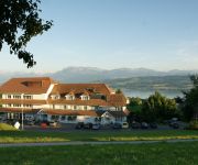
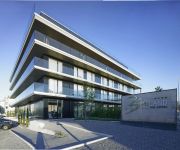
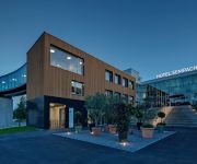
Hotels and Places to Stay
Vogelsang
Birdland The Hotel
Aquafit Wellness & Spa
Glashaus Hotel
Sonne Seehotel
Hotel Sempachersee Swiss Quality
Feld Hotel Restaurant
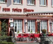
zum Roten Löwen
Central
Sursee
Videos from this area
These are videos related to the place based on their proximity to this place.
Traditions-Turnier 13./14. September 2014 in Rothenburg und Sempach
der Fahrgruppe Innerschweiz. Der Fahrer Toni Stofer vom "Team UFWIND" durchfährt mit seinen 6 Pferden gerade das historische Städchen Sempach im Kanton Luzern.
CS Gunzwil août 2012 - Baptiste F. 1/16 finale
Championnat Suisse Gunzwil, Baptiste F. 1/16 finale catégorie amateurs.
Hotel Vogelsang
http://www.vogelsang.ch Hotel mit einzigartigen Zimmer und Suiten im Loft - Design mit einer traumhaften Aussicht auf die Alpen. Die Gemeinde Eich liegt zwischen Sempach und Sursee am ...
Sprengung Sendeturm Beromünster
Am 19.08.2011 um 14 Uhr wurde der kleine Sendeturm in Beromünster gesprengt.
Sprengung des Reserve Radiosendeturms in Beromünster
Denkmal am Boden ! Heute 14.00 h (19.08.2011) ging ein Stück Schweizer Radio-Geschichte zu Ende. Der 125 Meter hohe Reserve-Turm ( Baujahr 1931 ) beim Landessender Beromünster wurde ...
Blosenbergturm ( Hauptsendeturm Beromünster) in der Dämmerung
Der Blosenbergturm ( Hauptsendeturm Beromünster) in der Dämmerung. Man beachte den rotierenden Scheinwerfer oberhalb der Kabine.
Blosenbergturm (Hauptsendeturm Beromünster) bei Nacht
Der Blosenbergturm ( Hauptsendturm Beromünster) bei Nacht nach Sendeschluss. Man beachte, daß das Blinklicht jetzt vollständig erlischt.
mercury vapor rectifier
historical mercury vapor rectifier used in Switzerland's national AM transmitter station Beromünster - to be closed down by the end of 2008. Taken during an open house day (farewell celebration)....
Videos provided by Youtube are under the copyright of their owners.
Attractions and noteworthy things
Distances are based on the centre of the city/town and sightseeing location. This list contains brief abstracts about monuments, holiday activities, national parcs, museums, organisations and more from the area as well as interesting facts about the region itself. Where available, you'll find the corresponding homepage. Otherwise the related wikipedia article.
Blosenbergturm
The Blosenbergturm is a former radio transmission tower built for the German-language radio station DRS at Beromünster in the Canton of Lucerne, Switzerland, in 1937. It radiated at 531 kHz, the lowest officially allocated frequency in the European medium-wave band. The Blosenbergturm is a self-radiating tower insulated against ground, i.e. the entire tower structure is used as an antenna. Its total height of 217 m makes it Switzerland's third-highest tower structure.
Lucerne District
Lucerne District is an Amt (administrative district) of the Canton of Lucerne, Switzerland. It has a population of 174,718 (as of 31 December 2011) and consists of 18 municipalities, of which the city of Lucerne is the largest and the district capital: ^a 1992/97 survey gives a total area of 216.65 km without including certain large lakes, while the 2000 survey includes lakes and gives the higher value. ^b Includes the area of Littau which merged into Luzern on 1 January 2010.
Lake Sempach
Lake Sempach is a lake in the Canton of Lucerne, Switzerland. Its area is about 14.5 km² and its maximum depth is 87 m. A 50 metre-large island named Gamma Insel is located east of Sursee.
Steinibühlweiher
Steinibühlweiher is a pond at Sempach in the Canton of Lucerne, Switzerland. The artificial reservoir has a surface area of 3 ha.
Schlachtkapelle
Schlachtkapelle (lit. "battle chapel") is a term used in Switzerland for a chapel dedicated to the memory of one of the battles of the Old Swiss Confederacy. Schlachtkapellen in Switzerland include those commemorating: the battle of Morgarten (1315), the battle of Sempach (1386), the battle of Näfels (1388), the battle of Stoss (1405), the battle of Dornach (1499), among others. \t\t \t\t\tKapelle Sempach 1. jpg \t\t\t Schlachtkapelle Sempach \t\t\t \t\t \t\t \t\t\tPicswiss SZ-20-01.


