Safety Score: 4,0 of 5.0 based on data from 9 authorites. Meaning please reconsider your need to travel to Switzerland.
Travel warnings are updated daily. Source: Travel Warning Switzerland. Last Update: 2024-08-13 08:21:03
Explore Alt Stafel
Alt Stafel in Canton of Glarus is located in Switzerland about 81 mi (or 131 km) east of Bern, the country's capital.
Local time in Alt Stafel is now 12:52 PM (Friday). The local timezone is named Europe / Zurich with an UTC offset of one hour. We know of 12 airports in the wider vicinity of Alt Stafel, of which 5 are larger airports. The closest is airport we know is Hohenems-Dornbirn Airport in Austria in a distance of 32 mi (or 52 km). The closest airport in Switzerland is St Gallen Altenrhein Airport in a distance of 33 mi (or 52 km), North-East. Besides the airports, there are other travel options available (check left side).
There are several Unesco world heritage sites nearby. The closest heritage site in Switzerland is Swiss Tectonic Arena Sardona in a distance of 13 mi (or 21 km), South. We found 5 points of interest in the vicinity of this place. If you need a place to sleep, we compiled a list of available hotels close to the map centre further down the page.
Depending on your travel schedule, you might want to pay a visit to some of the following locations: Amden, Glarus, Schmerikon, Herisau and Lachen. To further explore this place, just scroll down and browse the available info.
Local weather forecast
Todays Local Weather Conditions & Forecast: 11°C / 52 °F
| Morning Temperature | 3°C / 37 °F |
| Evening Temperature | 6°C / 43 °F |
| Night Temperature | 7°C / 44 °F |
| Chance of rainfall | 0% |
| Air Humidity | 58% |
| Air Pressure | 1024 hPa |
| Wind Speed | Light breeze with 5 km/h (3 mph) from North |
| Cloud Conditions | Broken clouds, covering 81% of sky |
| General Conditions | Broken clouds |
Saturday, 16th of November 2024
14°C (58 °F)
6°C (42 °F)
Sky is clear, light breeze, clear sky.
Sunday, 17th of November 2024
12°C (53 °F)
7°C (44 °F)
Light rain, light breeze, few clouds.
Monday, 18th of November 2024
6°C (43 °F)
2°C (35 °F)
Moderate rain, gentle breeze, overcast clouds.
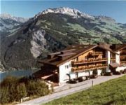
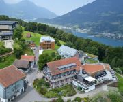
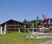
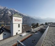
Hotels and Places to Stay
Römerturm
Lihn Seminarhotel
Arvenbüel
Lofthotel
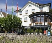
Parkhotel Schwert
AmdenLodge Bienenheim Naturhostel
Sidonie - Amden Dorf
Videos from this area
These are videos related to the place based on their proximity to this place.
MacMeier Boxing Sledge
The foehn wind blew, and the snow which had fallen so far this season melted a bit... and after Zurich's warmest Christmas day on record, Filzbach, between the Walensee below and the Talalpsee...
Arvenbüel, Amden Weesen time-lapse
This time-lapse I made in Arvenbüel, Switserland. Camera's used: Panasonic GH2 GoPro Hero 3 Black Haha, enough room for improvements on this time-lapse, but I thought it was worth to share....
Sailing on Wallensee, Switzerland. Yacht H Class Aotearoa
Ray and Ruedi sailing on Wallensee. The yacht is a 26 foot H Class day sailer. Check out sailing in New Zealand. www.aclasssailing.co.nz.
GPS-Tracks fürs iPhone - Karten speichern
GPS-Tracks fürs iPhone - Karten speichern: Grundsätzlich werden sämtliche Karten über die Datenverbindung des iPhones direkt von unseren Servern geladen (das Programm funktioniert in diesem...
GPS-Tracks fürs iPhone - Grundfunktionen
GPS-Tracks fürs iPhone - Grundfunktionen: Programmaufbau, Karten und Kartenmassstab wählen, Karte positionieren, Karte manuell verschieben, [Suchen] (Stern) zum suchen von Touren, POIs,...
Videos provided by Youtube are under the copyright of their owners.
Attractions and noteworthy things
Distances are based on the centre of the city/town and sightseeing location. This list contains brief abstracts about monuments, holiday activities, national parcs, museums, organisations and more from the area as well as interesting facts about the region itself. Where available, you'll find the corresponding homepage. Otherwise the related wikipedia article.
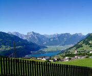
Walensee
The Walensee is one of the larger lakes in Switzerland, for about 2/3 of its surface in the Canton of St. Gallen and for 1/3 in the Canton of Glarus. It is also known as Lake Walen or Lake Walenstadt, after Walenstadt. Other towns and villages at the lake include: Weesen, Quinten, Quarten, and Murg. The three main rivers leading to this lake are the Seez, Murgbach, and Linth. The latter continues its course from Walensee to Lake Zurich.
Kerenzerberg Tunnel (road)
The Kerenzerberg Tunnel is a motorway tunnel in Switzerland, and forms part of the A3 motorway from Basel to Sargans. The tunnel is approximately 5.8 km long and it lies southwest of Lake Walen, under the Kerenzerberg Pass. The Kerenzerberg Tunnel is a one-way, unidirectional tunnel. Traffic from Zurich to Sargans must pass through the Kerenzerberg Tunnel, in the opposite direction the motorway runs along the shores of the Walensee through six short tunnels originally built for a railway.
Kerenzerberg Pass
Kerenzerberg Pass (el. 743 m. ) is a mountain pass in the Alps in the canton of Glarus in Switzerland. It connects Mollis and Mühlehorn above the Walensee. The pass road was built in 1848 and has a maximum grade of 10 percent. Two tunnels have been dug under the pass, a road tunnel for the A-3 Autobahn and a rail tunnel for the Ziegelbrücke to Sargans railway line. The area is known for both summer and winter sport.
Kerenzen-Mühlehorn
Kerenzen-Mühlehorn is a former municipality in the canton of Glarus, Switzerland. It ceased to exist in 1887, when it was split into the three new municipalities Filzbach, Mühlehorn and Obstalden.
Spaneggsee
Spaneggsee is a lake in Filzbach, Glarus, Switzerland. Its surface area is 4.7 ha.
Talalpsee
Talalpsee or Talsee is a lake at an elevation of 1086 m above Filzbach in the Canton of Glarus, Switzerland. Its surface area is 3.2 ha.
Kerenzerberg Tunnel (rail)
The Kerenzerberg Tunnel is a rail tunnel in the Swiss canton of Glarus. The tunnel is 3,955 metres long, and carries the Ziegelbrücke to Sargans line under the Kerenzerberg Pass to the south of the Walensee. Prior to 1960, the railway used a route along the shores of the Walensee and through shorter tunnels.


