Safety Score: 4,0 of 5.0 based on data from 9 authorites. Meaning please reconsider your need to travel to Switzerland.
Travel warnings are updated daily. Source: Travel Warning Switzerland. Last Update: 2024-08-13 08:21:03
Touring Merligen
Merligen in Thun District (Canton of Bern) is a town located in Switzerland about 22 mi (or 36 km) south-east of Bern, the country's capital place.
Time in Merligen is now 05:52 AM (Friday). The local timezone is named Europe / Zurich with an UTC offset of one hour. We know of 12 airports nearby Merligen, of which 5 are larger airports. The closest airport in Switzerland is Bern Belp Airport in a distance of 19 mi (or 30 km), North-West. Besides the airports, there are other travel options available (check left side).
There are several Unesco world heritage sites nearby. The closest heritage site in Switzerland is Swiss Alps Jungfrau-Aletsch in a distance of 20 mi (or 31 km), South-East. We collected 4 points of interest near this location. Need some hints on where to stay? We compiled a list of available hotels close to the map centre further down the page.
Being here already, you might want to pay a visit to some of the following locations: Darligen, Interlaken, Thun, Taegertschi and Langnau. To further explore this place, just scroll down and browse the available info.
Local weather forecast
Todays Local Weather Conditions & Forecast: 10°C / 51 °F
| Morning Temperature | 4°C / 38 °F |
| Evening Temperature | 5°C / 41 °F |
| Night Temperature | 6°C / 43 °F |
| Chance of rainfall | 0% |
| Air Humidity | 46% |
| Air Pressure | 1024 hPa |
| Wind Speed | Light breeze with 3 km/h (2 mph) from North-West |
| Cloud Conditions | Scattered clouds, covering 25% of sky |
| General Conditions | Scattered clouds |
Saturday, 16th of November 2024
14°C (56 °F)
6°C (43 °F)
Sky is clear, light breeze, clear sky.
Sunday, 17th of November 2024
13°C (55 °F)
7°C (45 °F)
Light rain, light breeze, clear sky.
Monday, 18th of November 2024
7°C (44 °F)
4°C (39 °F)
Light rain, light breeze, overcast clouds.
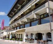
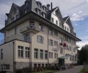
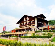
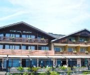
Hotels and Places to Stay
Hotel Bären Sigriswil
Dorint Blüemlisalp
Park Hotel
Eden Swiss Quality
Strandhotel Belvédère
Panorama Tsang
Strandhotel Seeblick
Seegarten Marina
Kreuz
Jägerhof-Hubertus
Videos from this area
These are videos related to the place based on their proximity to this place.
VA Vertiefungsarbeit - Sigriswil
Dorf Sigriswil, Stadt & Natur, Musik: Phil Collins Produktion: Paul Mai.
BSL Werrenäbnit-Surre, Schwanden
Die Gemeinde Sigriswil ist die Sonnenterasse am rechten Thunerseeufer nordwestlich von Thun und umfasst 11 Ortschaften, darunter auch das Dorf Schwanden und Sigriswil selber, getrennt durch...
BSL Wilerallmi-Alpiglen
Die Gemeinde Sigriswil ist die Sonnenterasse am rechten Thunerseeufer nordwestlich von Thun und umfasst 11 Ortschaften, darunter auch das Dorf Schwanden und Sigriswil selber, getrennt durch...
Trio Markus Liebi Heli Brunch
Musik, Brunch und Heilflug im Rest. Rothorn Schwanden ob Sigriswil - Sonntag, 15. Februar 2015 mit Trio Markus Liebi (Markus, Jean-Pierre und Daniel) & mountainflyers.ch.
Driving along Thunersee Panasonic Lumix DMC-TZ7 DMC ZS3
Driving along Thunersee Panasonic Lumix DMC-TZ7 DMC ZS3.
Winter Wellness am Thunersee im Hotel Beatus
Unterwegs am Thunersee bei einem Winter Wellness Wohlfühl Wochenende im Wellness & Spa Hotel Beatus. Außerdem Winterwandern im Berner Oberland mit Blick auf Eiger, Mönch und Jungfrau. Reiseberic...
Highland Fishing
Zum Anlass unseres Seitenstrarts (www.highland-fishing.ch) ein kleiner Zusammenschnitt bisheriger Filmsequenzen von: - Stimmungsbilder unserer schönen Schweizer Seen - Unterwsseraufnahmen.
Thunersee Zeitraffer
Dominic und Marc bei einer Feierabendausfahrt mit dem Rennrad. Die Kamera nahm ein Bild in 2 Sekunden auf.
Hochwasser Thunersee 2005, Busfahrt
Fahrt in einem Mercedes-Gelenkbus auf der STI-Linie 21 Interlaken Ost - Thun während des Hochwassers in der Schweiz im August 2005. Mercedes Bus on the STI-Line 21 Interlaken Ost - Thun...
RC Wasserflug auf dem Thunersee
Modell: Multiplex Funcub mit Schwimmern Kamera: GoPro HD Hero 3 Ort: Thunersee.
Videos provided by Youtube are under the copyright of their owners.
Attractions and noteworthy things
Distances are based on the centre of the city/town and sightseeing location. This list contains brief abstracts about monuments, holiday activities, national parcs, museums, organisations and more from the area as well as interesting facts about the region itself. Where available, you'll find the corresponding homepage. Otherwise the related wikipedia article.
Lake Thun
Lake Thun is an Alpine lake in the Bernese Oberland in Switzerland. It took its name from the city of Thun, on its northern shore. Lake Thun's approximately 2,500 km² large catchment area frequently causes local flooding after heavy rainfalls. This occurs because the river Aar, which drains Lake Thun, has only limited capacity to handle the excess runoff.
Thunersee–Beatenberg railway
The Thunersee–Beatenberg railway (German: Thunersee–Beatenberg Bahn; TBB) is a funicular in the Swiss Canton of Berne. It links Beatenbucht on Lake Thun, served by shipping services on the lake, to the village of Beatenberg, situated on the plateau above at 1120 metres above sea level. The funicular, opened in 1889, has a length of 1695 metres and overcomes a vertical distance of 556 metres with a maximum gradient of 41%.
Sternwarte Sirius
Sternwarte Sirius is an astronomical observatory owned and operated by Stiftung Sternwarte Planetarium SIRIUS. It is located at Schwanden above Sigriswil in the Canton of Berne, Switzerland.
Gibelacher
Gibelacher is a town close to Merligen in Berner Oberland, Switzerland. Gibelacher is not located just to Thunersee but ca. 200 metres up the mountains. Gibelacher has no railway station but has a regular bus traffic to Sagi, Schwanden, Merligen and Oberhofen. Cities close to Gibelacher includes Spiez, Thun and Interlaken.
Schlieregg
Schlieregg is a tiny village in Thun, Berner Oberland, Switzerland. It lies in the municipality of Sigriswil, not far from Thunersee.


