Safety Score: 4,0 of 5.0 based on data from 9 authorites. Meaning please reconsider your need to travel to Switzerland.
Travel warnings are updated daily. Source: Travel Warning Switzerland. Last Update: 2024-08-13 08:21:03
Discover Hagneck
Hagneck in Seeland District (Canton of Bern) with it's 400 citizens is a town in Switzerland about 14 mi (or 23 km) north-west of Bern, the country's capital city.
Current time in Hagneck is now 01:10 PM (Friday). The local timezone is named Europe / Zurich with an UTC offset of one hour. We know of 13 airports near Hagneck, of which 5 are larger airports. The closest airport in Switzerland is Grenchen Airport in a distance of 14 mi (or 22 km), North-East. Besides the airports, there are other travel options available (check left side).
There are several Unesco world heritage sites nearby. The closest heritage site in Switzerland is Old City of Berne in a distance of 15 mi (or 23 km), South-East. We discovered 7 points of interest in the vicinity of this place. Looking for a place to stay? we compiled a list of available hotels close to the map centre further down the page.
When in this area, you might want to pay a visit to some of the following locations: Biel/Bienne, Tafers, Fribourg, Neuchatel and Marly. To further explore this place, just scroll down and browse the available info.
Local weather forecast
Todays Local Weather Conditions & Forecast: 5°C / 41 °F
| Morning Temperature | -1°C / 30 °F |
| Evening Temperature | 1°C / 35 °F |
| Night Temperature | -0°C / 32 °F |
| Chance of rainfall | 0% |
| Air Humidity | 69% |
| Air Pressure | 1026 hPa |
| Wind Speed | Light breeze with 5 km/h (3 mph) from South-West |
| Cloud Conditions | Clear sky, covering 8% of sky |
| General Conditions | Sky is clear |
Saturday, 16th of November 2024
7°C (45 °F)
2°C (35 °F)
Sky is clear, light breeze, clear sky.
Sunday, 17th of November 2024
10°C (49 °F)
5°C (40 °F)
Light rain, moderate breeze, scattered clouds.
Monday, 18th of November 2024
6°C (42 °F)
2°C (36 °F)
Light rain, gentle breeze, overcast clouds.
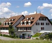
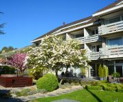
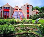
Hotels and Places to Stay
Schloessli Ipsach
Art Deco Elite
Mercure Plaza Biel
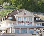
Bären Twann
Fontana
HOTEL TWANNBERG
City Hotel Biel Bienne
Dufour
Videos from this area
These are videos related to the place based on their proximity to this place.
Nico Brina & Charlie Weibel EICHENFUHR 2014 Siselen SCHWEIZ
Samstag, 3. Mai 2014, Eichenfuhr in Siselen, Schweiz NICO BRINA & CHARLIE WEIBEL Boogie Woogie, Blues, Jazz & Rock'n Roll.
CH-2577 Siselen BE Aare Seeland Mobil Kieszug August 2013
Zwischen Siselen und Sutz verkehren Kieszüge auf den Gleisen von Aare Seeland Mobil. Die Kippwagen stammen aus einer Braunkohlegrube der ehemaligen DDR.
Alfa Romeo 147 GTA 0-200kmh acceleration
alfa 147 GTA full decat' CF2 Manifolds Equal Lenght Downpipes Scorpion Decat Stock Catback Stock ECU Alfa Q2 Dial 17" Alloys Bridgestone REO70 Tyres flat road section : 0-200kmh = 22/23sec.
Stromstoss Örgeler live @ Eichenfuhr, Siselen (01.05.14)
Wir Oberländer / Schacherseppli / Örgelihuus / Summer 68.
Videos provided by Youtube are under the copyright of their owners.
Attractions and noteworthy things
Distances are based on the centre of the city/town and sightseeing location. This list contains brief abstracts about monuments, holiday activities, national parcs, museums, organisations and more from the area as well as interesting facts about the region itself. Where available, you'll find the corresponding homepage. Otherwise the related wikipedia article.
Lake Biel
Lake Biel or Lake Bienne is a lake in the west of Switzerland. Together with Lake Morat and Lake Neuchâtel, it is one of the three large lakes in the Jura region of Switzerland. It lies approximately at {{#invoke:Coordinates|coord}}{{#coordinates:47|5|N|7|10|E|type:waterbody_region:CH|| | |name=Lake Biel }}, at the language boundary between German & French speaking areas. The lake is 15 km long and up to 4.1 km wide. Its surface area is 39.3 km², the maximum depth 74 m.
St. Peter's Island
St. Peter’s Island is a peninsula situated in Lake Biel in the canton of Bern, Switzerland. It has a length of about 5 kilometres and a maximum width of 800 metres. Its highest point is 474 metres above sea level or 45 metres above lake level (429 m). It was formed in the last Ice Age, when the Rhône Glacier reached as far as the Jura mountains. It is a promontory of the Jolimont, above Erlach.


