Safety Score: 4,0 of 5.0 based on data from 9 authorites. Meaning please reconsider your need to travel to Switzerland.
Travel warnings are updated daily. Source: Travel Warning Switzerland. Last Update: 2024-08-13 08:21:03
Discover Furen
Furen in Interlaken-Oberhasli District (Canton of Bern) is a place in Switzerland about 45 mi (or 72 km) east of Bern, the country's capital city.
Current time in Furen is now 11:06 AM (Friday). The local timezone is named Europe / Zurich with an UTC offset of one hour. We know of 10 airports near Furen, of which 3 are larger airports. The closest airport in Switzerland is Buochs Airport in a distance of 17 mi (or 27 km), North. Besides the airports, there are other travel options available (check left side).
There are several Unesco world heritage sites nearby. The closest heritage site in Switzerland is Swiss Alps Jungfrau-Aletsch in a distance of 21 mi (or 34 km), South-West. We encountered 8 points of interest in the vicinity of this place. If you need a hotel, we compiled a list of available hotels close to the map centre further down the page.
While being here, you might want to pay a visit to some of the following locations: Sarnen, Stans, Ennetburgen, Emmetten and Bauen. To further explore this place, just scroll down and browse the available info.
Local weather forecast
Todays Local Weather Conditions & Forecast: 8°C / 47 °F
| Morning Temperature | 1°C / 34 °F |
| Evening Temperature | 4°C / 38 °F |
| Night Temperature | 4°C / 40 °F |
| Chance of rainfall | 0% |
| Air Humidity | 54% |
| Air Pressure | 1023 hPa |
| Wind Speed | Light breeze with 5 km/h (3 mph) from North |
| Cloud Conditions | Scattered clouds, covering 49% of sky |
| General Conditions | Scattered clouds |
Saturday, 16th of November 2024
11°C (52 °F)
4°C (39 °F)
Sky is clear, gentle breeze, clear sky.
Sunday, 17th of November 2024
9°C (48 °F)
5°C (41 °F)
Light snow, light breeze, clear sky.
Monday, 18th of November 2024
3°C (38 °F)
0°C (32 °F)
Snow, light breeze, overcast clouds.
Hotels and Places to Stay
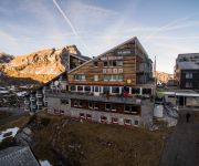
Fischers Alpenhotel
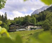
Bänklialp
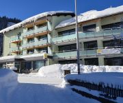
Hahnenblick Hotel & Restaurant
Videos from this area
These are videos related to the place based on their proximity to this place.
FABRICA TOMADA: Stocker, Luzern, Suiza 1990 Marzo Amarillo / camara hugo viggiano
Centralstrasse Luzern 90 En el mes de Marzo en el Canton Lucerna de la Suiza Central fue tomada la Fabrica abandonada llamada Stocker por un grupo de 20 personas aproximadamente, que ...
Gadmen 2010 Teil 1 Schlittenhunderennen in HD
Internationales Schlittenhunderennen Gadmen 2010 am Fusse des Sustenpasses im Haslital Berner Oberland. 20. und 21. Februar 2010. Schweizermeisterschaft 2010. Teil 1 Samstag 20. Februar ...
RT2012Dia6 - Fuhren to Wassen
Road Trip Lacerda 2012 Dia 6 28Ago2012 perto de Furka Pass Fuhren to Wassen na Suiça.
Sig Sauer X Five Entry .40S&W - First Shots
First shots with a brand new Sig Sauer X Five Entry. This particular sports pistol is chambered in .40S&W. (it also comes in 9X19 mm) After acquiring this pistol and unboxing it ,I cleaned...
Snowboard GoPro Engelberg Shred - Dez 2013
Engelberg Ride 2013 7 Crazy Dudes on a Mountain /// Ruben - Robin - Silvan - Mäsi - Andy - Claudio - Simon.
Silencieux d'échappement Inoxcar Subaru BRZ -Toyota GT86 - static & road test - MTK-
Disponible ici: http://www.mtk-tuning.com/silencieux-inoxcar-subaru-brz--toyota-gt86-20034.html Future reine des circuits de drift, de time attack et tout simplement digne héritière des...
Lakes in clouds (Jochpass)
The lakes are Engstlemsee, Jochsee, Trübsee. Phoros & videos from my hike via Jochpass (in Switzerland). I walked from Engstlenalp to Trübsee (under Titles mt.) 30 of september, 2008...
Videos provided by Youtube are under the copyright of their owners.
Attractions and noteworthy things
Distances are based on the centre of the city/town and sightseeing location. This list contains brief abstracts about monuments, holiday activities, national parcs, museums, organisations and more from the area as well as interesting facts about the region itself. Where available, you'll find the corresponding homepage. Otherwise the related wikipedia article.
Engstlensee
Engstlensee is a natural lake used as a reservoir in the municipality of Innertkirchen, Bernese Oberland, Switzerland. It is located near Joch Pass at an elevation of 1850 m. It can be reached by gondola and by foot from Titlis. The reservoir has a volume of 10.7 million m³ whereof 2 million m³ are used for electricity production. The lake's surface area is 0.44 km².
Tannensee
Tannensee is a reservoir in Obwalden, Switzerland. In 1958, Tannenbach and few other creeks were dammed with an earth-fill dam. The lake has a volume of 3.8 mio m³ and its surface area is 0.33 km². The reservoir is used to generate electricity at Kraftwerk Hugschwendi in Kerns.
Triftsee
The Triftsee is a lake in the Urner Alps near Gadmen in the canton of Berne, Switzerland. It was formed recently (after 2002) by the melting of the lower part of Trift Glacier.
Trift Bridge
Trift Bridge is the longest pedestrian-only suspension bridge in the Alps, totaling 170 metres in length and traversing a height of 100 metres . The bridge spans the lake, Triftsee, near Gadmen, Switzerland in an area that receives approximately 20,000 visitors per year to see the Trift Glacier. An earlier bridge was built in 2004. A replacement bridge was opened on June 12, 2009. It was completed in only six weeks.


