Safety Score: 4,0 of 5.0 based on data from 9 authorites. Meaning please reconsider your need to travel to Switzerland.
Travel warnings are updated daily. Source: Travel Warning Switzerland. Last Update: 2024-08-13 08:21:03
Delve into Ober Alp
The district Ober Alp of in Frutigen-Niedersimmental District (Canton of Bern) is a district located in Switzerland about 25 mi south of Bern, the country's capital town.
In need of a room? We compiled a list of available hotels close to the map centre further down the page.
Since you are here already, you might want to pay a visit to some of the following locations: Thun, Veyras, Leuk, Taegertschi and Tafers. To further explore this place, just scroll down and browse the available info.
Local weather forecast
Todays Local Weather Conditions & Forecast: -2°C / 29 °F
| Morning Temperature | -5°C / 23 °F |
| Evening Temperature | -2°C / 29 °F |
| Night Temperature | 2°C / 35 °F |
| Chance of rainfall | 20% |
| Air Humidity | 91% |
| Air Pressure | 1004 hPa |
| Wind Speed | Fresh Breeze with 14 km/h (9 mph) from North-East |
| Cloud Conditions | Overcast clouds, covering 96% of sky |
| General Conditions | Snow |
Friday, 22nd of November 2024
-2°C (28 °F)
-6°C (22 °F)
Snow, gentle breeze, overcast clouds.
Saturday, 23rd of November 2024
2°C (36 °F)
1°C (33 °F)
Broken clouds, gentle breeze.
Sunday, 24th of November 2024
6°C (44 °F)
2°C (36 °F)
Overcast clouds, gentle breeze.
Hotels and Places to Stay
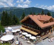
Rinderberg Swiss Alpine Lodge
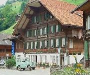
Simmental
Videos from this area
These are videos related to the place based on their proximity to this place.
Paragliding Zweisimmen (Wallis)
Im Rahmen der "Schweizer Woche" war ich mit der Flugschule Diemtigtal am 5.8.2009 in Zweisimmen (Berner Oberland). Mal wieder perfektes Wetter und frühe Morgenthermik.
Swiss Holiday - TSV 13/34
This week we went on holiday to Switzerland, for 1 week, we did a lot of walking as always, a bit of swimming, and a lot of watching of old planes! Day 1 - Arrival Day 2 - Walk from Zweisimmen...
Swiss Golden Pass PanoramicTrain - Zweisimmen to Montreux and Chillon Castle
At Zweisimmen we board the narrow gauge train for the last leg of our Golden Pass rail adventure, again travelling through stunning Swiss scenery. Lake Geneva glints in the evening sunlight...
Camping Vermeille Zweisimmen
RUHE, ERHOLUNG, SONNE UND NATUR PUR ... DAS IST DER SLOGAN DES GANZJÄHRIG GEÖFFNETEN CAMPING VERMEILLE IN ZWEISIMMEN IM MALERISCHEN SIMMENTAL, BERNER ...
Suisse, 04/06/2003, de Montreux à Interlaken, via Zweisimmen (part) (DV)
Au cours du voyage du GTF en Suisse, au mois de juin 2003. Au départ de Montreux, parcours avec le Golden Pass Panoramic du MOB (Montreux-Oberland-Bernois) sur voie métrique, vers ...
BLS 258 (Ae 4/4) Ausfahrt aus Zweisimmen
Bei strömendem Regen fährt die Ae 4/4 258 der Bern-Lätschberg-Simplon-Bahn den Personenzug von Zweisimmen nach Interlaken.
Driving in Switzerland - Zweisimmen to Spiez
Shot by Nokia5233 in the back seat of BMW-740D, chauffeured by my BOSS. We were returning from Lenk and were heading Zurich via Interlaken, Brünig. It was snowing heavily in Lenk when we ...
Atupri Aktiv Erste Hilfe Tag | 24. Mai 2014
Nach der Begrüssung und einer kleinen Stärkung, zeigten uns die Profis vom Samariterverein Zweisimmen, was im Notfall zu tun ist. Am Nachmittag besuchten wir Gruppenweise die Rega Basis...
Cycling Switzerland, in the snowy passes
Riding for a week in November in Switzerland took me through 450 KM of beautiful roads. This video features the passes of Brünig, Saanenmöser, les Mosses, Jaman, the vineyards of Lausanne,...
Videos provided by Youtube are under the copyright of their owners.
Attractions and noteworthy things
Distances are based on the centre of the city/town and sightseeing location. This list contains brief abstracts about monuments, holiday activities, national parcs, museums, organisations and more from the area as well as interesting facts about the region itself. Where available, you'll find the corresponding homepage. Otherwise the related wikipedia article.
Simmental
See also the breed of cattle called Simmental. Simmental is an alpine valley in the Bernese Oberland of Switzerland. It expands from Lenk to Boltigen, in a more or less south-north direction, and from there to the valley exit at Wimmis near Spiez it takes a west-east orientation. It comprises the municipalities of Lenk, St. Stephan, Zweisimmen, Boltigen, Oberwil, Därstetten, Erlenbach, Diemtigen and Wimmis. The Simme flows through the valley.
Engstligenalp
The Engstligenalp is the biggest plateau of the western Swiss Alps. It lies south of Adelboden at 1900 – 2000 m above sea level. Since 1996 it has belonged to the Swiss culture landscapes of national importance. The 7 square kilometre plateau, belonging to the community of Adelboden has the form of an oval measuring in north-south direction 1 km in east-west direction 2 km and is surrounded by mountains, dominated by the Wildstrubel in the southwest.
Obersimmental District
Obersimmental District was one of the 26 administrative districts in the Canton of Bern, Switzerland. Its capital was Blankenburg in the municipality of Zweisimmen. The district had an area of 334 km² and consisted of 4 municipalities:
Thun District
Thun District was one of the 25 administrative districts in the canton of Bern, Switzerland. Its capital was the municipality of Thun. The district had an area of 285 km² and consists of 27 municipalities:
Stadion Lachen
Stadion Lachen is a multi-use stadium in Thun, Switzerland. It is currently used mostly for football matches and was the home ground of FC Thun. The stadium holds 10,350 and was built in 1954. The stadium has places for both seating and standing.
Engstligen falls
The Engstligen falls near Adelboden in the Bernese Oberland are the second highest waterfalls in Switzerland. They are listed in the Swiss inventory of landscapes of national significance. The Engstligen falls have one of the highest water volumes of alpine water falls and are one of the sights of Adelboden.
Our Chalet
Our Chalet is an international Girl Guide/Girl Scout centre and one of four World Centres of the World Association of Girl Guides and Girl Scouts (WAGGGS). The others are Our Cabaña, Sangam, and Pax Lodge. Our Chalet is just outside of Adelboden, in the Bernese Oberland of Switzerland. Located in the Bernese Alps, it is 1,350 metres above sea level. This year (2012) it celebrated its 80th anniversary. Our Chalet, founded by Helen Storrow, opened in 1932.
Amsoldingersee
Amsoldingersee is small lake adjacent to the town of Amsoldingen, in the Upper Gürbetal. It is located near the city of Thun, Switzerland. The lake has a surface area of 38 hectares and a maximum length of 1.1 km and width of 500 m. The maximum depth is 14 m. It is fed by Rotmoos-Bach from the smaller Uebeschisee.
Uebeschisee
Uebeschisee is a small lake at Uebeschi, in the Upper Gürbetal, near Thun, Switzerland. It is located adjacent to the municipalities of Höfen, Amsoldingen and Uebeschi. The lake has a surface area of 14.2 hectares and a maximum depth of 15 m. Rotmoos-Bach drains it into the larger Amsoldingersee.
Seebergsee
Seebergsee is a lake in the Canton of Berne, Switzerland. Its surface area is 6 ha.
Daubensee
Daubensee is a lake at Gemmi Pass in Valais, Switzerland. It is the site of the annual Shepherd Festival held on the last Sunday in July. It has a surface area of 0.69 km².
Oberstockensee
Oberstockensee is a lake in Canton of Berne, Switzerland. Its surface area is 0.118 km. The lake is located above Erlenbach im Simmental, below Stockhorn.
Hinterstockensee
Hinterstockensee is a lake above Erlenbach im Simmental in the Canton of Berne, Switzerland. The lake is located at an elevation of 1595 m, below Stockhorn (2190 m) and near Oberstockensee (1665 m). In the lake is a 100 metre-long island.
Thun (administrative district)
Thun District in the Canton of Bern was created on 1 January 2010. It is part of the Oberland administrative region. It contains 35 municipalities with an area of 321.90 km and a population (as of December 2008) of 103,233.
Arena Thun
Arena Thun is a stadium in Thun, Switzerland. It has a capacity of 10,000 spectators and opened in 2011. It is the home of FC Thun of the Swiss Super League. It replaced Stadion Lachen as the club's home stadium.
Amsoldingen Castle
Amsoldingen Castle is a castle in the municipality of Amsoldingen in the canton of Bern in Switzerland. It is a Swiss heritage site of national significance.


