Safety Score: 4,0 of 5.0 based on data from 9 authorites. Meaning please reconsider your need to travel to Switzerland.
Travel warnings are updated daily. Source: Travel Warning Switzerland. Last Update: 2024-08-13 08:21:03
Touring Unterer Grossgarten
The district Unterer Grossgarten of in Canton of Appenzell Ausserrhoden is a subburb located in Switzerland about 90 mi east of Bern, the country's capital place.
Need some hints on where to stay? We compiled a list of available hotels close to the map centre further down the page.
Being here already, you might want to pay a visit to some of the following locations: Herisau, Haslen, Appenzell, Sankt Gallen and Amden. To further explore this place, just scroll down and browse the available info.
Local weather forecast
Todays Local Weather Conditions & Forecast: -2°C / 29 °F
| Morning Temperature | -4°C / 26 °F |
| Evening Temperature | -3°C / 26 °F |
| Night Temperature | -2°C / 28 °F |
| Chance of rainfall | 16% |
| Air Humidity | 86% |
| Air Pressure | 1013 hPa |
| Wind Speed | Gentle Breeze with 8 km/h (5 mph) from North-East |
| Cloud Conditions | Scattered clouds, covering 42% of sky |
| General Conditions | Snow |
Saturday, 23rd of November 2024
-0°C (31 °F)
-2°C (29 °F)
Light snow, gentle breeze, broken clouds.
Sunday, 24th of November 2024
2°C (36 °F)
-3°C (27 °F)
Overcast clouds, light breeze.
Monday, 25th of November 2024
3°C (37 °F)
3°C (37 °F)
Light rain, light breeze, overcast clouds.
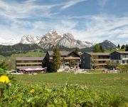
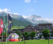
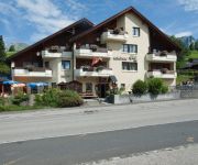
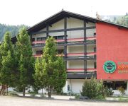
Hotels and Places to Stay
B&B Gästehaus Rössli Schwellbrunn
Stump s Alpenrose
Saentis- das Hotel
Hotel Sternen Unterwasser
Schoenau
Säntis
Hotel Bären Gonten
Toggenburg
Hirschen Swiss Quality
Sonne
Videos from this area
These are videos related to the place based on their proximity to this place.
Conquering Säntis in Switzerland
A 17min. video documentation of our hike at Säntis alp here in Switzerland. It took us 6 hours and 20 mins to reach the top of the mountain. The route that we took was from Ebenalp passing...
Bergtour - Säntis Summit (2.502 m), Schweiz / Appenzeller Alpen - 2013
Meine Tourenberichte: http://wochenendaussteiger.npage.de oder http://wochenendaussteiger.de - Der Säntis ist mit 2'501,9 m ü. M. der höchste Berg im Alpstein (Ostschweiz). Durch die exponierte,...
Fluss Urnäsch bei Urnäsch
Anschwellen des Flusses nach heftigen Gewittern über dem Alpstein/Schwägalp, Video vom 13. Juni 2014, 16:53 bis 16:55.
postcar drive from Urnäsch to Schwägalp (Appenzell) Swizerland
Die Postauto Linie Von Urnäsch nach Schwägalp (Appenzell) The postcar line from Urnäsch to Schwägalp (appenzell)
Silvesterchlausen 13.01.2015 - Puiiiii!
"Bewegende Klänge rühren manch Seele" Appenzell: Sinnlich gelebte Volkskultur, wo Traditionelle Werte tief verankert sind! PHOTOGRAPHY – Appenzell “hier wird Tradition gelebt” Session...
Videos provided by Youtube are under the copyright of their owners.
Attractions and noteworthy things
Distances are based on the centre of the city/town and sightseeing location. This list contains brief abstracts about monuments, holiday activities, national parcs, museums, organisations and more from the area as well as interesting facts about the region itself. Where available, you'll find the corresponding homepage. Otherwise the related wikipedia article.
Unterwasser
Unterwasser is a small village in the canton of St. Gallen, Switzerland. It is part of the municipality of Wildhaus-Alt St. Johann. It is a relatively small ski resort, and many of its trails are shared with the nearby village of Wildhaus. Unterwasser in English means "underwater" (and may be so translated in automatic translations), but in this context means "between the waters" as two rivers run through the village.
Kreuzbleichhalle
Kreuzbleichhalle (Sporthalle Kreuzbleiche) is an indoor sporting arena located in St. Gallen, Switzerland. The capacity of the arena is 4,000 people. It hosted some matches at the 2006 European Men's Handball Championship and is the home arena of the TSV St. Otmar team handball club.
AFG Arena
The AFG Arena is a multi-use stadium in St. Gallen, Switzerland, completed in 2008. It is used mostly for football matches and hosts the home matches of FC St. Gallen of the Swiss Challenge League. It replaces the Espenmoos stadium. The stadium has a capacity of 20,000 people. The name comes from the sponsor, the Arbonia-Forster-Gruppe AFG. When it was completed, FC St. Gallen was just relegated to the Challenge League.
Federal Administrative Court of Switzerland
The Federal Administrative Court of Switzerland is the judicial authority to which decisions of the federal authorities of Switzerland can be appealed. The FAC's decisions can generally be appealed, in turn, to the Federal Supreme Court of Switzerland.
Fälensee
Fälensee (or Fählensee) is a lake in the Alpstein range of the canton of Appenzell Innerrhoden, Switzerland. At an elevation of 1446 m, the surface area is 0.12 km². It is located in a narrow valley between Hundsteingrat and Roslen-Saxer First.
Sämtisersee
Sämtisersee is a lake in the Alpstein range of the canton of Appenzell Innerrhoden, Switzerland. At an elevation of 1209 m, the surface area is 0.13 km². It is located below Hoher Kasten not far from Fälensee.
Seealpsee
Seealpsee is a lake in the Alpstein range of the canton of Appenzell Innerrhoden, Switzerland. At an elevation of 1,143.2 m, the surface area is 13.6 hectares. The lake can be reached by foot from Wasserauen or from Ebenalp. A network of routes around Ebenalp connects Seealpsee with other notable sights in the Appenzell Alps, such as the Wildkirchli and Säntis. The Berggasthaus Forelle am Seealpsee, with a large open air terrace, dominates the western end of the lake.
Wildkirchli
Wildkirchli is the name of a system of three caves in the Alpstein massif of Appenzell, Switzerland. They are notable for the traces of paleolithic habitation discovered in 1940 by Emil Bächler (1868–1950), dating to ca. 50,000 to 30,000 BP. Even earlier are remnants of cave bears found in the caves, dating to ca. 90,000 BP. The hermit hut houses a large bear skeleton found in the caves on site. The caves were inhabited by hermits from 1658 to 1853.
Eastern Switzerland
Eastern Switzerland is the common name of the region situated to the north of Glarus Alps, with the cantons of Schaffhausen, Thurgau, St. Gallen, Appenzell Ausserrhoden, Appenzell Innerrhoden and Glarus. The north of canton Graubünden (with the city of Chur) is sometime considered to be part of Eastern Switzerland. Eastern Switzerland is also defined as one of the NUTS-2 regions of Switzerland.
Voralpsee
Voralpsee is a lake above Grabs in the Canton of St. Gallen, Switzerland.
Gübsensee
Gübsensee is a reservoir near the city of St. Gallen, Switzerland. Its dams were built between 1898 and 1900, the first hydroelectric reservoir in Switzerland. Kraftwerk Kubel has generated electrical power there since 1900. Gübsensee Ost is a gravity dam with a height of 24 m, Gübsensee West an earthfill dam. The lake's surface area is 0.17 km². Its volume is 1.5 mio m³.
Feuerschaugemeinde
Feuerschaugemeinde is a special-purpose municipality for firefighting, energy and water for the town Appenzell, capital of the canton of Appenzell Innerrhoden in Switzerland. The special-purpose municipality exists because parts of the town Appenzell belong to the districts Appenzell, Schwende and Rüte.
Paxmal
The Paxmal is a peace monument built by Karl Bickel between 1924 and 1949, in Walenstadtberg above Walenstadt, in Switzerland. The left wall is the earthly life: a couple of people in its existence and development, love and procreation. The right wall is devoted to the spiritual life: the beings who are awakened, struggling, and which keep growing. Karl Bickel was a Swiss artist who worked for the Swiss Post as a stamps graphic designer.
Ebenalp
The Ebenalp (1,640 m) is the northernmost summit of the Appenzell Alps. The mountain is a popular hiking destination and has been accessible by cable car from Wasserauen since 1955. Ebenalp attracts up to 200,000 visitors each year. From the high plateau of the cable car station visitors have a panoramic view of the rolling hills of Appenzell. impressive trails start at the station and lead to the a network of mountain huts.
St. John's Abbey in the Thurtal
St. John's Abbey in the Thurtal (German: Kloster St. Johann im Thurtal) was a Benedictine monastery originally established in Alt St. Johann in the Canton of St. Gallen, Switzerland, in the mid-12th century. The oldest written record of it is dated October 4, 1152, when Pope Eugene III took the monastery into his protection. The pope confirmed the monastery's possessions and free election of its abbot and Vogt. On October 24, 1178, Pope Alexander III confirmed the abbey's extended possessions.
Abbey library of Saint Gall
The Abbey Library of Saint Gall was founded by Saint Othmar, the founder of the Abbey of St. Gall. The library collection is the oldest in Switzerland, and is one of earliest and most important monastic libraries in the world. It holds 2,100 manuscripts dating back to the 8th through the 15th centuries, 1,650 incunabula (printed before 1500), and old printed books. The library holds almost 160,000 volumes. The manuscript B of the Nibelungenlied is kept here.
Churfirsten
Churfirsten is a mountain range in the Canton of St. Gallen, Switzerland. Depending on the way they are counted, there are seven to thirteen peaks.
Quinten
Quinten is an idyllic hamlet situated on the north shore of the Walensee in Switzerland. It belongs to the municipality of Quarten. As there are no roads leading to Quinten it is only reachable by boat or on foot.
Schwendisee
Schwendisee is a small lake above Wildhaus on the slopes of the Churfirsten, in Toggenburg, Canton of St. Gallen, Switzerland. Besides the main lake (Vorderer Schwendisee), there is a smaller lake nearby (Hinterer Schwendisee). Sediment cores from the lakes have been studied and provide a record of the climate of the last 600 years.
Alpstein
The Alpstein are a subgroup of the Appenzell Alps in Switzerland. The Alpstein massif is in Appenzell Innerrhoden, Appenzell Ausserrhoden and St. Gallen. Despite it being rather low when compared to other Alpine peaks - the highest mountain is the Säntis at 2502 metres - the Alpstein, due to their northern "outpost" position only a short distance from Lake Constance (nearly 30 km) are relatively tall when compared to the surrounding area.
Säntis transmitter
The Säntis transmitter is a 123.5 m (405.3 ft) high transmitting station on the summit of the 2,502 m (8,209 ft) high Säntis mountain in Switzerland. It is operated by Swisscom. The original tower was built in 1955, but due to the extreme weather at such a high altitude, it had to be repeatedly rebuilt. Finally in 1997, a completely new tower has been built which is specifically suited to the icy temperatures.
Meistersrüte
Meistersrüte is part of the district Appenzell Innerrhoden, c.a. 900 metres above sea level. It is a small village consisting of roughly 700 Inhabitants and has its own primary school, bakery, two carpenters, two builders,a furniture carpenter, a small 'bits and bobs' shop, a painter, several restaurants, a train stop (for the Appenzeller Bahnen- Sammelplatz) and an electrician.
Appenzell Castle
Appenzell Castle or Clanx Castle (German: Ruine Clanx or Burg zu Appenzell) is a ruined castle in the Appenzell District of the canton of Appenzell Innerrhoden in Switzerland. It is part of the Swiss heritage site of national significance. The castle is first mentioned in 1219 as in arce Clanx. It was built by the Abbot of St. Gall Ulrich von Sax (1204–20) and his brother, the Abbey-Vogt Heinrich. It was named after the Sax family holding in the Calanca valley.
Hohensax castle
Hohensax is a ruined castle in the Sennwald municipality in the Swiss canton St. Gallen. The castle was built around 1200 by the barons of Sax, and was destroyed in 1446. In 1248, the castle passed to Ulrich von Sax, founder of the Sax-Hohensax line of the noble family. The castle was plundered in a feud of 1393, and sold together with the villages of Sax and Gams to the dukes of Austria. In the Old Zürich War, the people of Appenzell captured and slighted the castle in 1446.
Gräpplang Castle
Gräpplang Castle is a castle in the municipality of Flums of the Canton of St. Gallen in Switzerland. It is a Swiss heritage site of national significance.


