Safety Score: 4,0 of 5.0 based on data from 9 authorites. Meaning please reconsider your need to travel to Switzerland.
Travel warnings are updated daily. Source: Travel Warning Switzerland. Last Update: 2024-08-13 08:21:03
Explore Stein
Stein in Bezirk Rheinfelden (Canton of Aargau) with it's 2,504 inhabitants is located in Switzerland about 48 mi (or 76 km) north-east of Bern, the country's capital.
Local time in Stein is now 12:21 PM (Sunday). The local timezone is named Europe / Zurich with an UTC offset of one hour. We know of 10 airports in the wider vicinity of Stein, of which 3 are larger airports. The closest is airport we know is EuroAirport Basel-Mulhouse-Freiburg Airport in France in a distance of 20 mi (or 32 km). The closest airport in Switzerland is Zürich Airport in a distance of 28 mi (or 32 km), West. Besides the airports, there are other travel options available (check left side).
There are several Unesco world heritage sites nearby. The closest heritage site is Prehistoric Pile dwellings around the Alps in Austria at a distance of 22 mi (or 35 km). The closest in Switzerland is Old City of Berne in a distance of 47 mi (or 35 km), South-East. We found 10 points of interest in the vicinity of this place. If you need a place to sleep, we compiled a list of available hotels close to the map centre further down the page.
Depending on your travel schedule, you might want to pay a visit to some of the following locations: Wittnau, Murg, Rickenbach, Schworstadt and Woelflinswil. To further explore this place, just scroll down and browse the available info.
Local weather forecast
Todays Local Weather Conditions & Forecast: 9°C / 47 °F
| Morning Temperature | 1°C / 34 °F |
| Evening Temperature | 3°C / 37 °F |
| Night Temperature | 0°C / 33 °F |
| Chance of rainfall | 0% |
| Air Humidity | 93% |
| Air Pressure | 1023 hPa |
| Wind Speed | Light breeze with 3 km/h (2 mph) from North-West |
| Cloud Conditions | Overcast clouds, covering 88% of sky |
| General Conditions | Overcast clouds |
Monday, 25th of November 2024
7°C (44 °F)
5°C (41 °F)
Light rain, light breeze, few clouds.
Tuesday, 26th of November 2024
8°C (46 °F)
2°C (36 °F)
Moderate rain, moderate breeze, overcast clouds.
Wednesday, 27th of November 2024
8°C (47 °F)
7°C (45 °F)
Overcast clouds, calm.
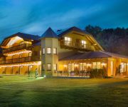
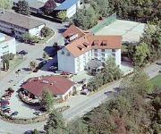
Hotels and Places to Stay
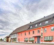
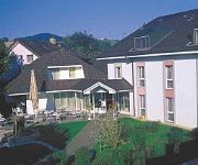
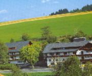
Ringhotel Goldener Knopf
Rheinsberg
Rheinfels Park
Am Hochrhein
St. Fridolin
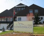
Schweizerblick
Hotel zum Hirsch
Zur Flüh
Platanenhof Seminarhotel
Alemannenhof Engel
Videos from this area
These are videos related to the place based on their proximity to this place.
Wälder Fasnacht in Bad Säckingen - 24.01.2013 (GoPro Hero3 Black Edition)
MEHR INFOS HIER !! Bad Säckingen am 24.01.2013 100% recorded on the GoPro HD 3 Black Edition Songs: Donaulied Badnerlied Viva Colonia Offiziell gilt der 1. Faißen als Tag der Männerfasnach.
01.06.2013 - HOCHWASSER IN BAD SÄCKINGEN
Eine Auswahl an Eindrücken von heute Mittag (13:35-14:35) - Gemisch aus Foto und Video-Clip. Wir haben noch richtig viel Glück, woanders ist komplett "Land unter". Dennoch ist es so beeindruckend ...
Das Niveau - Schwingschleifer - MPS Bad Säckingen 2012 HD
Das neu aufgetauchte Original der Band Das Niveau mit dem Namen "Schwingschleifer". Das wohl bekannteste Cover dieses einzigartigen Liedes findet sich auf dem Album "Aus der Asche" der ...
Feuerschwanz - Wunsch ist Wunsch, MPS Bad Säckingen 28.4.12
Wunsch ist Wunsch aus dem Nachmittagsprogramm mit ner sexy Fee ;)
Hip Hop Workshop Tanzschule Stengritt Bad Säckingen
Hip Hop Workshop of the Dancing Scool Stengritt in the southern Black Forrest. Hip Hop Workshop der Tanzschule Stengritt im ehem. Tanzverein-Trainingsraum in Bad Säckingen.
Hochwasser am Rhein 2013 in Bad Säckingen
Das Hochwasser am Rhein in Bad Säckingen 2013 The Flood at the Rhine in Germany 2013.
Videos provided by Youtube are under the copyright of their owners.
Attractions and noteworthy things
Distances are based on the centre of the city/town and sightseeing location. This list contains brief abstracts about monuments, holiday activities, national parcs, museums, organisations and more from the area as well as interesting facts about the region itself. Where available, you'll find the corresponding homepage. Otherwise the related wikipedia article.
Möhlintal
The Möhlintal is a 10-kilometre long valley running between Möhlin and Wegenstetten in the Rheinfelden district of Canton Aargau, Switzerland. The five municipalities in the valley have a total population of around 14,000 people. In the upper valley, the valley is also known as the "Wegenstettertal". This name was particularly used by associations and groups related to the upper Möhlintal municipalities. In Habsburg times the area Landschaft (territory) Möhlinbach was already known.
Fischingertal
The Fischingertal is a 5 kilometer long valley running between Mumpf and Schupfart in the Rheinfelden District of Canton Aargau, Switzerland.
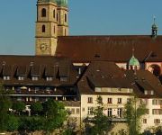
Säckingen Abbey
Säckingen Abbey is a former Roman Catholic abbey located in Bad Säckingen, Baden-Württemberg in Germany. The Abbey was founded in the 6th or 7th Century by Fridolin of Säckingen, an Irish monk. While the Abbey had both monks and nuns, only the nuns convent grew to be an important religious, economic and cultural institution for the entire upper Rhine.
Eggberg
Eggberg is a mountain of Baden-Württemberg, Germany.
Schöpfebach
Schöpfebach is a river of Baden-Württemberg, Germany.
Wehra
Wehra is a river of Baden-Württemberg, Germany.
Sissle
The Sissle is a 16-kilometer long river in the Swiss canton of Aargau in Switzerland. It is a tributary of the Rhine and drains the eastern part of the Fricktal. The largest town on the river is Frick. The river rises in the municipalities of Schinznach-Dorf and Thalheim at an altitude of 650 m above the sea (Switzerland) on the southern slope of Mount Dreierberg and the northern slope of Mount Zeiher Homberg, in the Jura Mountains.


