Safety Score: 4,0 of 5.0 based on data from 9 authorites. Meaning please reconsider your need to travel to Switzerland.
Travel warnings are updated daily. Source: Travel Warning Switzerland. Last Update: 2024-08-13 08:21:03
Explore Gruben
Gruben in Leuk District (Canton du Valais) is located in Switzerland about 52 mi (or 84 km) south of Bern, the country's capital.
Local time in Gruben is now 06:32 AM (Friday). The local timezone is named Europe / Zurich with an UTC offset of one hour. We know of 10 airports in the wider vicinity of Gruben, of which 3 are larger airports. The closest airport in Switzerland is Sion Airport in a distance of 18 mi (or 29 km), West. Besides the airports, there are other travel options available (check left side).
There are several Unesco world heritage sites nearby. The closest heritage site in Switzerland is Swiss Alps Jungfrau-Aletsch in a distance of 25 mi (or 41 km), North-East. If you need a place to sleep, we compiled a list of available hotels close to the map centre further down the page.
Depending on your travel schedule, you might want to pay a visit to some of the following locations: Leuk, Raron, Veyras, Visp and Brig. To further explore this place, just scroll down and browse the available info.
Local weather forecast
Todays Local Weather Conditions & Forecast: 10°C / 50 °F
| Morning Temperature | 3°C / 37 °F |
| Evening Temperature | 4°C / 39 °F |
| Night Temperature | 4°C / 39 °F |
| Chance of rainfall | 0% |
| Air Humidity | 52% |
| Air Pressure | 1021 hPa |
| Wind Speed | Light breeze with 3 km/h (2 mph) from North |
| Cloud Conditions | Few clouds, covering 10% of sky |
| General Conditions | Sky is clear |
Saturday, 16th of November 2024
11°C (52 °F)
3°C (38 °F)
Sky is clear, light breeze, clear sky.
Sunday, 17th of November 2024
7°C (45 °F)
3°C (37 °F)
Few clouds, light breeze.
Monday, 18th of November 2024
3°C (37 °F)
0°C (33 °F)
Rain and snow, gentle breeze, overcast clouds.
Hotels and Places to Stay
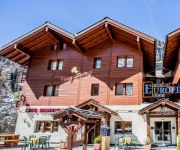
Europe
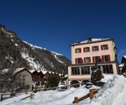
Le Besso
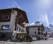
A la Pointe de Zinal
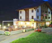
EMSHORN
Videos from this area
These are videos related to the place based on their proximity to this place.
Festgelände des Oberwallisers in Ergisch
Auf diesem Video werden Sie durch das Festgelände des 73. Oberwalliser Tambour- und Pfeiferfestes in Ergisch geführt. Viel Spass!
HT-FPV
HT-FPV Frame from hoverthings. Flies pretty good. -Coptercontrol -Sunnysky 800kv Motors -8" Gemfan Props -Gopro HD.
Val d'Anniviers Grimentz webcam time lapse 2011-2012
http://www.wintersporters.nl - Bekijk hoe het seizoen 2011-2012 in Val d'Anniviers Grimentz is verlopen. Een prachtige webcam time lapse.
Val d'Anniviers Grimentz webcam time lapse 2010-2011
http://www.wintersporters.nl - Bekijk hoe het seizoen 2010-2011 in Val d\'Anniviers Grimentz is verlopen. Een prachtige webcam time lapse.
Val d'Anniviers Ayer webcam time lapse 2011-2012
http://www.wintersporters.nl - Bekijk hoe het seizoen 2011-2012 in Val d'Anniviers Ayer is verlopen. Een prachtige webcam time lapse.
Val d'Anniviers Vercorin webcam time lapse 2010-2011
http://www.wintersporters.nl - Bekijk hoe het seizoen 2010-2011 in Val d\'Anniviers Vercorin is verlopen. Een prachtige webcam time lapse.
Val d'Anniviers Grimentz webcam time lapse 2010-2011
http://www.wintersporters.nl - Bekijk hoe het seizoen 2010-2011 in Val d\'Anniviers Grimentz is verlopen. Een prachtige webcam time lapse.
Zinal webcam time lapse 2011-2012
http://www.wintersporters.nl - Bekijk hoe het seizoen 2011-2012 in Val d'Anniviers Zinal is verlopen. Een prachtige webcam time lapse.
Val d'Anniviers Sorebois webcam time lapse 2011-2012
http://www.wintersporters.nl - Bekijk hoe het seizoen 2011-2012 in Val d'Anniviers Sorebois is verlopen. Een prachtige webcam time lapse.
Videos provided by Youtube are under the copyright of their owners.
Attractions and noteworthy things
Distances are based on the centre of the city/town and sightseeing location. This list contains brief abstracts about monuments, holiday activities, national parcs, museums, organisations and more from the area as well as interesting facts about the region itself. Where available, you'll find the corresponding homepage. Otherwise the related wikipedia article.
Schwarzsee (Oberems)
Schwarzsee is a mountain lake in the canton of Valais, Switzerland. It is located at an elevation of 2611 m, below Bella Tola (3025 m) and Brunnethorn (2952 m), above the Turtmanntal. It is part of the municipality of Oberems.


