Safety Score: 3,1 of 5.0 based on data from 9 authorites. Meaning please reconsider your need to travel to Sri Lanka.
Travel warnings are updated daily. Source: Travel Warning Sri Lanka. Last Update: 2024-08-13 08:21:03
Discover Medakumbura South
Medakumbura South in Central Province is a town in Sri Lanka about 54 mi (or 87 km) east of Colombo, the country's capital city.
Current time in Medakumbura South is now 08:03 PM (Saturday). The local timezone is named Asia / Colombo with an UTC offset of 5.5 hours. We know of 8 airports near Medakumbura South, of which one is a larger airport. The closest airport in Sri Lanka is Colombo Ratmalana Airport in a distance of 53 mi (or 85 km), West. Besides the airports, there are other travel options available (check left side).
There are several Unesco world heritage sites nearby. The closest heritage site in Sri Lanka is Sacred City of Kandy in a distance of 22 mi (or 35 km), North. Looking for a place to stay? we compiled a list of available hotels close to the map centre further down the page.
When in this area, you might want to pay a visit to some of the following locations: Kandy, Ratnapura, Badulla, Kurunegala and Katunayaka. To further explore this place, just scroll down and browse the available info.
Local weather forecast
Todays Local Weather Conditions & Forecast: 17°C / 63 °F
| Morning Temperature | 12°C / 53 °F |
| Evening Temperature | 15°C / 60 °F |
| Night Temperature | 13°C / 55 °F |
| Chance of rainfall | 2% |
| Air Humidity | 73% |
| Air Pressure | 1014 hPa |
| Wind Speed | Light breeze with 3 km/h (2 mph) from South-West |
| Cloud Conditions | Overcast clouds, covering 100% of sky |
| General Conditions | Light rain |
Sunday, 24th of November 2024
15°C (60 °F)
12°C (54 °F)
Overcast clouds, light breeze.
Monday, 25th of November 2024
14°C (57 °F)
10°C (50 °F)
Light rain, gentle breeze, overcast clouds.
Tuesday, 26th of November 2024
12°C (54 °F)
11°C (52 °F)
Overcast clouds, gentle breeze.
Hotels and Places to Stay
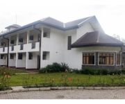
Vista Talawakelle Rest House
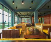
Oak Ray Tea Bush
Ramboda Falls Hotel
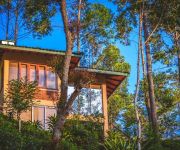
The Tea Cottage Resort & Spa
Videos from this area
These are videos related to the place based on their proximity to this place.
St.Clairs waterfalls, Pathana, Hatton, Sri Lanka.
St.Clair's Waterfalls is about two Kilometers from Devon waterfalls, on the Hatton - Thalawakele road. There is a point on the road near a restaurant where you can see both waterfalls.
pray on the tree house (fishing hut from sri lanka) farsha217
best place in sri lanka 4 ever farsha217.
Шри Ланка 2015
Это небольшая короткометражная история о том, как мы побывали на Шри Ланке в 2015 г. Трип Команда "ТурГениева"...
Travel on Train in Sri Lanka - Udarata Manike train going through misty hill
Udarata Manike is one of famous train travelling on hill country of Sri Lanka. It is traveling from Colombo to Badulla by passing 292.393 km long distance. when traveling by this way you can...
Videos provided by Youtube are under the copyright of their owners.
Attractions and noteworthy things
Distances are based on the centre of the city/town and sightseeing location. This list contains brief abstracts about monuments, holiday activities, national parcs, museums, organisations and more from the area as well as interesting facts about the region itself. Where available, you'll find the corresponding homepage. Otherwise the related wikipedia article.
St. Clair's Falls
St. Clair's Falls is one the widest waterfalls in Sri Lanka ("Bomburu Ella" in Welimada is the widest). St. Clair's Falls is called the "Little Niagara of Sri Lanka". and it is one of the most politically discussed environmental entities in Sri Lanka.
Bogawela
Bogawela is a village in Sri Lanka. It is located within Central Province.
Halpola
Halpola is a village in Sri Lanka. It is located within Central Province.
Kadadoovapitiya
Kadadoovapitiya is a village in Sri Lanka. It is located within Central Province.
Metagama
Metagama is a village in Sri Lanka. It is located within Central Province.
Methagama
Methagama is a village in Sri Lanka. It is located within Central Province.
Rawanagoda
Rawanagoda is a village in Sri Lanka. It is located within Central Province.
Wijebahukanda
Wijebahukanda is a village in Sri Lanka. It is located within Central Province.


