Safety Score: 3,0 of 5.0 based on data from 9 authorites. Meaning we advice caution when travelling to Spain.
Travel warnings are updated daily. Source: Travel Warning Spain. Last Update: 2024-08-13 08:21:03
Delve into les Creus
The district les Creus of Maçanet de Cabrenys in Girona (Catalonia) is a subburb in Spain about 361 mi north-east of Madrid, the country's capital town.
If you need a hotel, we compiled a list of available hotels close to the map centre further down the page.
While being here, you might want to pay a visit to some of the following locations: Sant Llorenc de la Muga, Darnius, Ceret, Agullana and Terrades. To further explore this place, just scroll down and browse the available info.
Local weather forecast
Todays Local Weather Conditions & Forecast: 19°C / 66 °F
| Morning Temperature | 10°C / 50 °F |
| Evening Temperature | 16°C / 61 °F |
| Night Temperature | 11°C / 52 °F |
| Chance of rainfall | 0% |
| Air Humidity | 53% |
| Air Pressure | 1018 hPa |
| Wind Speed | Light breeze with 4 km/h (2 mph) from North-West |
| Cloud Conditions | Scattered clouds, covering 29% of sky |
| General Conditions | Scattered clouds |
Monday, 18th of November 2024
16°C (61 °F)
11°C (52 °F)
Few clouds, light breeze.
Tuesday, 19th of November 2024
17°C (62 °F)
13°C (56 °F)
Broken clouds, light breeze.
Wednesday, 20th of November 2024
13°C (55 °F)
8°C (47 °F)
Light rain, moderate breeze, overcast clouds.
Hotels and Places to Stay
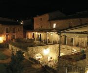
Rusticae Torre Laurentii
Mas Pauline
Videos from this area
These are videos related to the place based on their proximity to this place.
[OFF] Tufão na piscina - Ceret Tatuapé - SP (Cyclone on pool)
o.O "Micro tufão" atinge piscina em Ceret Tatuapé - SP e deixa pessoas assustadas. EN: Small cyclone hits pool and scares people.
A square in Ceret (Southern France)
It was evening, there was a jazz band, I was having to wait too long for my food, I got bored, took some photos, recorded some sound and I made this (later). The sound isn't all that great...
CERET Si Céret m'était Dansé - 5 Juillet 2012- 2/5
Festival de danse dans les rues de Cérét . Eté 2012. Festival GRATUIT proposant à tout public une déambulation dansé dans les rues de la ville. Ici Place Pablo Picasso. Du 5 juillet...
chant sainte barbe sapeurs pompiers CERET
poême général CASSO et chant des sapeurs pompiers à la sainte barbe des pompiers de CERET sur l'air de la chanson de nana MOUSKOURI - L'enfant au tambour.
Attentat à Ceret (Bar le Pablo)
Un attentat a eu lieu à Ceret (Languedoc Roussillon) au bar le Pablo. Bilan: un disparu et deux blessés légers (les deux gérants du bar)
1er saut à l'élastique - Luz Aventure - Pont du diable ( Ceret ) vue d'en haut
Mon 1er saut à l'élastique au pont du diable à Céret avec l'équipe de Luz Aventure. C'était vraiment génial ! Le saut à l'élastique c'est quelque chose qu'il faut faire au moins une...
Ceret Property
Delightful 2 Bedroom apartment for sale on the outskirts of the market town of Ceret, Pyrenees Orientales, Languedoc Roussillon, France Further Details http://www.ceretproperty.com/Property/Reside...
Place de Neuf Jets in Ceret
3 gezellige restaurantjes op Place de Neuf Jets in Ceret vlak bij Reynes, Middelandse zee en de vakantie villa in Le Vert Vallon.
Videos provided by Youtube are under the copyright of their owners.
Attractions and noteworthy things
Distances are based on the centre of the city/town and sightseeing location. This list contains brief abstracts about monuments, holiday activities, national parcs, museums, organisations and more from the area as well as interesting facts about the region itself. Where available, you'll find the corresponding homepage. Otherwise the related wikipedia article.
Vallespir
Vallespir is a historical Catalan comarca of Northern Catalonia, part of the French Département of Pyrénées-Orientales. The capital of the comarca is Ceret, and it borders Conflent, Rosselló, Alt Empordà, Garrotxa and Ripollès. It is in the Tech River valley. The main towns in the Vallespir are Ceret, Amelie Les Bains, Arles Sur Tech and Prats De Mollo La Preste
Battle of the Col de Panissars
The Battle of the Col de Panissars was fought on 30 September and 1 October 1285 between the forces of Philip III of France and Peter III of Aragón. It was a severe defeat for the French, who were already retiring over the Pyrenees when the Aragonese fell on them. It was the last battle of the Aragonese Crusade, a papally-sanctioned war on behalf of Charles of Valois to secure the Aragonese throne from the excommunicate king Peter, who had conquered Sicily against papal interests.
Autovía A-7
The Autovía A-7 (also called Autovia del Mediterráneo) is a Spanish autovía which starts in La Jonquera, near the French frontier and ends in Algeciras. Once it is finished upon completion of the sections west of Almeria and around Motril it will be a free alternate route of Autopista AP-7, and the longest national motorway in Europe.
Autopista AP-7
The Autopista AP-7 (also called Autopista del Mediterráneo) is a Spanish autopista. It is a toll motorway that runs along the Mediterranean coast of Spain. AP-7 has two different sections (911+96 km): From Els Límits to Vera: 911 km long. Main cities passed: Figueres Girona Sabadell Barcelona Tarragona Reus Salou Amposta Castelló de la Plana Sagunt Valencia Gandia Dénia Benidorm Alacant Elx Cartagena From Málaga to Guadiaro: 96 km long.
Fort de Bellegarde
The Fort de Bellegarde is a 17th century fortification located above the town of Le Perthus, in the Pyrénées-Orientales département of southern France.
European route E15
The European route E 15 is part of the United Nations international E-road network. It is a north-south "reference road", running from Inverness, Scotland south through England and France to Algeciras, Spain. Along most of its route between Paris and London, the road parallels the LGV Nord (as the French A1 autoroute) and High Speed 1 (as the English M20 motorway). Distances in this article are computed from www. viamichelin. co. uk.
Agullana
Agullana is a municipality in the comarca of Alt Empordà, Girona, Catalonia, Spain.
Albanyà
Albanyà is a municipality in the comarca of Alt Empordà, Girona, Catalonia, Spain.
Cabanelles
Cabanelles is a municipality in the comarca of Alt Empordà, Girona, Catalonia, Spain.
Capmany
Capmany is a municipality in the comarca of Alt Empordà, Girona, Catalonia, Spain.
Cistella
Cistella is a municipality in the comarca of Alt Empordà, Girona, Catalonia, Spain.
Lladó
Lladó (also known as Lledó d'Empordà) is a municipality in the comarca of Alt Empordà, Girona, Catalonia, Spain.
La Vajol
La Vajol is a municipality in the comarca of Alt Empordà, Girona, Catalonia, Spain.
Pont du Diable (Céret)
The Pont du Diable (English: Devil's bridge) or Pont Vieux (English: Old bridge) is a medieval stone arch bridge at Céret, France, built between 1321 and 1341. Spanning the river Tech with an imposing single arch of 45.45 m span length, the Pont du Diable featured at the time of its construction the world's largest bridge arch. The apex of the Pont du Diable at its highest point above ground is 22.3 m. The bridge was partly modified in the 18th century.
Perthus Tunnel
The Perthus Tunnel is a twin-bore railway tunnel between Perpignan, France and Figueres, Spain built as part of the high-speed railway line between Barcelona and Montpellier under the Eastern Pyrenees. The tunnel took five years to build and was completed on February 17, 2009. The tunnel was built by a private sector consortium TP Ferro under a fifty-year concession and has been designed to allow for freight as well as passenger traffic. It is 8.3-kilometre long.
Priory of Santa Maria del Vilar
The Priory of Santa Maria del Vilar at Villelongue-dels-Monts in the department of the Pyrénées-Orientales, France, houses the Romanian Orthodox Monastery of the Dormition of the Mother of God. It falls under the jurisdiction of the Romanian Orthodox Metropolitan of Western and Southern Europe.
Musée d'Art Moderne de Céret
Le Musée d'Art Moderne de Céret is a modern art museum in Céret, Pyrénées-Orientales, France, created by Pierre Brune and Frank Burty Haviland in 1950 with the personal support of their friends Pablo Picasso and Henri Matisse who were involved in its creation.
Beuda
Beuda is a Spanish municipality located in the comarca of Garrotxa, in the province of Girona, Catalonia, Spain. It is located on the slopes near the Mont massif, to the north of Besalú.
Puig de Bassegoda
Puig de Bassegoda is a mountain of Catalonia, Spain. It has an altitude of 1373 metres (4504 ft)above sea level.
Mare de Déu del Mont
El Mont or Serra del Mont, better known as Mare de Déu del Mont, is a mountain range of the Alta Garrotxa natural region, Catalonia, Spain. It has an altitude of 1123 metres above sea level. This mountain has a traditionally very popular Virgin Mary shrine on top of the highest peak, hence its name meaning Mother of God of the Mountain. It has been often mentioned in Catalan literature, having been referred to as Porta del Pirineu, meaning "the Gate of the Pyrenees", among other epithets.
Monasteries of San Millán de la Cogolla
The monasteries of San Millán de Suso and San Millán de Yuso are two monasteries situated in the village of San Millán de la Cogolla, La Rioja, Spain. They have been designated a World Heritage Site by UNESCO since December 1997. The two monasteries' names Suso and Yuso mean the "upper" and the "lower" in archaic Castilian, respectively. Suso is the older building and is believed to be built on the site of a hermitage where Saint Emilian lived.
Argelaguer
Argelaguer is a village in the province of Girona and autonomous community of Catalonia, Spain. The municipality covers an area of 12.56 square kilometres and as of 2011 had a population of 424 people.
Maià de Montcal
Maià de Montcal is a village in the province of Girona and autonomous community of Catalonia, Spain. The municipality covers an area of 17.28 square kilometres and as of 2011 had a population of 432 people.
Sales de Llierca
Sales de Llierca is a village and municipality in the province of Girona and autonomous community of Catalonia, Spain. The municipality covers an area of 35.84 square kilometres and as of 2011 had a population of 144 people.
Tortellà
Tortellà is a village in the province of Girona and autonomous community of Catalonia, Spain.


!['[OFF] Tufão na piscina - Ceret Tatuapé - SP (Cyclone on pool)' preview picture of video '[OFF] Tufão na piscina - Ceret Tatuapé - SP (Cyclone on pool)'](https://img.youtube.com/vi/SDMI-P0untk/mqdefault.jpg)


