Safety Score: 3,0 of 5.0 based on data from 9 authorites. Meaning we advice caution when travelling to Spain.
Travel warnings are updated daily. Source: Travel Warning Spain. Last Update: 2024-08-13 08:21:03
Discover La Lechuza
The district La Lechuza of in Las Palmas (Canary Islands) is a district in Spain about 1,091 mi south-west of Madrid, the country's capital city.
Looking for a place to stay? we compiled a list of available hotels close to the map centre further down the page.
When in this area, you might want to pay a visit to some of the following locations: Vega de San Mateo, Valleseco, Santa Brigida, Teror and Valsequillo de Gran Canaria. To further explore this place, just scroll down and browse the available info.
Local weather forecast
Todays Local Weather Conditions & Forecast: 16°C / 62 °F
| Morning Temperature | 13°C / 56 °F |
| Evening Temperature | 15°C / 60 °F |
| Night Temperature | 14°C / 58 °F |
| Chance of rainfall | 0% |
| Air Humidity | 65% |
| Air Pressure | 1013 hPa |
| Wind Speed | Light breeze with 3 km/h (2 mph) from South-West |
| Cloud Conditions | Few clouds, covering 20% of sky |
| General Conditions | Light rain |
Saturday, 16th of November 2024
18°C (64 °F)
15°C (59 °F)
Sky is clear, light breeze, clear sky.
Sunday, 17th of November 2024
18°C (64 °F)
16°C (60 °F)
Scattered clouds, light breeze.
Monday, 18th of November 2024
18°C (65 °F)
16°C (61 °F)
Light rain, gentle breeze, broken clouds.
Hotels and Places to Stay
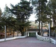
Finca Valsequillo
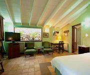
Las Calas Hotel Rural
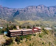
Parador de Cruz de Tejeda
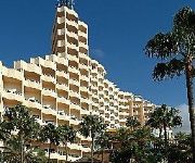
IFA Dunamar Hotel
Hotel Las Tirajanas
Santa Brigida Hotel Escuela
El Refugio Hotel Rural
Hotel Rural Fonda de la Tea
Ocean Ponderosa
Casas Rurales de Guayadeque
Videos from this area
These are videos related to the place based on their proximity to this place.
CARACTER LATINO - Sueños Rotos - LATINOS 2009 - En Vega de San Mateo (07/11/2009)
Actuación de Caracter Latino en el evento LATINOS 2009 que tuvo lugar en Vega de San Mateo el 07 de Noviembre de 2009. Tambien actuaron muchos Grupos más, incluyendo Dj's. www.
DE VEGA, ALTA COSTURA 2011-VEGA DE SAN MATEO-GRAN CANARIA
La Vega de San Mateo se vistió de glamour de la mano de Kiko Barroso ese fantástico presentador de roscas y cotufas que junto a diseñadores como Cristobal Vidal, Juan Carlos de Armas, Oswaldo...
APICULTORES DE LA VEGA DE SAN MATEO
Paco Mata y Pedro Quintana nos enseñan como castrar las colmenas de las "abejas negras" . La auténtica abeja canaria. Un oficio transmitido de padres a hijos y que aún permanece inalterable...
GUIRA LATINA - Que Levante La Mano - LATINOS 2009 - Vega de San Mateo (07/11/2009)
GUIRA LATINA TAMBIEN ESTUVO EN EL EVENTO "LATINOS 2009" AMENIZANDO PARTE DE LA NOCHE CON SU ACTUACIÓN. www.MusiCalida.com.
Susita del Chorrillo 81 años 3/3 ( Vega de San Mateo, Gran Canaria )
3/3 Susita 81 años de la Vega de San Mateo Gran Canaria ( ISLAS CANARIAS )
ÚLTIMO PLENO DEL AÑO 2011 EN VEGA DE SAN MATEO-PRIMERA ENTREGA.wmv
El pasado 30 de Diciembre del 2011 se celebró en el Salón de Plenos en el Ilmo. Ayuntamiento de La Vega de San Mateo el último Pleno del Año 2011 en el que se debatieron diversos puntos...
Agricultores de La Vega de San Mateo
Corte de Radio de la intervención de Don Jose Hernández, Concejal de La Agrupación de Agricultores de La Vega de San Mateo.
AVESAN - Ayuntamiento de la Vega de San Mateo - Toma de Posesión 2
Toma de Posesión en el Ayuntamiento de Vega de San Mateo Parte 2.
AVESAN - Ayuntamiento Vega de San Mateo - 11-06-11 Toma de Posesión 1
Toma de Posesión en el Ayuntamiento de Vega de San Mateo de 11-06-11 Salón de Plenos - Parte 1.
Videos provided by Youtube are under the copyright of their owners.
Attractions and noteworthy things
Distances are based on the centre of the city/town and sightseeing location. This list contains brief abstracts about monuments, holiday activities, national parcs, museums, organisations and more from the area as well as interesting facts about the region itself. Where available, you'll find the corresponding homepage. Otherwise the related wikipedia article.
Gran Canaria
Gran Canaria (originally meaning 'Great of Dogs') is the second most populous island of the Canary Islands, a Spanish archipelago, with a population of 838,397 which constitutes approximately 40% of the population of the archipelago. Located in the Atlantic Ocean about 150 kilometers (~93 miles) off the northwestern coast of Africa and about 1350 km (~838 miles) from Europe. Gran Canaria was populated by the Canarii (Guanches), who may have arrived as early as 500 BC.
Mogán, Las Palmas
Mogán is a municipality in the southwestern corner of the island of Gran Canaria, which is one of the three main islands making up the Spanish province of Las Palmas in the Canary Islands. It includes the fishing towns of Puerto de Mogán and Arguineguin. Mogán is the second largest municipality by area on the island. The population is 15,176, its density is 88.17/km² and the area is 172 km². Much of the population lives on the Atlantic coastline.
Palmitos Park
Palmitos Park is a 20-hectare botanical garden and aviary on the island of Gran Canaria, one of the Canary islands, which are a part of Spain. The subtropical park is situated in the south of the island, about 10 kilometres north of the tourist beaches and dunes of Maspalomas, but towards the interior. The park lies in a countryside setting, in the midst of mountains. Because of this park visitors have the opportunity in many places of beautiful views and vistas when walking through the park.
Santa María de Guía de Gran Canaria
Santa María de Guía de Gran Canaria is a municipality in Las Palmas province of the Canary Islands. It is located on the north side of Grand Canary island. Santa María's area is 42.59 km², its population of about 14,107 inhabitants and its density is 332.95/km². Its maximum elevation is 180 metres. Santa Maria is situated in a valley setting.
Firgas, Las Palmas
Firgas is a Canary Islands municipality in the province of Las Palmas. Is a suburb of Las Palmas city. It is situated in the north of Gran Canaria. It has an area of 15.77 km², 7,023 inhabitants and the density of 455.34/km². It celebrated its 500th anniversary in 1988. The town was founded in 1488.
Santa Brígida, Las Palmas
Villa de Santa Brígida is a Canarian municipality in the northeastern portion of the island of Gran Canaria in the Province of Las Palmas of the Canary Islands. The suburbs of Las Palmas. The population is 18,817, its density is 790.3/km² and the area is 23.81 km². It is located by a main highway linking it to the capital - Las Palmas and has access with the superhighway GC3. The main industries are agriculture and tourism especially in the park area.
Vega de San Mateo, Las Palmas
Vega de San Mateo (latter part Spanish meaning Saint Matthew is a Canarian municipality in the eastern portion of the island of Gran Canaria in the Las Palmas province in the Canary Islands. The population is 7,617, its density is 199.66/km² and the area is 37.89 km². Vega de San Mateo is located SW of Las Palmas de Gran Canaria and W of Telde and is on a road linking to the capital as well as Telde and the northwestern part of Gran Canaria. The main industry are agriculture and tourism.
Ingenio, Las Palmas
Ingenio is a Canarian municipality in the eastern portion of the island of Gran Canaria in the Las Palmas province in the Canary Islands. The population is 26,857, its density is 692.87/km² and the area is 38.15 km². Ingenio is situated between the mountains and the Atlantic Ocean, south of Las Palmas de Gran Canaria and Telde and is accessed with the GC1 highway. The main industries are agriculture and tourism.
San Bartolomé de Tirajana
San Bartolomé de Tirajana is a Canarian municipality in the southeastern portion of the island of Gran Canaria in the Las Palmas province in the Canary Islands. San Bartolomé de Tirajana is the largest municipality in area on the island as well as the Canary Islands almost covering between a quarter and one-third of the whole island of Gran Canaria and more than 5 to 6% of the archipelago. The capital is situated in "La Caldera de Las Tirajanas".
Tejeda
Tejeda is a Canarian municipality in the westcentral and the central portion of the island of Gran Canaria in the Las Palmas province in the Canary Islands. Tejeda is the main city of Cumbre and is the second smallest village on the island as well as the highest municipal seat on the island. The population is 2,347, its density is 22.73/km² and the area is 103.29 km². Tejeda is situated in the mountains and the valley area that are mainly covered with greenspaces and forests.
Gáldar, Las Palmas
Gáldar is a municipality in the north of the island of Gran Canaria. Gáldar's area is 61.59 km² with a population of about 24,361 and its density is 395.53/km². Gáldar is situated in the mountains and are surrounded by valleys. Farmlands are within the coastline while the mountains lies to the southeast, the Atlantic Ocean lies to the west and to the north. A promontory is facing to the northwest.
Moya, Las Palmas
Moya is a municipality of Las Palmas province, on the Canary Islands. It is in the northern part of the Grand Canary island or Gran Canaria. Moya's area is 31.87 km² with a population of about 8,307 and its density is 250.63/km². Moya is situated in the mountains while the valleys cover the northern part, the mountains cover the southern part. Farmlands are within the coastline, the Atlantic Ocean lies to the north.
Valleseco, Las Palmas
Valleseco is a municipality of Las Palmas province, on the Canary Islands. It is in the northcentral part of Gran Canaria. Valleseco means "dry valley" in Spanish, but its name is misleading, since it is actually one of the wettest municipalities of the island. Valleseco's area is 22.11 km² with a population of about 4,045 and its density is 182.95/km². The elevation is 1,000 m. Valleseco is a municipality situated at 7 km. from Teror and 28 from the city of Las Palmas.
Fataga
Fataga is a village in the municipality of San Bartolomé de Tirajana on the island of Gran Canaria (Canary Islands, Spain). Latitude 27°53'15"N, longitude 15°33'50"W. Altitude approx 1980 feet (600 metres) above mean sea level. The village can trace its origins back for more than 2000 years, when the area of the current village was inhabited by the Guanche natives.
Roque Nublo
Roque Nublo (Spanish meaning the "Rock Clouded") is a monolith feature that is 80 m tall. It is one of the most famous landmarks on the island of Gran Canaria. The elevation is 1,813 m, ranking it second on the island and one of the tallest in the archipelago. It is municipally located in Tejeda, a few kilometres from the town centre. It was formed by a volcanic eruption around 4.5 million years ago. It can be reached very easily by hiking some 30 minutes from a nearby parking lot.
El Dedo de Dios
El Dedo de Dios was a famous rock structure in the Atlantic Ocean, located in the northern part of Gran Canaria, one of the Canary Islands. During Tropical Storm Delta in November 2005, the thin top of the rocky monument was broken off and fell into the sea, destroying its unique characteristic that had the shape of a finger (hence the name "God's finger"). It was one of the many natural monuments of the Canary Islands located outside the coastal town of Agaete, at the north of Gran Canaria.
Teror
Teror is a Canarian municipality in the northern portion of the island of Gran Canaria in the Las Palmas province in the Canary Islands. Teror is a suburb of Las Palmas city. September 8 is the local festivity celebrating Virgen del Pino (virgin of the pine, patron of the Gran Canaria). If there were a prize for the 'most Canarian' municipality, Teror would definitely win it! Architecture, piety and culinary delights - everthing here has a special Canaria quality.
Estadio Gran Canaria
Estadio Gran Canaria is a multi-purpose stadium in Las Palmas, Spain. It is currently used mostly for football matches by the UD Las Palmas team. The club had previously played at the Estadio Insular. The stadium holds 31,250 people. It was built in 2003 and their website can be found at Estadio de Gran Canaria. -
Bandama Caldera
The Bandama Natural Monument is part of the Tafira Protected Landscape on the island of Gran Canaria in the Canary Islands, Spain. It's considered a point of geological interest, because of the Caldera de Bandama. This volcanic caldera reaches 569 m (1,867 ft) above sea level at the highest point on its rim, Pico de Bandama, and is about 1,000 m (3,300 ft) wide and 200 m (700 ft) deep. The steep walk to the bottom of the caldera takes about half an hour.
Centro Insular de Deportes
Centro Insular de Deportes is an indoor arena in Las Palmas, Spain. It is the home arena of the Spanish ACB League professional basketball team Gran Canaria. The arena holds 5,200 people.
Estadio Municipal de Vecindario
Estadio Municipal de Vecindario is a multi-use stadium in Vecindario, Spain. It is currently used mostly for football matches and is the home ground of UD Vecindario. The stadium holds 4,500 people. The pitch size is 101x64m.
Estadio Insular
Estadio Insular was a multi-use stadium in Las Palmas, Spain. It was initially used as the stadium of UD Las Palmas matches before Estadio Gran Canaria opened in 2003. The stadium held 21,000 people and was built in 1945.
Port of Las Palmas
Port of Las Palmas (also called La Luz Port) (Spanish: Puerto de Las Palmas or Puerto de La Luz) is a port for fishing, commercial, passenger and sports boats in the north-west of the Las Palmas, Spain, European Union. For five centuries, the Port of Las Palmas (La Luz Port) has been the traditional base for scale and supplying ships on their way through the Middle Atlantic.
Palacio Multiusos de Gran Canaria
Palacio de Deportes de Las Palmas, also named Palacio Multiusos de Gran Canaria is a description of a planned indoor sporting arena located in Las Palmas de Gran Canaria, Spain. Once opened in 2013, the capacity of the arena will be 11,500 spectators. It is being built for the 2014 FIBA World Championships and will be the home arena of CB Gran Canaria.
Jardín Botánico Canario Viera y Clavijo
Jardín Botánico Canario Viera y Clavijo is the full name of the botanical garden on Gran Canaria, one of the Canary Islands. “Jardín Botánico Canario” means “Botanical Garden of the Canaries”, while the additional words “Viera y Clavijo” honor the pioneering Spanish cleric and scholar José Viera y Clavijo (1731–1813), who attempted to found a botanical garden in the Canary Islands in the late eighteenth century.


