Discover Banggaro
Banggaro in Seoul is a city in South Korea a little north of Seoul, the country's capital city.
Local time in Banggaro is now 10:19 PM (Thursday). The local timezone is named Asia / Seoul with an UTC offset of 9 hours. We know of 8 airports in the vicinity of Banggaro, of which 3 are larger airports. The closest airport in South Korea is Gimpo International Airport in a distance of 14 mi (or 23 km), South-West. Besides the airports, there are other travel options available (check left side).
There are several Unesco world heritage sites nearby. The closest heritage site in South Korea is Jongmyo Shrine in a distance of 8 mi (or 14 km), South. We discovered 3 points of interest in the vicinity of this place. Looking for a place to stay? we compiled a list of available hotels close to the map centre further down the page.
When in this area, you might want to pay a visit to some of the following locations: Jangheung, Seoul, Gwangjeok, Jinjeop and Gwangtan. To further explore this place, just scroll down and browse the available info.
Local weather forecast
Todays Local Weather Conditions & Forecast: 13°C / 55 °F
| Morning Temperature | 8°C / 46 °F |
| Evening Temperature | 12°C / 53 °F |
| Night Temperature | 10°C / 50 °F |
| Chance of rainfall | 0% |
| Air Humidity | 55% |
| Air Pressure | 1020 hPa |
| Wind Speed | Gentle Breeze with 8 km/h (5 mph) from East |
| Cloud Conditions | Broken clouds, covering 71% of sky |
| General Conditions | Light rain |
Friday, 22nd of November 2024
8°C (46 °F)
7°C (44 °F)
Sky is clear, gentle breeze, clear sky.
Saturday, 23rd of November 2024
9°C (47 °F)
8°C (47 °F)
Broken clouds, calm.
Sunday, 24th of November 2024
9°C (49 °F)
9°C (49 °F)
Sky is clear, calm, clear sky.
Hotels and Places to Stay
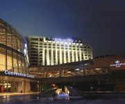
Grand Hilton Seoul
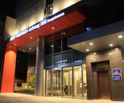
BEST WESTERN Arirang Hill Hotel Dongdaemun
Videos from this area
These are videos related to the place based on their proximity to this place.
Why am I happy that I came to Korea?
The video audio is a bit unclear (my pronaunciation sux) so I made subtitles in English)!!! In this short movie I wanted to show why am I happy that I came to Korea... Yeah just like the...
[QUICK TV]강북 퀵 평가전 GB QUICK vs 신일고등학교 다시보기
QUICK TV 2015년 2월 28일 강북청소년수련관 실내체육관에서 열린 강북 퀵vs신일고 평가전 다시보기 영상입니다. 경기 중 소리는 나오지 않습니다.
Lotte World. Парк развлечений. Карнавал. Южная Корея. Сеул. HD
Туристическая поездка в Сеул от турагенства "Владбюро". Обсудить данное видео можно на нашем форуме http://fotovid...
Baekundae
Join me on my hike up to Baekundae, Seoul's highest peak, located in Bukhansan National Park.
Bukhansan - Ha Szöulban jársz ne hagyd ki!
http://varaljay.com - Mindenhol jó, de messze a legjobb! - Ha valaki Szöulban jár mindenképp menjen fel az egyik hegyre, ahonnan rálátni a városra: http://varaljay.com/2013/01/bukhansan-szo...
Smartphone RC Tank (1/35th scale M1A1 Abrams)
The RC tank has been converted from a plasticmodel kit. For more information, visit website http://smartrc.tistory.com or contact e-mail kjy313@naver.com.
Videos provided by Youtube are under the copyright of their owners.
Attractions and noteworthy things
Distances are based on the centre of the city/town and sightseeing location. This list contains brief abstracts about monuments, holiday activities, national parcs, museums, organisations and more from the area as well as interesting facts about the region itself. Where available, you'll find the corresponding homepage. Otherwise the related wikipedia article.
Suyu Station
Suyu Station is a station on the Seoul Subway Line 4. This station is located in Suyu-dong, Gangbuk-gu, Seoul.
Ssangmun Station
Ssangmun Station is a station on the Seoul Subway Line 4.
Bukhansan
Bukhansan, or Bukhan Mountain, is a mountain on the northern peripheries of Seoul, South Korea. At 836.5 meters above sea level and bordering a considerable part of the city, Bukhansan is a major landmark visible from most districts of the metropolis. The name "Bukhansan" means "Mountain north of the Han," referring to its location approximately ten kilometers to the north of the Han River. During the Joseon era, the peaks marked the extreme northern point of Seoul.
Gangbuk District
Gangbuk District (Gangbuk-gu) is one of the 25 gu which make up the city of Seoul, South Korea. Its name is derived from the fact that it is located at the north of Han river. It was created from neighbouring Dobong District (도봉구) in 1995. The current mayor is Park Gyeom-su(박겸수).
Dobong Station
Dobong Station is a metro station on Seoul Subway Line 1. It is in the extreme north of Seoul and offers services connecting the city to the cities to the north in Gyeonggi-do.
Banghak Station
Banghak Station is a metro station on Seoul Subway Line 1. It is the closest station to the Dobong-gu District Office in Seoul.
Onggi Folk Museum
The Onggi Folk Museum, located in Seoul, South Korea is a private museum specializing in onggi, Korean earthenware which is used for storage and utilitarian purposes. It was established as the Goryeo Folk Museum (고려민속박물관) in 1991 and later was changed to the current name. The museum consists of three-story building and an outdoor exhibition hall where 3,300 items of onggi and other items such as dancheong patterns, Korean traditional decorative coloring used for building are exhibited.
Dobongsan
Dobongsan is a mountain in Bukhansan National Park, South Korea. It extends across Seoul, the national capital, and the cities of Yangju and Uijeongbu, in the province of Gyeonggi-do. It has an elevation of 739.5 m . Nearby Dobongsan Station is named for it.


!['[QUICK TV]강북 퀵 평가전 GB QUICK vs 신일고등학교 다시보기' preview picture of video '[QUICK TV]강북 퀵 평가전 GB QUICK vs 신일고등학교 다시보기'](https://img.youtube.com/vi/cM7Y__S_dVY/mqdefault.jpg)


!['[열린예술극장]서울, 문화의 향기가 날리다.북한산 야외무대-김삼' preview picture of video '[열린예술극장]서울, 문화의 향기가 날리다.북한산 야외무대-김삼'](https://img.youtube.com/vi/8Q_1538M-F4/mqdefault.jpg)


