Discover Hyojabi
Hyojabi in Gyeonggi-do is a town in South Korea a little north of Seoul, the country's capital city.
Current time in Hyojabi is now 06:59 AM (Friday). The local timezone is named Asia / Seoul with an UTC offset of 9 hours. We know of 8 airports near Hyojabi, of which 3 are larger airports. The closest airport in South Korea is Gimpo International Airport in a distance of 12 mi (or 19 km), South-West. Besides the airports, there are other travel options available (check left side).
There are several Unesco world heritage sites nearby. The closest heritage site in South Korea is Jongmyo Shrine in a distance of 9 mi (or 14 km), South. We discovered 3 points of interest in the vicinity of this place. Looking for a place to stay? we compiled a list of available hotels close to the map centre further down the page.
When in this area, you might want to pay a visit to some of the following locations: Jangheung, Seoul, Gwangtan, Gwangjeok and Beobwon. To further explore this place, just scroll down and browse the available info.
Local weather forecast
Todays Local Weather Conditions & Forecast: 12°C / 53 °F
| Morning Temperature | 7°C / 45 °F |
| Evening Temperature | 10°C / 49 °F |
| Night Temperature | 7°C / 45 °F |
| Chance of rainfall | 0% |
| Air Humidity | 22% |
| Air Pressure | 1031 hPa |
| Wind Speed | Light breeze with 3 km/h (2 mph) from South-East |
| Cloud Conditions | Clear sky, covering 0% of sky |
| General Conditions | Sky is clear |
Friday, 8th of November 2024
13°C (56 °F)
12°C (54 °F)
Sky is clear, calm, clear sky.
Saturday, 9th of November 2024
15°C (59 °F)
14°C (57 °F)
Sky is clear, calm, clear sky.
Sunday, 10th of November 2024
16°C (61 °F)
15°C (59 °F)
Overcast clouds, light breeze.
Hotels and Places to Stay
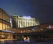
Grand Hilton Seoul
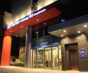
BEST WESTERN Arirang Hill Hotel Dongdaemun
Videos from this area
These are videos related to the place based on their proximity to this place.
북한산 족두리봉 등반 실황(HD) - Mount Jokduri Bukhansan Korea(HD) psy's country
This Video is a Climb Mount Jokduri Bukhansan Full Video(2012) This Video is real Climing Scene. Bukhansan is one of Korea National Park. Mount Jokduri is one of Bukhansan. Mount Jokduri...
Why am I happy that I came to Korea?
The video audio is a bit unclear (my pronaunciation sux) so I made subtitles in English)!!! In this short movie I wanted to show why am I happy that I came to Korea... Yeah just like the...
[QUICK TV]강북 퀵 평가전 GB QUICK vs 신일고등학교 다시보기
QUICK TV 2015년 2월 28일 강북청소년수련관 실내체육관에서 열린 강북 퀵vs신일고 평가전 다시보기 영상입니다. 경기 중 소리는 나오지 않습니다.
curatorsim의 문화유산답사 - 북한산성시구문에서 덕암사 가는길
외국인들에게 북한산성을 소개시켜주는 임무를 맡게 되었어요. 그래서 쉬운 코스를 찾던중 덕암사에서 북한산성 시구문으로 가는 길을 사전답사하...
Mountain Talk V7 Sangwon Son 손상원
Sangwon Son's 손상원 first ascent of Mountain Talk V7 in Bukhansan National Park in Seoul, S. Korea.
호박송편
This is SONGPYUN. it is a rice cake steamed on a layer of pine needles. and korean traditional food. we called "PUMPKIN SONGPYUN "
ILSAN Trails MTB Seoul Sep 2009 South Korea(season1)
Cameraman/Gareeon Editor/Gareeon,Shinwoo Rider/Tajoo ,Shinwoo.
Videos provided by Youtube are under the copyright of their owners.
Attractions and noteworthy things
Distances are based on the centre of the city/town and sightseeing location. This list contains brief abstracts about monuments, holiday activities, national parcs, museums, organisations and more from the area as well as interesting facts about the region itself. Where available, you'll find the corresponding homepage. Otherwise the related wikipedia article.
Gupabal Station
Gupabal Station is a station on the Seoul Subway Line 3. Some Line 3 trains only offer service up to this station, although it is not the technical end of Line 3 (Jichuk is the actual end).
Bukhansan
Bukhansan, or Bukhan Mountain, is a mountain on the northern peripheries of Seoul, South Korea. At 836.5 meters above sea level and bordering a considerable part of the city, Bukhansan is a major landmark visible from most districts of the metropolis. The name "Bukhansan" means "Mountain north of the Han," referring to its location approximately ten kilometers to the north of the Han River. During the Joseon era, the peaks marked the extreme northern point of Seoul.


!['[QUICK TV]강북 퀵 평가전 GB QUICK vs 신일고등학교 다시보기' preview picture of video '[QUICK TV]강북 퀵 평가전 GB QUICK vs 신일고등학교 다시보기'](https://img.youtube.com/vi/cM7Y__S_dVY/mqdefault.jpg)


!['[스탠바이]임시완 부산사투리 ㅋㅋㅋ' preview picture of video '[스탠바이]임시완 부산사투리 ㅋㅋㅋ'](https://img.youtube.com/vi/ljeuWC1-6_0/mqdefault.jpg)


