Safety Score: 3,4 of 5.0 based on data from 9 authorites. Meaning please reconsider your need to travel to South Africa.
Travel warnings are updated daily. Source: Travel Warning South Africa. Last Update: 2024-08-13 08:21:03
Discover Sun Valley
Sun Valley in City of Cape Town (Western Cape) is a town in South Africa about 823 mi (or 1,324 km) south-west of Pretoria, the country's capital city.
Current time in Sun Valley is now 03:34 AM (Friday). The local timezone is named Africa / Johannesburg with an UTC offset of 2 hours. We know of 6 airports near Sun Valley, of which one is a larger airport. The closest airport in South Africa is Cape Town International Airport in a distance of 16 mi (or 26 km), North-East. Besides the airports, there are other travel options available (check left side).
There is one Unesco world heritage site nearby. It's Cape Floral Region Protected Areas in a distance of 20 mi (or 32 km), North. We discovered 1 points of interest in the vicinity of this place. Looking for a place to stay? we compiled a list of available hotels close to the map centre further down the page.
When in this area, you might want to pay a visit to some of the following locations: Cape Town, Stellenbosch, Paarl, Malmesbury and Hermanus. To further explore this place, just scroll down and browse the available info.
Local weather forecast
Todays Local Weather Conditions & Forecast: 20°C / 68 °F
| Morning Temperature | 15°C / 59 °F |
| Evening Temperature | 18°C / 64 °F |
| Night Temperature | 16°C / 61 °F |
| Chance of rainfall | 0% |
| Air Humidity | 62% |
| Air Pressure | 1013 hPa |
| Wind Speed | Fresh Breeze with 15 km/h (9 mph) from North |
| Cloud Conditions | Clear sky, covering 1% of sky |
| General Conditions | Sky is clear |
Saturday, 16th of November 2024
19°C (67 °F)
16°C (61 °F)
Sky is clear, moderate breeze, clear sky.
Sunday, 17th of November 2024
21°C (69 °F)
16°C (61 °F)
Sky is clear, gentle breeze, clear sky.
Monday, 18th of November 2024
18°C (64 °F)
16°C (60 °F)
Light rain, moderate breeze, broken clouds.
Hotels and Places to Stay
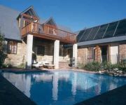
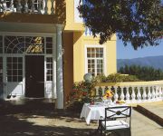
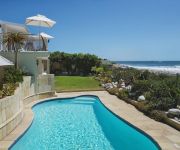
Rodwell House
Villa Honeywood Guest House
Colona Castle Manor House
The Last Word Long Beach
St James Manor
Steenberg Hotel
Brynbrook House
Grosvenor Guest House
A Boat House
Albatross Guest House
Videos from this area
These are videos related to the place based on their proximity to this place.
Cape Town, South Africa - recommended sites full day tour
Todd Beck explores Table Mountain, Hout Bay Seal Island, Kirstenbosch National Botanical Gardens, Boulders Beach, Penguin Colony, Cape of Good Hope, Cape Point Funicular, Cape Point baboons ...
FHERF RC Radian Pro
Schalk with his Radian Pro glider on maiden flight at the Fish Hoek Radio Flyers Club.
FHERF RC Flight Training Formation Mustang vs Trojan
Barry & Schalk are training their fomation flypass for the Fish Hoeh Radio Flyers Club family day.
Baboon's vs Human's
The Handshake team visit the Baboons of Cape Town and monitor them with Baboon Matters. They learn about the initiative to minimise human and baboon conflict and get up close and personal with...
FHERF R C Mystique Res Glider
wilem Hoek flying his Mystique Res Glider at the Fish Hoek Radio Flyers Club.
FHERF R C Beechcreaft T 34 Mentor
Barry with his T-34 maiden flight at the Fish Hoek Radio Flyers Club.
FHERF RC Hercules C130
Francois Viljoen's Hercules C130 at the Fish Hoek Radio Flyers club open day.
Videos provided by Youtube are under the copyright of their owners.
Attractions and noteworthy things
Distances are based on the centre of the city/town and sightseeing location. This list contains brief abstracts about monuments, holiday activities, national parcs, museums, organisations and more from the area as well as interesting facts about the region itself. Where available, you'll find the corresponding homepage. Otherwise the related wikipedia article.
Chapman's Peak
Chapman's Peak Drive]] Chapman's Peak is the name of a mountain on the western side of the Cape Peninsula, about 15 kilometres south of Cape Town, South Africa. It is opposite the inlet on which the town of Hout Bay is centred. The western flank of the mountain falls sharply for hundreds of metres into the Atlantic Ocean. A spectacular road, known as Chapman's Peak Drive, hugs the near-vertical face of the mountain from Hout Bay to Noordhoek.
Masiphumelele High School
Masiphumelele High School is a publicly owned secondary school (grades 8-12) in Masiphumelele, Cape Town, in the Western Cape region of South Africa. As of 2005 it had some 942 students. The school has piped indoor water. In February 2006 students of the school were involved in violent protests, which resulted injuries to two teachers and damage to three police vehicles. http://www. westerncape. gov. za/eng/pubs/news/2005/feb/99374
Fish Hoek Valley
The Fish Hoek Valley is situated in the Cape Peninsula, eighteen miles south of Cape Town, South Africa. It takes its name from the town of Fish Hoek on the False Bay coast. The valley is bound by mountains (including Chapman's Peak, Spitskop, Silvermine Mountain, and Ridge Peak) on the north; Fish Hoek Bay and False Bay on the east; mountains (including Elsie's Peak, Rooikrans, and Slangkop) on the south; and Chapman's Bay and the Atlantic Ocean on the west.


