Safety Score: 3,4 of 5.0 based on data from 9 authorites. Meaning please reconsider your need to travel to South Africa.
Travel warnings are updated daily. Source: Travel Warning South Africa. Last Update: 2024-08-13 08:21:03
Explore Conradie
The district Conradie of Pinelands in City of Cape Town (Western Cape) is located in South Africa about 809 mi south-west of Pretoria, the country's capital.
If you need a place to sleep, we compiled a list of available hotels close to the map centre further down the page.
Depending on your travel schedule, you might want to pay a visit to some of the following locations: Cape Town, Stellenbosch, Paarl, Malmesbury and Moorreesburg. To further explore this place, just scroll down and browse the available info.
Local weather forecast
Todays Local Weather Conditions & Forecast: 23°C / 73 °F
| Morning Temperature | 18°C / 65 °F |
| Evening Temperature | 21°C / 69 °F |
| Night Temperature | 18°C / 64 °F |
| Chance of rainfall | 0% |
| Air Humidity | 63% |
| Air Pressure | 1013 hPa |
| Wind Speed | Gentle Breeze with 7 km/h (4 mph) from East |
| Cloud Conditions | Overcast clouds, covering 92% of sky |
| General Conditions | Overcast clouds |
Saturday, 23rd of November 2024
22°C (72 °F)
18°C (65 °F)
Few clouds, moderate breeze.
Sunday, 24th of November 2024
26°C (80 °F)
19°C (66 °F)
Sky is clear, moderate breeze, clear sky.
Monday, 25th of November 2024
20°C (69 °F)
16°C (61 °F)
Light rain, moderate breeze, scattered clouds.
Hotels and Places to Stay
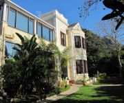
Carmichael Guest House
Protea Hotel Cape Town Mowbray
Banksia Boutique
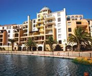
Island Club Hotel & Apartments
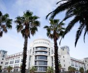
Colosseum Luxury
7 Church Street Luxury Guest House
Cape Town Marriott Hotel Crystal Towers
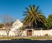
51 on Forest Drive
EHL House
City Lodge Hotel Pinelands
Videos from this area
These are videos related to the place based on their proximity to this place.
Pinelands Canal Flood 2
In the 34 years I have lived in Pinelands, I have never seen the river burst its banks like this. With another 3 days of rain forecast, I wonder what it will look like by the end.
Talkoot! Day 10 November 2012, Cape Town
Talkoot! Day 10 November 2012 Kayelitsha Challenge Statement and Framing ....The challenge to participants is to come up with innovative solutions/interventions by asking the question 'what...
PARACHUTE FAILS AFTER LIGHTNING SETS CLIMB RECORD.
Braking parachute fails after Lightning sets climb record. Philanthropist and businessman John Caudwell won an auction lot to be a passenger in a former RAF Lightning fighter jet as an attempt...
Cape Town wedding videographers - Emdon Video Productions
A montage of some of our wedding productions. Emdon Video Productions www.emdonvideos.co.za.
Zuid-Afrika: Township en Gospeltour in Kaapstad met Camissa
Het is erg de moeite waard om op een zondag met een gids een kerk in de Langa Township in Kaapstad te bezoeken. Ook tijdens deze reis is dat mogelijk http://bit.ly/1gFIGGs.
Kapstadt - mit dem Bus vom Flughafen in die Stadt
Fahrt mit dem MYCiti-Bus vom Flughafen Kapstadt zum Civic Center am 27.02.2013.
The Submarine
XNA Game demo of submarine taking out a ship and watching it hit the ocean floor. You should hear those dolphins cry...
Cape Town Cooling Towers Demolition
The Cape Town cooling towers aka Salt And Pepper Shakers got demolished.
Cape Town to Durban on SAA
Because Mango had cancelled its flights out of Cape Town International, we decided to go with South African Airways. Their business class is excellent and very reasonably priced. More Jack...
Videos provided by Youtube are under the copyright of their owners.
Attractions and noteworthy things
Distances are based on the centre of the city/town and sightseeing location. This list contains brief abstracts about monuments, holiday activities, national parcs, museums, organisations and more from the area as well as interesting facts about the region itself. Where available, you'll find the corresponding homepage. Otherwise the related wikipedia article.
Canal Walk
Canal Walk is a shopping centre in Cape Town, South Africa, that opened in 2000 and was built around a series of canals. It has a total retail area of 141,000-square-metre . The centre forms the heart of a mixed-use development known as Century City, which includes office blocks, residential areas and the Ratanga Junction theme park.
South African Astronomical Observatory
South African Astronomical Observatory (SAAO) is the national center for optical and infrared astronomy in South Africa. It was established in 1972. The observatory is run by the National Research Foundation of South Africa. The facility's function is to conduct research in astronomy and astrophysics. The primary telescopes are located in Sutherland, which is 370 kilometres from Observatory, Cape Town, which is where the headquarters is located.
Diocesan College
The Diocesan College, or Bishops as it is more commonly known, is an independent, all-boys school situated in the suburb of Rondebosch in Cape Town, South Africa. It consists of three schools: the College for grades 8 – 12 and post matric (an optional year following grade 12 which covers the A-levels); the Preparatory School for grades 3 – 7 and the Pre-Preparatory School for Pre-Kindergarten – Grade 0-2. Established in 1849, it is the fifth oldest existing school in Africa.
AFDA, The South African School of Motion Picture Medium and Live Performance
AFDA the South African School of Motion Picture Medium and Live Performance is a film school located on campuses in Auckland Park, Johannesburg, and Observatory, Cape Town, South Africa. AFDA is South Africa's only full member of CILECT and therefore all AFDA degrees are recognized internationally.
International Peace University of South Africa
International Peace University of South Africa was formed when the Islamic College of Southern Africa (ICOSA) and Darul Arqam Islamic Institute (DAII) merged.
Elsieskraal River
The Elsieskraal River is a small river that flows through the Cape Town metropolitan area, in South Africa. It rises in the Tygerberg Hills and flows in a generally south westerly direction to its confluence with the Black River just south of Pinelands. 65% of the course of the Elsieskraal River has been canalised to prevent flooding. Its catchment is part of the Central Management Area of the City of Cape Town.
Athlone Stadium
Athlone Stadium is a stadium in Athlone on the Cape Flats in Cape Town, South Africa. It is used mostly for football matches and is the home ground of Santos Cape Town. The stadium holds 30,000 people and was built in 1972. The stadium was upgraded in the lead up to the 2010 FIFA World Cup with the intention of using it as a training venue. The estimated cost of the upgrade was R297 million.
Liesbeek River
The Liesbeek River (also spelt Liesbeeck) is a river in Cape Town in South Africa. It is named after a small river in Holland. The first "free burghers" of the Dutch East India Company were granted land to farm along the river in 1657, shortly after the first Dutch settlers arrived in the Cape. The river was originally called the Amstel or Versse Rivier. It is the first river that Jan Van Riebeeck named.
St. George's Grammar School (Cape Town)
St. George's Grammar School is a private co-educational day school located in Mowbray, a suburb of Cape Town, South Africa. It was historically the cathedral school attached to St. George's Cathedral, having been founded in 1848 by Robert Gray, the first Anglican Bishop of Cape Town. St. George's claims to be the oldest independent school in South Africa.
Observatory, Cape Town
Observatory is a suburb in Cape Town, South Africa, bordered by Mowbray to the south, and Salt River to the north. The area is best known as student neighbourhood, most of whom attend the University of Cape Town located close by, and for being the home of the South African Astronomical Observatory headquarters as well as Groote Schuur Hospital.
Rustenburg School for Girls
Rustenburg Girls' High School and Rustenburg Junior School make up a public school situated in the suburb of Rondebosch in Cape Town, Western Cape, South Africa. It was founded in 1894. The school offers a range of cultural activities and societies.
Alexander Sinton Secondary School
Alexander Sinton Secondary School, also known as Alexander Sinton High School is an English-medium school in Athlone, South Africa, a suburb of Cape Town, South Africa. As of 2006 it had some 1,113 students and was staffed by 35 educators. http://www. khanya. co. za/schools/khanyaschool. php?emisno=0105483311. In 2006 the Western Cape Education Department designated it one of 10 "Arts and Culture focus schools" to be set up over the following three years. http://curriculum. wcape. school.
Norwood, Western Cape
Norwood is a suburb of Cape Town, in the Western Cape province of South Africa.
MTN Sciencentre
The MTN Sciencentre is a not-for-profit science centre in Cape Town, South Africa. It forms part of a wide range of non-classroom initiatives to improve the quality of science understanding and science literacy in South Africa. Until early 2010, the centre was located in the Canal Walk shopping mall. It will reopen in Observatory later in 2010. The MTN Sciencentre's Ericsson cell phone is in the Guinness Book of World Records as the world's largest working cell phone.
Rosebank railway station
Rosebank railway station is a Metrorail station on the Southern Line in Rosebank, a suburb of Cape Town. It is located between Main Road and Liesbeek Parkway; on the west side it is accessible from Ryan Road and Hope Road, while on the east side it is accessible from Lower Nursery Road. Rosebank is the closest railway station to the main campus of the University of Cape Town, being located only 300 metres from the university's Jammie Shuttle bus stop at Tugwell Hall residence.
N2 Gateway
The N2 Gateway Housing Pilot Project is a large housebuilding project under construction in Cape Town, South Africa. It has been labeled by the national government's former Housing Minister Lindiwe Sisulu as “the biggest housing project ever undertaken by any Government.
Colleges of Medicine of South Africa
The Colleges of Medicine of South Africa (CMSA) is the custodian of the quality of medical care in South Africa. It is unique in the world in that its 27 constituent Colleges represent all the disciplines of medicine and dentistry. One route to specialisation in South Africa, is via a "Fellowship" conferred by the College. See Medical education in South Africa; Dental degree: South Africa.
Cannons Creek Independent School
Cannons Creek Independent School, situated in Pinelands, Cape Town, South Africa was founded in January 1997 by Ms Carol Barhouch (now Booth) together with four teachers, Mrs Hazelmay Duncan, Kevin Wroth, Nicola du Plooy and Lesley Jacobson as a Primary co-educational English speaking Christian School. The School currently incorporates a primary school (Grade RR to 7) and a high school (Grades 8 to 12 writing WCED Matric exams).
Wingfield Aerodrome
Wingfield Aerodrome was first the Cape Town Municipal Aerodrome, then Air Force Station Wingfield under the SAAF, before being used as a Fleet Air Arm base by the Royal Navy. After World War II, the aerodrome reverted to being the municipal airport for a while. The history of Wingfield is synonymous with the history of flight in South Africa, including pioneering attempts at commercial aviation.
Mutual railway station
Mutual railway station is a Metrorail commuter rail station located between the suburbs of Maitland and Pinelands in Cape Town, South Africa. It is situated next to the South African headquarters of the Old Mutual, from which it takes its name. Mutual is a particularly busy station because it is the junction at which the Central Line towards Mitchell's Plain and Khayelitsha diverges from the Northern Line main line to Bellville.
Crawford railway station (Cape Town)
Crawford railway station is a Metrorail station that serves the suburbs of Rondebosch East and Crawford in Cape Town, South Africa. It is served by trains on the Cape Flats Line. The station, which is located between First Avenue in Rondebosch East and Allister Road in Crawford, has two side platforms and a station building at ground level on the west side of the tracks. The platforms are connected by two pedestrian subways.
Observatory railway station
Observatory railway station is a Metrorail station serving the suburb of Observatory in Cape Town. It is served by trains on the Southern Line. The station is located under the Station Road bridge. It has two tracks served by two side platforms, connected by pedestrian subways.
Mowbray railway station
Mowbray railway station is a Metrorail station on the Southern Line, serving the suburb of Mowbray in Cape Town. The station has three tracks, served by a side platform and an island platform; the station building is at ground level on the western side of the tracks. Adjacent to the station is major bus station of the Golden Arrow Bus Services and a large minibus taxi rank; Mowbray is the western end of the Klipfontein Road transport corridor to the Cape Flats.
Pinelands High School
Pinelands High School is a public school situated in Forest Drive, Pinelands in the city of Cape Town, South Africa. It was opened in July 1952 and the founding principal was Mr Jack Kent. The school now has about 950 students. In 2004, the school provided filming locations for the motion picture Ask the Dust, with the sets built to simulate Los Angeles in the 1930s. The school originally had a House System, which was scrapped some years after its formation.
Steenberg railway station
Steenberg railway station is a Metrorail station on the Southern Line in Steenberg, a suburb of Cape Town. It is located on Henley Road, which is just off Military Road. The station is located on the edge of Steenberg, towards Kirstenhof and is alongside the Keyser River, which flows into Zandvlei. Steenberg has a small taxi rank which only serves Grassy Park and Steenberg. Busses to Cape Town are only available at early times of the morning.


