Safety Score: 3,4 of 5.0 based on data from 9 authorites. Meaning please reconsider your need to travel to South Africa.
Travel warnings are updated daily. Source: Travel Warning South Africa. Last Update: 2024-08-13 08:21:03
Delve into The Boulders
The district The Boulders of Oatlands in City of Cape Town (Western Cape) is a subburb in South Africa about 824 mi south-west of Pretoria, the country's capital town.
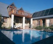
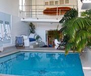
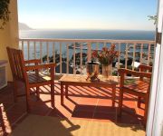
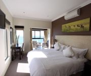
If you need a hotel, we compiled a list of available hotels close to the map centre further down the page.
While being here, you might want to pay a visit to some of the following locations: Cape Town, Stellenbosch, Paarl, Malmesbury and Hermanus. To further explore this place, just scroll down and browse the available info.
Local weather forecast
Todays Local Weather Conditions & Forecast: 22°C / 71 °F
| Morning Temperature | 16°C / 61 °F |
| Evening Temperature | 19°C / 67 °F |
| Night Temperature | 17°C / 63 °F |
| Chance of rainfall | 0% |
| Air Humidity | 51% |
| Air Pressure | 1022 hPa |
| Wind Speed | Fresh Breeze with 15 km/h (9 mph) from North |
| Cloud Conditions | Clear sky, covering 9% of sky |
| General Conditions | Sky is clear |
Friday, 29th of November 2024
22°C (72 °F)
17°C (63 °F)
Few clouds, moderate breeze.
Saturday, 30th of November 2024
20°C (68 °F)
17°C (63 °F)
Sky is clear, fresh breeze, clear sky.
Sunday, 1st of December 2024
19°C (67 °F)
17°C (63 °F)
Scattered clouds, fresh breeze.
Hotels and Places to Stay
Villa Honeywood Guest House
St James Manor
Rodwell House
Magellan's Passage
Mariner Guesthouse
Port Of Call
Grosvenor Guest House
A Boat House
Albatross Guest House
Simon's Town Guest House
Videos from this area
These are videos related to the place based on their proximity to this place.
Twin penguin chicks vie for food
Twin South African penguin chicks in the Boulders Beach breeding colony on False Bay near Simons Town on Cape Point won't take no for an answer when they are hungry. Since penguin gender ...
Foxy Beach, Simon's Town - South Africa Travel Channel
Simon's Town, South Africa http://www.myvideomedia.de English see below [dt.] Foxy Beach bei Simon's Town ist eine von drei Festlandkolonien von Pinguinen in Südafrika. Foxy Beach ist Teil...
Wheelchair access Boulders Beach South Africa
Boulders Beach, the penguins are best viewed from Foxy Beach, where newly-constructed boardwalks take disabled travellers an wheel chair users to within a few meters of the penguins.
African Penguin Colony - Simon's Town
Visiting the African Penguins (Spheniscus demersus, Black-footed Penguin, Jackass Penguin) at Boulders Beach, Simon's Town, South Africa. Google Maps Link: ...
Somebody Lost a Hat - Somebody Found a Nest
Somebody Lost a Hat - Somebody Found a Nest We went to the African Penguin colony at Boulders Beach in Simon's Town. There were lots of tourists and one of the tourists lost a straw hat....
31102013 Penguin colony. Boulders bay. Foxy beach. South Africa
"Fluidscape" Kevin MacLeod (incompetech.com) Licensed under Creative Commons: By Attribution 3.0 http://creativecommons.org/licenses/by/3.0/
Simon's Town, South Africa (with penguins)
Day trip to Simon's Town (from Cape Town) in South Africa. Simon's Town is mainly famous for its penguin colony, but the train ride there also offers a beautiful view. http://www.world-nomad.com...
Videos provided by Youtube are under the copyright of their owners.
Attractions and noteworthy things
Distances are based on the centre of the city/town and sightseeing location. This list contains brief abstracts about monuments, holiday activities, national parcs, museums, organisations and more from the area as well as interesting facts about the region itself. Where available, you'll find the corresponding homepage. Otherwise the related wikipedia article.
Cape of Good Hope
The Cape of Good Hope is a rocky headland on the Atlantic coast of the Cape Peninsula, South Africa. There is a misconception that the Cape of Good Hope is the southern tip of Africa, because it was once believed to be the dividing point between the Atlantic and Indian Oceans. In fact, the southernmost point is Cape Agulhas, about 150 kilometres to the east-southeast.
Fynbos
Fynbos is the natural shrubland or heathland vegetation occurring in a small belt of the Western Cape of South Africa, mainly in winter rainfall coastal and mountainous areas with a Mediterranean climate. The Fynbos ecoregion is within the Mediterranean forests, woodlands, and scrub biome. In fields related to biogeography, fynbos is known for its exceptional degree of biodiversity.
Cape Point
Cape Point is a promontory at the southeast corner of the Cape Peninsula, which is a mountainous and scenic landform that runs north-south for about thirty kilometres at the extreme southwestern tip of the African continent in the Republic of South Africa. Table Mountain and the city of Cape Town are close to the northern extremity of the same peninsula.
African Institute for Mathematical Sciences
The African Institute for Mathematical Sciences (AIMS) is a tertiary education and research institute in Muizenberg, South Africa, established in September 2003. AIMS was formed as a partnership between the following universities: University of Stellenbosch, University of Cambridge, University of Cape Town, University of Oxford, University of Paris-Sud, and University of the Western Cape.
Cape Peninsula
The Cape Peninsula is a generally rocky peninsula that juts out into the Atlantic Ocean at the south-western extremity of the African continent. At the southern end of the peninsula are Cape Point and the Cape of Good Hope. On the northern end is Table Mountain, overlooking Cape Town, South Africa. The peninsula is 52 km long from Mouille point in the north to Cape Point in the south.
Pollsmoor Prison
Pollsmoor Prison, officially, Pollsmoor Maximum Security Prison is a prison in the Cape Town suburb of Tokai in South Africa. Nelson Mandela was the most famous inmate of the prison. He describes Pollsmoor Prison as "the truth of Oscar Wilde's haunting line about the tent of blue that prisoners call the sky. " Pollsmoor is a maximum security prison with little means in the way of escape. Some of South Africa's most dangerous criminals and roughest gangsters are held in Pollsmoor Prison.
Constantiaberg
Constantiaberg is a large, whalebacked mountain that forms part of the mountainous spine of the Cape Peninsula in Table Mountain National Park, Cape Town, South Africa. It lies about 7 km south of Table Mountain, on the southern side of Constantia Nek. The mountain is 927 m high. It is not known who first ascended the peak. Constantiaberg, Devil's Peak and Table Mountain are the highest mountains in the range that stretches from Table Mountain all the way to Cape Point.
Bible Institute of South Africa
The Bible Institute of South Africa is an evangelical Bible college located in Kalk Bay, a suburb of Cape Town on the False Bay coast of the Cape Peninsula, South Africa. The school is non-denominational and has students from all over Africa, as well as from Europe, Asia and North America. It is accredited by North-West University and has a missions focus with many of the faculty having previous on-field missionary experience. The Acting Principal is Dr.
False Bay College
False Bay College is located in Cape Town, South Africa. False Bay College forms part of the band of education known as further education and training (FET). They offer FET courses from NQF levels 2 to 4. Eighty per cent of courses are in this band, and 20 per cent are on higher education and adult basic education and training (ABET).
Chapman's Peak
Chapman's Peak Drive]] Chapman's Peak is the name of a mountain on the western side of the Cape Peninsula, about 15 kilometres south of Cape Town, South Africa. It is opposite the inlet on which the town of Hout Bay is centred. The western flank of the mountain falls sharply for hundreds of metres into the Atlantic Ocean. A spectacular road, known as Chapman's Peak Drive, hugs the near-vertical face of the mountain from Hout Bay to Noordhoek.
HMS Pelorus (J291)
HMS Pelorus (J291) was an Algerine-class minesweeper, built by Lobnitz of Renfrew, Scotland and launched on 19 June 1943. While equipped with minesweeping gear, she was primarily assigned to convoy escort duty in the Atlantic. In 1944, she led the D-Day invasion of Normandy. In 1947 the ship was sold to the South African Navy and renamed HMSAS Pietermaritzburg (and later SAS Pietermaritzburg).
Boulders Beach
Boulders Beach is a sheltered beach made up of inlets between granite boulders, from which the name originated. It is located in the Cape Peninsula, near Simon's Town towards Cape Point, near Cape Town in the Western Cape province of South Africa. It is also commonly known as Boulders Bay. It is a popular tourist stop because of a colony of African Penguins which settled there in 1982. Boulders Beach forms part of the Table Mountain National Park.
Seal Island, South Africa
Seal Island is a small land mass located 5.7 km off the northern beaches of False Bay, near Cape Town, in South Africa. The island is so named because of the great number of Cape Fur Seals that occupy it. It is home to sea birds too and it is likely that non-marine species (in no great number)fly there to breed as well (see external link to the Avian Demographic Unit at the University of Cape Town).
Bergvliet High School
Bergvliet High School is a public high school in the suburb of Bergvliet in Cape Town, Western Cape, South Africa.
Cape Floristic Region
The Cape Floristic Region is a floristic region located near the southern tip of South Africa. It is the only floristic region of the Cape (South African) Floristic Kingdom, and includes only one floristic province, known as the Cape Floristic Province. The Cape Floristic Region, the smallest of the six recognised floral kingdoms of the world, is an area of extraordinarily high diversity and endemism, and is home to more than 9 000 vascular plant species, of which 69 percent are endemic.
SS Thomas T. Tucker
The SS Thomas T. Tucker (Hull Number 269) was a Liberty ship, built by The Houston Shipbuilding Corporation for service as a troop & weapons carrier. Liberty ships were named after prominent (deceased) Americans, starting with Patrick Henry and the signers of the Declaration of Independence. She was named after Thomas Tudor Tucker, an American physician and politician from Charleston, South Carolina. He represented South Carolina in both the Continental Congress and the U.S. House.
Masiphumelele High School
Masiphumelele High School is a publicly owned secondary school (grades 8-12) in Masiphumelele, Cape Town, in the Western Cape region of South Africa. As of 2005 it had some 942 students. The school has piped indoor water. In February 2006 students of the school were involved in violent protests, which resulted injuries to two teachers and damage to three police vehicles. http://www. westerncape. gov. za/eng/pubs/news/2005/feb/99374
Sepia dubia
Sepia dubia is a species of cuttlefish native to the southeastern Atlantic Ocean. It is known only from the type locality, where it was caught at a depth of 25 m. S. dubia is known to grow to a mantle length of 17 mm. The type specimen was collected in False Bay, South Africa . It is deposited at The Natural History Museum in London.
Flying Dutchman Funicular
The Flying Dutchman Funicular, also known as the Cape Point Funicular, is a funicular railway located at Cape Point, near the Cape of Good Hope in the Western Cape province of South Africa. It is believed to be the only commercial funicular of its type in Africa, and takes its name from the legend of the Flying Dutchman ghost ship. The line runs from a lower station at the Cape Point car park, up an incline through dense fynbos to the upper lighthouse.
Bergvliet Primary School
Bergvliet Primary School is a co-educational primary school located in Bergvliet, Cape Town, South Africa. Founded in 1950, the school currently has over 700 students enrolled, offering education from Reception Grade to Grade 7.
Simon's Town railway station
Simon's Town railway station is a Metrorail railway station in the town of Simon's Town on the Cape Peninsula; it is the southern terminus of the Southern Line. The station is located between Station Road and the beach. The railway line from Fish Hoek into Simon's Town is single-track, but the station itself has three tracks; one track is served by a side platform next to the station building on Station Road, while the other two are served by an island platform connected by a pedestrian subway.
Retreat railway station
Retreat railway station is a Metrorail station in Retreat, a suburb of Cape Town. It is a stop on the Southern Line, and the terminus of the Cape Flats Line. The station is located next to a terminus of Golden Arrow Bus Services and a large minibus taxi rank, forming a major transport interchange for the South Peninsula region. The station building is on the western side of the line, attached to Platform 1. Platforms 2 and 3 are on an island.
Zeekoevlei
Zeekoevlei is a major freshwater lake on the Cape Flats near Cape Town, Western Cape Province, South Africa. The name means "hippopotamus vlei," with "vlei" being Afrikaans for "lake", and "zeekoe" (i.e. "sea-cow") being an archaic spelling of the Afrikaans for hippopotamus. Zeekoevlei Nature Reserve (established in June 2000) is based on the lake. It is separated by a peninsula from the Rondevlei Nature Reserve and preserves endangered Cape Lowland Freshwater Wetland ecosystems.
Fish Hoek Valley
The Fish Hoek Valley is situated in the Cape Peninsula, eighteen miles south of Cape Town, South Africa. It takes its name from the town of Fish Hoek on the False Bay coast. The valley is bound by mountains (including Chapman's Peak, Spitskop, Silvermine Mountain, and Ridge Peak) on the north; Fish Hoek Bay and False Bay on the east; mountains (including Elsie's Peak, Rooikrans, and Slangkop) on the south; and Chapman's Bay and the Atlantic Ocean on the west.
Cape Academy of Mathematics, Science and Technology
The Cape Academy of Mathematics, Science and Technology, often abbreviated to "Cape Academy", is a co-educational public boarding school, situated in the Constantia Valley of Cape Town, South Africa. The Cape Academy was founded in 2004 by the Western Cape Education Department to offer quality instruction in the sciences to students from previously disadvantaged backgrounds, as part of the government's strategy to fill the skills gap present in South Africa.


