Safety Score: 3,4 of 5.0 based on data from 9 authorites. Meaning please reconsider your need to travel to South Africa.
Travel warnings are updated daily. Source: Travel Warning South Africa. Last Update: 2024-08-13 08:21:03
Delve into Monte Vista
The district Monte Vista of Cape Town in City of Cape Town (Western Cape) is a district located in South Africa about 805 mi south-west of Pretoria, the country's capital town.
In need of a room? We compiled a list of available hotels close to the map centre further down the page.
Since you are here already, you might want to pay a visit to some of the following locations: Stellenbosch, Paarl, Malmesbury, Moorreesburg and Hermanus. To further explore this place, just scroll down and browse the available info.
Local weather forecast
Todays Local Weather Conditions & Forecast: 22°C / 72 °F
| Morning Temperature | 16°C / 62 °F |
| Evening Temperature | 19°C / 66 °F |
| Night Temperature | 17°C / 62 °F |
| Chance of rainfall | 0% |
| Air Humidity | 52% |
| Air Pressure | 1017 hPa |
| Wind Speed | Moderate breeze with 12 km/h (8 mph) from North |
| Cloud Conditions | Clear sky, covering 1% of sky |
| General Conditions | Sky is clear |
Tuesday, 19th of November 2024
22°C (72 °F)
19°C (66 °F)
Sky is clear, moderate breeze, clear sky.
Wednesday, 20th of November 2024
26°C (79 °F)
18°C (65 °F)
Moderate rain, fresh breeze, broken clouds.
Thursday, 21st of November 2024
21°C (70 °F)
19°C (65 °F)
Light rain, moderate breeze, broken clouds.
Hotels and Places to Stay
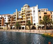
Island Club Hotel & Apartments
Cape Town Marriott Hotel Crystal Towers
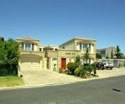
Casa Mia Guesthouse
Wind-Rose Guest House
Plattekloof Lodge
Hajo's Lodge
Panaview Bed and Breakfast
Homestead Villas
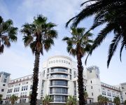
Colosseum Luxury
Protea Hotel Cape Town Tyger Valley
Videos from this area
These are videos related to the place based on their proximity to this place.
Bad Driving - Durbanville Road, Bothasig, Cape Town
The driver of the Opel Kadett enter this roundabout a little too aggressively wouldn't you agree? DLAPC Rating: 7/10 Opel Kadett no registration details available.
Bad Driving - Plattekloof Road, Bothasig, Cape Town
Yet another lass who thinks a red traffic light means go, or she is just colour blind - who knows? DLAPC Rating: 7/10 VW Polo Sedan Grey - CA140-887.
Bad Driving - Bosmansdam Road, Montague Gardens, Cape Town 3
Just another video displaying how drivers ignore red traffic lights because their time is too precious to stop. DLAPC Raing: 5/10 No registrations.
Bad Driving - Bosmansdam Road, Montague Gardens, Cape Town 3
The driver of this Tazz was all over the place and almost ended up as a Tazz sandwich, almost! Again it comes down to patience, innit? DLAPC Rating: 7/10 Toyota Tazz in shiny silvery/blue: CX39572.
Self Storage in South Africa - StorageCube
StorageCube Cape Town is one of our storage facilities in Cape Town. Should you stay in Montague Gardens, Century City, Goodwood, Parow, Bellville, Brackenfell or Claremont (or areas close...
Bad Driving - Bosmansdam Road, Bothasig, Cape Town
Apologies for audio feed in this video** This video is proof that drivers are simply impatient and selfish while behind the wheel of a vehicle. Yet another company vehicle being driven by...
VW Golf Mk7 TDI consumption
Distance: +- 29km Temp: +- 21°C Since start: 3.8l/100km Location: Cape Town Route: De Villiers Dr, Faitrees Rd, Eversdal Rd, Old Oak Rd, N1, N7, Plattekloof Rd, Koeberg Rd, Blaauwberg Rd ...
Netcare Oncology & Interventional Centre
The Netcare Oncology & Interventional Centre is a state of the art facility and is situated at Netcare N1 City Hospital, Cape Town. The term Centre of Excellence is often used these days but...
April 2013 - Koi Pond of George and Lourens Greenaway: 9000 - 10 000l est
Koi Pond of George and Lourens Greenaway: 9000 - 10 000l est. Goodwood, Cape Town, South Africa.
Videos provided by Youtube are under the copyright of their owners.
Attractions and noteworthy things
Distances are based on the centre of the city/town and sightseeing location. This list contains brief abstracts about monuments, holiday activities, national parcs, museums, organisations and more from the area as well as interesting facts about the region itself. Where available, you'll find the corresponding homepage. Otherwise the related wikipedia article.
Canal Walk
Canal Walk is a shopping centre in Cape Town, South Africa, that opened in 2000 and was built around a series of canals. It has a total retail area of 141,000-square-metre . The centre forms the heart of a mixed-use development known as Century City, which includes office blocks, residential areas and the Ratanga Junction theme park.
Elsieskraal River
The Elsieskraal River is a small river that flows through the Cape Town metropolitan area, in South Africa. It rises in the Tygerberg Hills and flows in a generally south westerly direction to its confluence with the Black River just south of Pinelands. 65% of the course of the Elsieskraal River has been canalised to prevent flooding. Its catchment is part of the Central Management Area of the City of Cape Town.
Athlone Stadium
Athlone Stadium is a stadium in Athlone on the Cape Flats in Cape Town, South Africa. It is used mostly for football matches and is the home ground of Santos Cape Town. The stadium holds 30,000 people and was built in 1972. The stadium was upgraded in the lead up to the 2010 FIFA World Cup with the intention of using it as a training venue. The estimated cost of the upgrade was R297 million.
Tygerberg
Tygerberg is one of the northern suburbs of Cape Town in South Africa. It is also the name the range of hills above the town.
Bellville Velodrome
The Bellville Velodrome is a 250 meter, multi-purpose indoor velodrome located in Bellville (about 25 kilometers outside of the centre of Cape Town), South Africa. The velodrome was initially developed for the South African Olympic Bid, this venue hosted the World Cycling Federation Championships in 1999. The project was completed in 9 months from inception. The Velodrome features an acoustically treated soffit lining for purposes of hosting music and other entertainment events.
Bellville Stadium
Bellville Stadium is a multi-use stadium in Cape Town, South Africa. It is currently used mostly for football matches and is the home stadium of Vasco Da Gama.
Belhar Secondary School
Belhar Secondary School is an Afrikaans/English mixed medium school in Bellville, Western Cape, South Africa. As of 2006 it had some 1,274 students http://wcedemis. wcape. gov. za/ibi_apps/WFServlet?IBIF_ex=INERSCHOOLN&EMIS_NO=0101323500 and was staffed by 35 educators. http://www. khanya. co. za/schools/khanyaschool. php?emisno=0101323500. In 2006 the Western Cape Education Department designated it one of 10 "Arts and Culture focus schools" to be set up over the following three years.
Killarney Motor Racing Complex
Killarney Motor Racing Complex is a motor racing complex in Cape Town, South Africa. It first saw action in 1947. In 1959/60 the track was upgraded and rebuilt to conform to the required FIA standard for the 1500 cc Formula One cars of the time. The design was entrusted to Edgar Hoal, a leading racing driver and roads engineer, who also supervised its construction.
Norwood, Western Cape
Norwood is a suburb of Cape Town, in the Western Cape province of South Africa.
MTN Sciencentre
The MTN Sciencentre is a not-for-profit science centre in Cape Town, South Africa. It forms part of a wide range of non-classroom initiatives to improve the quality of science understanding and science literacy in South Africa. Until early 2010, the centre was located in the Canal Walk shopping mall. It will reopen in Observatory later in 2010. The MTN Sciencentre's Ericsson cell phone is in the Guinness Book of World Records as the world's largest working cell phone.
Milnerton High School
Milnerton High School is a state school in the suburb of Milnerton in Cape Town, South Africa. It was founded in 1959.
Fairbairn College
Fairbairn College is a public, co-educational high school in the suburb of Goodwood in Cape Town, Western Cape, South Africa.
N2 Gateway
The N2 Gateway Housing Pilot Project is a large housebuilding project under construction in Cape Town, South Africa. It has been labeled by the national government's former Housing Minister Lindiwe Sisulu as “the biggest housing project ever undertaken by any Government.
Bellville railway station
Bellville railway station is a railway station in the town of Bellville, Western Cape, South Africa. It is the second-biggest station in the Cape Town Metrorail railway network, after the Cape Town terminus. All trains on Metrorail's Northern Line pass through Bellville, and one branch of the Central Line also terminates there. It is also a stop for Shosholoza Meyl trains that terminate in Cape Town.
Cannons Creek Independent School
Cannons Creek Independent School, situated in Pinelands, Cape Town, South Africa was founded in January 1997 by Ms Carol Barhouch (now Booth) together with four teachers, Mrs Hazelmay Duncan, Kevin Wroth, Nicola du Plooy and Lesley Jacobson as a Primary co-educational English speaking Christian School. The School currently incorporates a primary school (Grade RR to 7) and a high school (Grades 8 to 12 writing WCED Matric exams).
Hugo Lambrechts Music Centre
Hugo Lambrechts Music Centre is a dedicated centre for the study of classical music for school-going pupils. Established in 1986, it is housed in one of the oldest school buildings in the northern suburbs of Cape Town.
Wingfield Aerodrome
Wingfield Aerodrome was first the Cape Town Municipal Aerodrome, then Air Force Station Wingfield under the SAAF, before being used as a Fleet Air Arm base by the Royal Navy. After World War II, the aerodrome reverted to being the municipal airport for a while. The history of Wingfield is synonymous with the history of flight in South Africa, including pioneering attempts at commercial aviation.
Mutual railway station
Mutual railway station is a Metrorail commuter rail station located between the suburbs of Maitland and Pinelands in Cape Town, South Africa. It is situated next to the South African headquarters of the Old Mutual, from which it takes its name. Mutual is a particularly busy station because it is the junction at which the Central Line towards Mitchell's Plain and Khayelitsha diverges from the Northern Line main line to Bellville.
University of Stellenbosch Business School
University of Stellenbosch Business School (USB) is the business school of the University of Stellenbosch in Bellville, Western Cape, South Africa.
Table View High School
Table View High School was founded in 1986 in Table View, a suburb of Cape Town, and is a dual-medium Afrikaans and English school that enrolls both boys and girls (co-educational). The school is financially assisted by the Western Cape Education Department and therefore, like most other schools in South Africa, it charges a school fee, as regulated by the South African Schools Act.
Range High School (Cape Town)
Range High School is an Afrikaans medium school in Matroosfontein, Western Cape, South Africa.
NNK Rugby Stadium
NNK Rugby Stadium is a multi-use stadium, situated in the Parow suburb of Cape Town, at the Western Cape Province in South Africa. Previously it was mostly used for rugby matches. Since September 2010, where the stadium became the new home venue for the National First Division club FC Cape Town, it has mainly been used to host football matches.
Parklands College
Bosmansdam High School
Bosmansdam High School was founded in 1971 in Bothasig, a suburb of Cape Town, and is a dual medium Afrikaans and English school. The school is state assisted and therefore, like most other schools in South Africa, it charges a set amount of money for its services. The school offers a wide variety of sporting and cultural activities.
Pinelands High School
Pinelands High School is a public school situated in Forest Drive, Pinelands in the city of Cape Town, South Africa. It was opened in July 1952 and the founding principal was Mr Jack Kent. The school now has about 950 students. In 2004, the school provided filming locations for the motion picture Ask the Dust, with the sets built to simulate Los Angeles in the 1930s. The school originally had a House System, which was scrapped some years after its formation.


