Safety Score: 3,4 of 5.0 based on data from 9 authorites. Meaning please reconsider your need to travel to South Africa.
Travel warnings are updated daily. Source: Travel Warning South Africa. Last Update: 2024-08-13 08:21:03
Discover Ronald’s Vlei
Ronald’s Vlei in Frances Baard District Municipality (Northern Cape) is a city in South Africa about 298 mi (or 479 km) south-west of Pretoria, the country's capital city.
Local time in Ronald’s Vlei is now 04:13 PM (Thursday). The local timezone is named Africa / Johannesburg with an UTC offset of 2 hours. We know of 8 airports in the vicinity of Ronald’s Vlei. The closest airport in South Africa is Kimberley Airport in a distance of 1 mi (or 2 km), South-East. Besides the airports, there are other travel options available (check left side).
Looking for a place to stay? we compiled a list of available hotels close to the map centre further down the page.
When in this area, you might want to pay a visit to some of the following locations: Kimberley, Barkly West, Boshof, Koffiefontein and Warrenton. To further explore this place, just scroll down and browse the available info.
Local weather forecast
Todays Local Weather Conditions & Forecast: 32°C / 89 °F
| Morning Temperature | 20°C / 68 °F |
| Evening Temperature | 24°C / 74 °F |
| Night Temperature | 20°C / 69 °F |
| Chance of rainfall | 5% |
| Air Humidity | 27% |
| Air Pressure | 1011 hPa |
| Wind Speed | Strong breeze with 18 km/h (11 mph) from South-East |
| Cloud Conditions | Scattered clouds, covering 38% of sky |
| General Conditions | Moderate rain |
Friday, 22nd of November 2024
32°C (90 °F)
23°C (73 °F)
Sky is clear, fresh breeze, clear sky.
Saturday, 23rd of November 2024
33°C (91 °F)
27°C (81 °F)
Sky is clear, moderate breeze, clear sky.
Sunday, 24th of November 2024
35°C (94 °F)
29°C (84 °F)
Sky is clear, gentle breeze, clear sky.
Hotels and Places to Stay
Oleander Guest House
Aletheim Guest House Collection
Protea Hotel Kimberley
Diggies Lodge
Mc Kala Guest House
44 Memorial Manor
Agros Guest House
The Solomon
Kimberley Country House
Kimberley Manor Guesthouse
Videos from this area
These are videos related to the place based on their proximity to this place.
South Africa 33: Cribzzz in Kimberley
A nonsense video in Kimberley of me making fun of Cribz (all improvised) :P It's the house we lived in for a couple of nights during our stay there. It's not my house! Just rented it. Soon...
Warlords of Draenor: Highmaul - The Walled City [warr][dps][lfr]
Warlords of Draenor: Highmaul - The Walled City [warr][dps][lfr]
Transnet Freight Rail Class 34-000s at Kimberley in a brewing lightning storm
General Electric U-boats no's. 34-027 and 34-111 slowly chug out of Kimberley Station with a southbound 'Pride of Africa' landcruise. They sound lovely don't they? The booming sound is...
Mokala National Park Goodrichodyssey's photos around Kimberley, South Africa (mokala street)
Preview of Goodrichodyssey's blog at TravelPod. Read the full blog here: http://www.travelpod.com/travel-blog-entries/goodrichodyssey/3/1237394460/tpod.html This blog preview was made by...
Gotta see the Big Hole Blmc's photos around Kimberley, South Africa (the big hole south africa)
Preview of Blmc's blog at TravelPod. Read the full blog here: http://www.travelpod.com/travel-blog-entries/blmc/1/1260481021/tpod.html This blog preview was made by TravelPod using the TripAdvis...
Kimberley's historical buildings
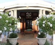
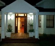
With tastefully furnished guest rooms, ample secure parking & relaxing shaded gardens, The Solomon Edwardian Guest House provides the perfect accommodation for your stay in Kimberley.
What is there to see or do in Kimberley South Africa
If you plan to visit Kimberley and you cannot set aside at least 1 to 3 hours to visit the Big Hole of Kimberley, you will definately lose out on a historica...
Maloof Money Cup South Africa: Vert Finals 2011
Alex Perelson, Pierre Luc Gagnon, Adam Taylor, Pedro Barros, Bob Burnquist, Andy MacDonald, Marcelo Bastos, Jake Brown, Sandro Dias, and Elliot Sloan on the vert ramp in Kimberley, South Africa.
Videos provided by Youtube are under the copyright of their owners.
Attractions and noteworthy things
Distances are based on the centre of the city/town and sightseeing location. This list contains brief abstracts about monuments, holiday activities, national parcs, museums, organisations and more from the area as well as interesting facts about the region itself. Where available, you'll find the corresponding homepage. Otherwise the related wikipedia article.
McGregor Museum
The McGregor Museum in Kimberley, South Africa, originally known as the Alexander McGregor Memorial Museum, is a province-aided museum established in 1907.
Kimberley Boys' High School
Kimberley Boys' High School is a state secondary school or high school situated adjacent to the Honoured Dead Memorial, in the arc between Dalham and Memorial Roads, Kimberley, Northern Cape, South Africa – a site it has occupied since January 1914. The school was founded, along with what would become Kimberley Girls' High School, in 1887, under the name Kimberley Public Undenominational Schools.
HTS Kimberley
HTS Kimberley is an Hogere technische school in Kimberley, South Africa. An HTS is similar to a high school, in Dutch countries they serve as the education level just below university. The English name is 'THS' (Technical High School) Kimberley.
Kimberley Girls' High School
Kimberley Girls' High School is a high school located on Elsmere Road in Kimberley, Northern Cape, South Africa. It is over a hundred years old and has close affiliation with Kimberley Boys' High School and Kimberley Junior School.
Hoffe Park Stadium
Hoffe Park Stadium, also known by is sponsored branding name, GWK Park, is a multi-purpose stadium in Kimberley, South Africa. It is part of a larger multi-sport complex known as Hoffe Park. It is currently used mostly for rugby union matches and is the home stadium of the GWK Griquas who compete in the Currie Cup and the part time home of the Central Cheetahs of Super Rugby. The stadium has a capacity of 18,000 spectators.
Honoured Dead Memorial
The Honoured Dead Memorial is a provincial heritage site in Kimberley in the Northern Cape province of South Africa. It is situated at the meeting point of five roads, and commemorates those who died defending the city during the Siege of Kimberley in the Anglo-Boer War. In 1986, it was described in the Government Gazette as Cecil John Rhodes commissioned Sir Herbert Baker to design a memorial... which commemorates those who fell during the Kimberley Siege.
Long Cecil
Long Cecil is a unique one-off gun, designed by George Labram, a United States citizen, and built in the workshops of the De Beers mining company in Kimberley for use by the British during the Siege of Kimberley in the Second Boer War. In 1902, during Cecil Rhodes' funeral procession in Cape Town, his coffin was carried on top of the Long Cecil carriage. Today the gun is located on the stylobate of the Honoured Dead Memorial in Kimberley.
Du Toit's Pan
Du Toit's Pan, now usually Dutoitspan, refers to one of the earliest diamond mining camps at what is now Kimberley, South Africa. It was renamed Beaconsfield, which existed as a separate borough from Kimberley itself until Kimberley and Beaconsfield were amalgamated as the City of Kimberley in 1912.


!['Warlords of Draenor: Highmaul - The Walled City [warr][dps][lfr]' preview picture of video 'Warlords of Draenor: Highmaul - The Walled City [warr][dps][lfr]'](https://img.youtube.com/vi/S4FYHGTyIZo/mqdefault.jpg)


