Safety Score: 3,4 of 5.0 based on data from 9 authorites. Meaning please reconsider your need to travel to South Africa.
Travel warnings are updated daily. Source: Travel Warning South Africa. Last Update: 2024-08-13 08:21:03
Touring Forest Haven
The district Forest Haven of in eThekwini Metropolitan Municipality (KwaZulu-Natal) is a subburb located in South Africa about 322 mi south-east of Pretoria, the country's capital place.
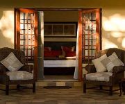
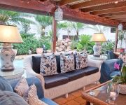
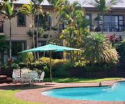
Need some hints on where to stay? We compiled a list of available hotels close to the map centre further down the page.
Being here already, you might want to pay a visit to some of the following locations: Durban, Ndwedwe, Camperdown, Wartburg and Pietermaritzburg. To further explore this place, just scroll down and browse the available info.
Local weather forecast
Todays Local Weather Conditions & Forecast: 25°C / 77 °F
| Morning Temperature | 23°C / 73 °F |
| Evening Temperature | 24°C / 74 °F |
| Night Temperature | 22°C / 71 °F |
| Chance of rainfall | 1% |
| Air Humidity | 77% |
| Air Pressure | 1015 hPa |
| Wind Speed | Fresh Breeze with 14 km/h (9 mph) from North-East |
| Cloud Conditions | Overcast clouds, covering 92% of sky |
| General Conditions | Light rain |
Sunday, 24th of November 2024
24°C (75 °F)
23°C (73 °F)
Light rain, moderate breeze, broken clouds.
Monday, 25th of November 2024
28°C (83 °F)
25°C (76 °F)
Broken clouds, moderate breeze.
Tuesday, 26th of November 2024
25°C (77 °F)
21°C (70 °F)
Moderate rain, moderate breeze, overcast clouds.
Hotels and Places to Stay
Sanchia Luxury Guesthouse
Gateway Country Lodge - Guest House
J.R. Guesthouse
Manaar House
Protea Hotel Durban Umhlanga Ridge
Royal Palm Hotel
City Lodge Hotel Umhlanga Ridge
Tesorino
Coastlands Umhlanga Hotel & Convention Centre
COASTLANDS UMHLANGA
Videos from this area
These are videos related to the place based on their proximity to this place.
How to Make a Wool Felt Acorn Shaped Christmas Ornament - Crafty Hangouts -Holiday Show
How to Make a Wool Felt Acorn Shaped Christmas Ornament - Crafty Hangouts -Holiday Show See how to create a acorn style woodland themed ornament for your Thanksgiving table setting, on a ...
UMHLANGA TOURISM DEC 2012
This Video captures the beauty of Umhlanga, It shows off the best attractions and activities in the area. If you looking for your next holiday destination, look no further you have found it....
Red Mercedes C350 NUR 65735 reckless and negligent driving
Idiot endangering the lives of those around him by applying his brakes in the overtaking lane on the highway. All because a vehicle wished for him to move over or speed up (he was travelling...
Haitian Brown Tarantula - Phormictopus cancerides - Rehousing
Haitian Brown - Phormictopus cancerides slings are blue and slowly change colour as they get older. These Tarantulas show purplish colour on their legs as adults and in some cases the clolour...
Mt Moreland Mom and Baby Release
We return to Mt Moreland where 4 weeks prior we rescued a female monkey shot with a pellet gun. The tot was also taken in at the same time, luckily unhurt. Recovered nicely, we release them...
Wild Caught Brown House Snakes in Verulam, KZN, South Africa
Wild caught South African Brown House Snakes in KZN South Africa. Brown House Snake hatchling and Brown House Snake Yearling.
AVIS Van Rental Richards Bay NRB40912 dangerous driving
AVIS Van Rental Richards Bay registration # NRB40912 dangerous driving.
Assegai - A Kung Fu Story
A Kung-Fu short film shot for fun and in isiZulu in Durban, South Africa featuring the Black Fox Martial Arts School, directed by Heinrich Bohmke, original score Dean Henning, produced by Xalanga...
Videos provided by Youtube are under the copyright of their owners.
Attractions and noteworthy things
Distances are based on the centre of the city/town and sightseeing location. This list contains brief abstracts about monuments, holiday activities, national parcs, museums, organisations and more from the area as well as interesting facts about the region itself. Where available, you'll find the corresponding homepage. Otherwise the related wikipedia article.
Gateway Theatre of Shopping
Gateway Theatre of Shopping or Gateway has been described as both the largest shopping centre in Africa and the largest in the southern hemisphere, although other shopping centres have also claimed the southern hemisphere title. It is located on Umhlanga Ridge in Umhlanga, north of Durban, KwaZulu-Natal, South Africa. Construction commenced on 3 March 1998 and it officially opened during September 2001 and currently has a retail floor space area of 180,000 sq. metres.
Kings Park Stadium
Kings Park (previously known as ABSA Stadium and Mr Price Kings Park Stadium for sponsorship reasons and also commercially promoted as The Shark Tank), is a stadium in the Kings Park Sporting Precinct in Durban, South Africa, which was originally built in 1891 and extensively renovated in the 1990s. It has a capacity of 55,000 and is the home ground of the Sharks. The stadium has also been used by Durban based Premier Soccer League football (soccer) clubs, as well as for large football finals.
Kings Park Soccer Stadium
Kings Park Soccer Stadium was a multi-use stadium in Durban, South Africa. It was formerly used mostly for football matches and was the home of Manning Rangers who played in the Premier Soccer League. The stadium had a capacity of 35,000 people. The stadium was demolished in 2006 to make way for the Moses Mabhida Stadium.
Durban street circuit
The Durban street circuit is a 3.283 kilometres temporary street circuit located in Durban, South Africa which is 300 metres from Durban's North Beach and 800 metres from Durban's CBD. It was used for the A1 Grand Prix from 2005 to 2008. The A1 Grand Prix race held on this circuit was the first international open-wheel automobile race held in the country since the 1993 South African Grand Prix. The 2006 event attracted more than 105,000 spectators despite restricted seating (22 000).
Moses Mabhida Stadium
The Moses Mabhida Stadium is a stadium in Durban, South Africa, named after Moses Mabhida, a former General Secretary of the South African Communist Party. It is a multi-use stadium. It was one of the host stadiums for the 2010 FIFA World Cup. The stadium has a capacity of 62,760 during the World Cup and 54,000 afterwards. The stadium is adjacent to the Kings Park Stadium, in the Kings Park Sporting Precinct, and the Durban street circuit used for the A1GP World Cup of Motorsport.
Clifton School
Clifton School is an independent school for boys located in Durban, Kwazulu-Natal, in the Republic of South Africa.
Princess Magogo Stadium
Princess Magogo Stadium is a multi-purpose stadium in KwaMashu, a suburb of Durban, South Africa. It is currently used mostly for football matches and is set to be utilized as a training field for teams participating in the 2010 FIFA World Cup after being renovated in 2009 and brought up to FIFA standards. The stadium is named after Princess Constance Magogo, a Zulu princess who spent much of her life as a singer and composer while developing an understanding for Zulu tradition and culture.
Durban North
Durban North is situated just north of Durban in the eThekwini Metropolitan Municipality, created in 2000, which includes the greater Durban area in KwaZulu-Natal, South Africa. It lies between the N2 freeway and the eastern seashore, with the Umgeni River forming its southern boundary. It is flanked by La Lucia in the north.
Sepia insignis
Sepia insignis is a species of cuttlefish native to the southwestern Indian Ocean, specifically South Africa, from the Cape of Good Hope to Natal. It lives at depths to 42 m. S. insignis grows to a mantle length of 60 mm. The type specimens, consisting solely of cuttlebones, were collected on Tongaat Beach, KwaZulu-Natal, South Africa . They are deposited at The Natural History Museum in London.
Kennedy Road, Durban
Kennedy Road is a shack settlement, in the suburb of Clare Estate in Durban, in the province of KwaZulu-Natal in South Africa. It was founded by a Mr. Mzobe in the late 1970s. The land on which the settlement was founded is steep and runs down between the Municipal Dump and the 6 lane Umgeni Road. At the time of the occupation, the suburb of Clare Estate was reserved, under apartheid legislation, for the exclusive use of people of Indian descent.
Kings Park Sporting Precinct
Kings Park Sporting Precinct is a site located in Stamford Hill, Durban, KwaZulu Natal, South Africa. It was developed primarily to host the 2010 FIFA World Cup, but will also form part of the city's long term plan to host the Summer Olympics. The precinct regularly hosts domestic and international rugby union and association football events, as well as national and international swimming galas. The Kings Park Sporting Precinct is managed by the City of Durban.
Al Falaah College
Al Falaah College is an alternative, independent school situated in the coastal city of Durban, in KwaZulu-Natal, South Africa.
Inanda Dam
Inanda Dam is an earth-fill type dam located on the Umgeni River, near Hillcrest, KwaZulu-Natal, South Africa. It was established in 1989 and its primary purpose is to serve for domestic and industrial use. The hazard potential of the dam construction as been ranked high (3).
Jameson Park and Rose Garden
Jameson Park and Rose Garden {{#invoke:Coordinates|coord}}{{#coordinates:29|49|37|S|31|00|31|E| |primary |name= }} is a rose garden located in Durban, South Africa. Once being a pineapple plantation, it currently possesses about 200 species of roses which are prominent in the South African Spring months of September to November.
Burman Bush
Burman Bush is a nature reserve in Morningside, Durban, situated some 8 km north of the CBD. At about 50 hectares it constitutes a small coastal forest, that forms part of the Durban Municipal Open Space System (D'MOSS). Among the forest trees that populate the reserve are flat-crowns, the forest fever-berry and red beech.
Hazelmere Dam
Hazelmere Dam is a combined concrete gravity type dam located on the Mdloti River, Kwazulu Natal, South Africa. It was established in 1977 and its primary purpose is to serve for irrigation and domestic use. The hazard potential of the dam assembly has been ranked high (3).
Educor
Educor is a premier supplier of tertiary education in South Africa. Educor is an abbreviation for the Education Investment Corporation Limited. They are the largest provider of private education in Southern Africa. They provide Higher, Further and Vocational education via face-to-face classes, distance learning and online learning. They also offer full-time and part-time studies, providing people from all walks of life with access to education.
Hawaan Forest
The Hawaan Forest is situated near Umhlanga, KwaZulu-Natal, South Africa. It is a large remnant of a climax dry coastal dune forest and the last of its kind. This forest grows on a dune that dates back 18,000 years. The Hawaan forest is currently under the guardianship of the Wildlife and Environment Society of Southern Africa, but is owned by the Tongaat Hulett Group.
Sugar Ray Xulu Stadium
Sugar Ray Xulu Stadium is a multi-purpose stadium in Clermont, a township of Durban, South Africa. It is currently used mostly for football matches and is set to be utilized as a training field for teams participating in the 2010 FIFA World Cup after being renovated in 2010 and brought up to FIFA standards. The stadium's small capacity was expanded from 1,700 to 6,500 as a lasting legacy of the World Cup.
Mitchell Park Zoo
Mitchell Park Zoo is also known as Mitchell Park or Mitchell's Park. Situated in the Morningside suburb of Durban, South Africa, it is the only zoo in Durban. The zoo was established as an Ostrich farm in 1910, but was unprofitable and started adding other animals. At one time it was home to many large animals, the most notable of which was an Indian Elephant named Nellie.
Umgeni River Bird Park
The Umgeni River Bird Park is a bird zoo located in Durban, in the province of KwaZulu-Natal, South Africa.
Lambert Road Baptist Church
Lambert Road Baptist Church is an evangelical church located in the suburb of Morningside, in Durban, South Africa. This church is a member of the Baptist Union of Southern Africa.
The Oyster Box (South Africa)
The Oyster Box is a luxury five-star hotel in Umhlanga, just north of Durban, South Africa. It was built in 1869 as a beach cottage and retained its name when it was converted into a hotel in the 1930s. In July 2011, Prince Albert II of Monaco and Princess Charlene of Monaco spent their honeymoon in its £4600 a night Presidential Suite.
Umhlanga Lagoon
Umhlanga lagoon is a nature reserve in Umhlanga Rocks, Durban, South Africa. It is at the point where the Ohlanga River empties into the Indian Ocean. It has picnic sites, the remains of a prehistoric shell midden and walking trails. It is well known as an unofficial nudist beach.
Overport
Overport is a hilly residential area in Durban, South Africa. The name Overport is commonly used to refer to the suburbs of Overport, Sydenham, Sparks and parts of Essenwood, with the part of Sydenham west of Brickfield Road usually called Asherville rather than Overport. The name Overport was coined by William Hartley, the eighth Mayor of Durban for an estate he developed in what had up to then been called West Hill.


