Safety Score: 3,4 of 5.0 based on data from 9 authorites. Meaning please reconsider your need to travel to South Africa.
Travel warnings are updated daily. Source: Travel Warning South Africa. Last Update: 2024-08-13 08:21:03
Discover Folweni
The district Folweni of in eThekwini Metropolitan Municipality (KwaZulu-Natal) is a district in South Africa about 334 mi south-east of Pretoria, the country's capital city.
Looking for a place to stay? we compiled a list of available hotels close to the map centre further down the page.
When in this area, you might want to pay a visit to some of the following locations: Durban, Scottburgh, Camperdown, Ndwedwe and Richmond. To further explore this place, just scroll down and browse the available info.
Local weather forecast
Todays Local Weather Conditions & Forecast: 28°C / 82 °F
| Morning Temperature | 20°C / 68 °F |
| Evening Temperature | 24°C / 76 °F |
| Night Temperature | 23°C / 73 °F |
| Chance of rainfall | 0% |
| Air Humidity | 67% |
| Air Pressure | 1008 hPa |
| Wind Speed | Strong breeze with 18 km/h (11 mph) from North-East |
| Cloud Conditions | Clear sky, covering 0% of sky |
| General Conditions | Sky is clear |
Tuesday, 19th of November 2024
23°C (74 °F)
21°C (70 °F)
Overcast clouds, fresh breeze.
Wednesday, 20th of November 2024
26°C (79 °F)
23°C (73 °F)
Few clouds, moderate breeze.
Thursday, 21st of November 2024
27°C (81 °F)
23°C (73 °F)
Light rain, moderate breeze, overcast clouds.
Hotels and Places to Stay
The View Boutique Hotel
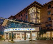
Protea Hotel Karridene Beach
ANTOINETTE'S GUESTHOUSE (TV)-KWAZULU NAT
Videos from this area
These are videos related to the place based on their proximity to this place.
Trike Drifting Durban South Africa - Inanda
Drifting the slopes of Inanda! Comment if you in the area and wanna meet up for a session! #Drift-zn.
Inconsiderate driving
Woman jumps the stop street and stops in the road, at first I did not notice she had stopped and I nearly hit her. She then goes into the left turn only lane and turns right across my direction...
Road Marine Logistics Truck
Reckless and Negligent driving, N2 South bound just before M7 off ramp, I am traveling 120 km/p/h this truck from Road Marine Logistics indicating left pulls out to the right, in front of me...
Ubuhle Bamangwane
Ubuhle Bamangwane Zulu Dance Group Formed for entertainment in every event. So it is available for bookings everywhere you need them. for contact you can contact Mr Zikode @ 071 968 0133 or...
South African Police Don't Give a Fuck About Your 80kph Wheelies
Erle Vaughn pops a casual wheelie down a busy main road, as two cop cars pass by.
Videos provided by Youtube are under the copyright of their owners.
Attractions and noteworthy things
Distances are based on the centre of the city/town and sightseeing location. This list contains brief abstracts about monuments, holiday activities, national parcs, museums, organisations and more from the area as well as interesting facts about the region itself. Where available, you'll find the corresponding homepage. Otherwise the related wikipedia article.
Westville Boys' High School
Westville Boys' High School, often referred to as WBHS, is a public high school for boys located in Westville, KwaZulu-Natal, South Africa.
Mangosuthu University of Technology
Mangosuthu University of Technology (abbreviated MUT; formerly Mangosuthu Technikon) is a University of Technology situated on the outskirts of Durban, South Africa, on a site overlooking the Indian Ocean. The majority of students speak Zulu and it is situated near the T section in Umlazi.
King Zwelithini Stadium
King Zwelithini Stadium is a multi-purpose stadium in Umlazi, a suburb of Durban, South Africa. It is currently used mostly for football matches and was initially set to be utilized as a training field for teams participating in the 2010 FIFA World Cup after being renovated in 2010 and brought up to FIFA standards. However, since teams will be residing in the north of Durban, it was decided that King Zwelithini Stadium is too far away for practice sessions.
Airlink Flight 8911
Airlink Flight 8911 was a positioning flight from Durban International Airport to Pietermaritzburg Airport that crashed into the grounds of Merebank Secondary School shortly after takeoff at around 8:00 a.m. local time on September 24, 2009, injuring the three occupants of the aircraft and one on the ground. The captain of the flight subsequently died of his injuries on October 7, 2009.
Illovo River
The Illovo River is in KwaZulu-Natal Province, South Africa. It rises in the upper Illovo area in the Richmond vicinity near the Drakensberg, and empties into the Indian Ocean near Winklespruit. During the year 2009, the mouth of the Illovo River moved significantly, moving north by approximately 0.7 kilometers within a year from the original mouth area at Illovo Beach, KwaZulu-Natal.
Chatsworth Stadium
Chatsworth Stadium is a multi-purpose stadium in Durban, South Africa. It is currently used mostly for football matches and serves as the home stadium of Golden Arrows.
Umbilo River
The Umbilo River is a river in KwaZulu-Natal, South Africa. The mouth of the river is situated in Durban harbour. The Umbilo River forms part of the Durban Metro's d'Moss trail and conservation efforts.
Amanzimtoti River
Amanzimtoti River, (also known as Manzimtoti), is a short river in the KwaZulu-Natal province of South Africa, that originates northwest of Adams Mission, and flows through the town of Amanzimtoti, South Africa. The N2 crosses the river just before its mouth at the Indian Ocean. (coordinates river mouth see Manzimtoti Lagoon).
SJ Smith Stadium
SJ Smith Stadium is a multi-use stadium at the Lamontville district, in the Chatsworth suburb of Durban, situated in the KwaZulu-Natal province of South Africa. It is currently used mostly for football matches, and was the home venue of Durban Stars and African Wanderers during the 2010-11 season of Vodacom League.


