Safety Score: 3,4 of 5.0 based on data from 9 authorites. Meaning please reconsider your need to travel to South Africa.
Travel warnings are updated daily. Source: Travel Warning South Africa. Last Update: 2024-08-13 08:21:03
Delve into Rynsoord
The district Rynsoord of in Ekurhuleni Metropolitan Municipality (Gauteng) is a subburb in South Africa about 33 mi south of Pretoria, the country's capital town.
If you need a hotel, we compiled a list of available hotels close to the map centre further down the page.
While being here, you might want to pay a visit to some of the following locations: Germiston, Johannesburg, Heidelberg, Delmas and Riverlea. To further explore this place, just scroll down and browse the available info.
Local weather forecast
Todays Local Weather Conditions & Forecast: 27°C / 81 °F
| Morning Temperature | 17°C / 63 °F |
| Evening Temperature | 20°C / 67 °F |
| Night Temperature | 18°C / 65 °F |
| Chance of rainfall | 4% |
| Air Humidity | 29% |
| Air Pressure | 1014 hPa |
| Wind Speed | Moderate breeze with 10 km/h (6 mph) from North |
| Cloud Conditions | Clear sky, covering 7% of sky |
| General Conditions | Moderate rain |
Tuesday, 19th of November 2024
27°C (80 °F)
16°C (61 °F)
Heavy intensity rain, gentle breeze, scattered clouds.
Wednesday, 20th of November 2024
26°C (79 °F)
21°C (70 °F)
Light rain, gentle breeze, clear sky.
Thursday, 21st of November 2024
27°C (81 °F)
18°C (64 °F)
Light rain, moderate breeze, overcast clouds.
Hotels and Places to Stay
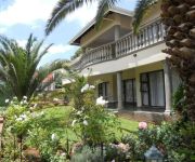
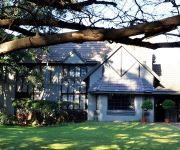
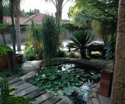
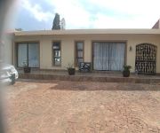
Homestead Lake Cottage
Lakeview Boutique Hotel & Conference Center
Villa Amanzi Boutique Guest House
Outlook Lodge Lakefield
Summer Garden Guest House and Self Catering Apartments
Carnival Club Hotel
Abacus Guest House
Elizabeth Lodge
Ikaze Guest Lodge
Flamingo's Nest Guest House & Conference Centre
Videos from this area
These are videos related to the place based on their proximity to this place.
754 HP BMW M3 Dragging Burnouts Drifting at Top Gear
Produced www.digitalcarworld.tv " The Thing " by RG Motorsport produces an untamed beast, boasting 754 HP. Stunt driven by Jim Mcfarlane. bmw m3 vs mercedes c63 amg, bmw m3 e92, bmw m3...
South Africa's Gusheshe (BMW), Drag Racing #GautengMotorShow
Drag racing at The Rock Raceway. Gauteng Motor Show July 2014.
2012 Subaru WRX (stock) vs. Lotus 7 (1.6l 20v Toyota engine) [3 of 3]
1/8 mile drag against the fairly impressive Lotus 7 running the Toyota RSi 1.6l 20v motor (Race 3 of 3)
2012 Subaru WRX (stock) vs. Renault Megane RS (modded)
1/8 mile drag against a Megane RS running a few mods (still can't keep up with AWD though)
Carol
Acoustic Rebels performing their version of Carol. Another production done by L A J Photography. For more info contact Braam on 082 774 8340 or Mariska on 079 492 9892.
2012 Subaru WRX (stock) vs. Lotus 7 (1.6l 20v Toyota engine) [2 of 3]
1/8 mile drag against the fairly impressive Lotus 7 running the Toyota RSi 1.6l 20v motor (Race 2 of 3)
Videos provided by Youtube are under the copyright of their owners.
Attractions and noteworthy things
Distances are based on the centre of the city/town and sightseeing location. This list contains brief abstracts about monuments, holiday activities, national parcs, museums, organisations and more from the area as well as interesting facts about the region itself. Where available, you'll find the corresponding homepage. Otherwise the related wikipedia article.
East Rand
The East Rand is the name of the urban eastern part of the Witwatersrand that is functionally merged with the Johannesburg conurbation. This area became settled by Europeans after a gold-bearing reef discovered in 1886 and sparked the gold rush that gave rise to the establishment of Johannesburg. The large black townships of the East Rand were the scene of heavy clashes between the African National Congress and the Inkatha Freedom Party before the end of Apartheid.
Potgietersrus Rugby Stadium
Potgietersrus Rugby Stadium is a stadium in Johannesburg, South Africa. It seats around 20,000 people. Previously it was used as home venue by the Katlehong City Football Club, but when the club was relegated from the National First Division in May 2002, they moved their home venue to another place in the Free State Province. Since then, the stadium has mostly been used to host various Rugby games in Johannesburg.
Willowmoore Park
Willowmoore Park is a multi-purpose stadium in Benoni, South Africa. It is currently used mostly for cricket matches and hosted two matches during the 2003 Cricket World Cup. The stadium holds 20,000 people and opened in 1924. After withdrawing their sponsorship from St George's Park in Port Elizabeth, Sahara started sponsoring Willowmoore Park, thus for sponsorship reasons it is known as "Sahara Willowmoore Park".
PAM Brink Stadium
PAM Brink Stadium is a multi-use stadium in Springs, South Africa. It is currently used mostly for football matches and is the home ground of Benoni Premier United and has long been the lair of the Eastern Transvaal rugby team who plays in the Currie Cup first division. The stadium holds 25,000 people. It takes its name from P.A.M.
Sinaba Stadium
Sinaba Stadium is a multi-use stadium in Benoni, South Africa. It is currently used mostly for football matches and is the home ground of Benoni Premier United. The stadium holds 15,000 people. It underwent a major upgrade during 2009 as it had been chosen as a training facility during the FIFA world cup in 2010 in South Africa.
Pholosong Hospital
Pholosong Hospital is located in Tsakane, Gauteng, South Africa. This hospital serves people from Tsakane, Kwa-Thema and Duduza.
Barnard Stadium
Barnard Stadium is a sports stadium situated in Kempton Park, South Africa. It is the home of the Falcons Rugby Union team.
St Catherine's School, Germiston
St Catherine's School is a private, co-educational school, named after Saint Catherine of Siena, located in Germiston, South Africa.
Marievale Bird Sanctuary
Marievale Bird Sanctuary is a protected area in Gauteng, South Africa. It is about 10 km² in size, and situated on the East Rand on the Blesbokspruit. The Blesbokspruit is a major perennial river in Gauteng which is flanked by extensive floodplains on either side. No exact numbers are quoted, but a visitor's information pamphlet produced by the Wildlife and Environment Society of South Africa and available at the sanctuary claims that almost 300 bird species frequent the wetland.
Blesbokspruit
Blesbokspruit, originates north of Daveyton, Gauteng, South Africa. It is a stream running south and later west, past the towns of Springs, Nigel and Heidelberg, before it joins the Suikerbosrand River. The Marievale Bird Sanctuary is situated in its upper reaches.







!['2012 Subaru WRX (stock) vs. Lotus 7 (1.6l 20v Toyota engine) [3 of 3]' preview picture of video '2012 Subaru WRX (stock) vs. Lotus 7 (1.6l 20v Toyota engine) [3 of 3]'](https://img.youtube.com/vi/N1on-vH7Myk/mqdefault.jpg)


!['2012 Subaru WRX (stock) vs. Lotus 7 (1.6l 20v Toyota engine) [2 of 3]' preview picture of video '2012 Subaru WRX (stock) vs. Lotus 7 (1.6l 20v Toyota engine) [2 of 3]'](https://img.youtube.com/vi/c0wvYv83OV0/mqdefault.jpg)
