Safety Score: 3,4 of 5.0 based on data from 9 authorites. Meaning please reconsider your need to travel to South Africa.
Travel warnings are updated daily. Source: Travel Warning South Africa. Last Update: 2024-08-13 08:21:03
Discover Dukathole
The district Dukathole of in Ekurhuleni Metropolitan Municipality (Gauteng) is a subburb in South Africa about 33 mi south of Pretoria, the country's capital city.
If you need a hotel, we compiled a list of available hotels close to the map centre further down the page.
While being here, you might want to pay a visit to some of the following locations: Germiston, Johannesburg, Riverlea, Heidelberg and Meyerton. To further explore this place, just scroll down and browse the available info.
Local weather forecast
Todays Local Weather Conditions & Forecast: 24°C / 75 °F
| Morning Temperature | 15°C / 59 °F |
| Evening Temperature | 21°C / 70 °F |
| Night Temperature | 20°C / 67 °F |
| Chance of rainfall | 0% |
| Air Humidity | 36% |
| Air Pressure | 1018 hPa |
| Wind Speed | Gentle Breeze with 8 km/h (5 mph) from South |
| Cloud Conditions | Clear sky, covering 0% of sky |
| General Conditions | Light rain |
Saturday, 16th of November 2024
28°C (82 °F)
18°C (65 °F)
Moderate rain, gentle breeze, clear sky.
Sunday, 17th of November 2024
28°C (83 °F)
19°C (65 °F)
Light rain, moderate breeze, few clouds.
Monday, 18th of November 2024
28°C (83 °F)
19°C (67 °F)
Light rain, gentle breeze, clear sky.
Hotels and Places to Stay
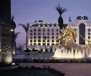
JNB PEERMONT D OREALE GRANDE
Afrique Boutique Hotel O.R Tambo
17 on 13th Guest House
Dunvegan Execu Lodge
The Nicol Hotel and Apartments
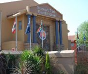
Sunward Park Guesthouse
Holiday Inn JOHANNESBURG AIRPORT
Afrique Boutique Hotel Oliver Tambo
Europrime Boutique Hotel
Fly Inn Lodge & Conference Venues
Videos from this area
These are videos related to the place based on their proximity to this place.
Gold Reef City - The Tower of Terror ride
Gold Reef City: Tower of Terror. A short but AWESOME ride. Aleesha's facial expressions are brilliant.
Gold Reef City - UFO ride
Gold Reef City: The UFO. Not the most exciting to watch, but most excellent to ride.
Gold Reef City - The River Rapids
Gold Reef City: The River Rapids. A bit of a tame ride, but still much enjoyed by all - even if we did all get off looking like we'd pissed in our pants...
Gold Reef City - The Golden Loop
Gold Reef City: For some reason the golden loop - or looping star as we called it in my day ;) always has the shortest Q's. I can't figure out why; it's definitely one of the better rides at the park.
Johannesburg, South Africa
First glimpses of Johannesburg skyline and surrounds coming from Oliver R Tambo International Airport.
Bell machine tools
Thread rolling a M12 x 1.75 thread on a Herbert 2D using a Fette F2 thread rolling head.
Shelving and Racking Johannesburg, Gauteng, South Africa
http://www.racking-shelving-flooring.co.za Racking and Shelving systems as well as pallet racking, office shelving, storage and mezzanine floors, Johannesburg, Gauteng South Africa.
737 at Rand Airport
A short video of the 737, filmed during the 17th May airshow at Rand Airport in South Africa.
Videos provided by Youtube are under the copyright of their owners.
Attractions and noteworthy things
Distances are based on the centre of the city/town and sightseeing location. This list contains brief abstracts about monuments, holiday activities, national parcs, museums, organisations and more from the area as well as interesting facts about the region itself. Where available, you'll find the corresponding homepage. Otherwise the related wikipedia article.
Union Observatory
Union Observatory was an astronomical observatory located in the suburb Observatory, Johannesburg, South Africa. It bears IAU code 078. Known as the Transvaal Observatory in its early years, it became the Republic Observatory in 1961. Well remembered for the quality of its Directors, work done on minor planets and the discovery of Proxima Centauri, growing light pollution problems in Johannesburg led to its closure in 1971-1972.
Eastgate shopping centre, Johannesburg
Eastgate was Johannesburgs first 'super-regional' shopping centre. When it opened in 1979, it was the largest shopping centre in the southern hemisphere. It remains one of the largest centres in the country, and is the second-largest shopping centre in the Greater Johannesburg Metropolitan Area, after Sandton City The centre lies next to the R24 airport freeway, between the Johannesburg CBD and Johannesburg International Airport.
East Rand
The East Rand is the name of the urban eastern part of the Witwatersrand that is functionally merged with the Johannesburg conurbation. This area became settled by Europeans after a gold-bearing reef discovered in 1886 and sparked the gold rush that gave rise to the establishment of Johannesburg. The large black townships of the East Rand were the scene of heavy clashes between the African National Congress and the Inkatha Freedom Party before the end of Apartheid.
Ellis Park Stadium
Ellis Park Stadium is a rugby union and association football stadium in the city of Johannesburg, Gauteng Province, South Africa. It hosted the final of the 1995 Rugby World Cup, which was won by the country's national team, the Springboks. The large stadium was the country's most modern when it was upgraded in 1982 to accommodate almost 60,000 people. Today, the stadium hosts both football and rugby, and is also used as a venue for other large events, such as open-air concerts.
Johannesburg Stadium
Johannesburg Stadium is a stadium, in the Doornfontein suburb of Johannesburg, Gauteng Province, South Africa. The stadium has a sweeping roof and can accommodate 37,500 people. It was originally built as an athletics stadium, but also hosted football and rugby matches. The eighth IAAF World Cup in Athletics was held at the stadium in 1998. It served as the main stadium for the 1999 All-Africa Games. It is mostly used as a training ground for Orlando Pirates and the Golden Lions Rugby Union.
Elladoone
Elladoone is a suburb of Johannesburg, South Africa. It is located in Region F.
Bagleyston
Bagleyston is a suburb of Johannesburg, South Africa. It is located in Region E.
Bertrams, Gauteng
Bertrams is a suburb of Johannesburg, South Africa. It is located in Region F. Bertrams is a clean and friendly neighbourhood, close to Ellis Park Stadium. With amenities including the swimming pool and The University of Johannesburg within this locality. Bertrams borders central Johannesburg or "Town" but is suburban enough to maintain its calm and pleasant atmosphere while being close to it and easy to access.
Elcedes
Elcedes is a suburb of Johannesburg, South Africa. It is located in Region F.
Fairview, Gauteng
Fairview is a suburb of Johannesburg, South Africa. It is located in Region F. Another Fairwiew suburb is located in Centurion, Gauteng.
Observatory Ridge, Johannesburg
Observatory Ridge is the highest point in Johannesburg, South Africa. It is 1808 metres above sea level. It is based in the suburb of Observatory. There is a large sandstone monument on top of the ridge that commemorates the British Indian Army. The monument bears the inscription: "To the memory of British Officers, Natives, NCOs and Men, Veterinary Assistants, Nalbands, and Followers of the Indian Army".
Jeppe High School for Boys
– Jeppe High School for Boys Image:JeppeHighSchool crest. jpg "Forti Nihil Diffilcilius" Address Good Hope & Roberts Avenue Johannesburg, Gauteng, South Africa, 2101 22x20px South Africa Coordinates coord}}{{#coordinates:26|12|0|S|28|5|58|E|type:edu_region:ZA-GP primary name= }} Information Type Public & Boarding Established 1890 Founder Sir Julius Jeppe School board National Senior Certificate School district D9 School number GDE No. 130633 Principal Anton Dempsey Vice principal M.H. Gill, C.
Potgietersrus Rugby Stadium
Potgietersrus Rugby Stadium is a stadium in Johannesburg, South Africa. It seats around 20,000 people. Previously it was used as home venue by the Katlehong City Football Club, but when the club was relegated from the National First Division in May 2002, they moved their home venue to another place in the Free State Province. Since then, the stadium has mostly been used to host various Rugby games in Johannesburg.
Ellis Park Stadium disaster
The Ellis Park Stadium disaster was the worst sporting accident in South African history. On 11 April 2001, spectators poured into the Ellis Park Stadium in the city of Johannesburg, Gauteng Province, South Africa, for the local derby association football match between Kaizer Chiefs and Orlando Pirates. There was already a 60,000 capacity crowd in the stadium, but reports suggest a further 30,000 fans were still trying to gain entry to the stadium.
Standard Bank Arena
Standard Bank Arena is an indoor sporting arena located in Johannesburg, South Africa. The capacity of the arena is 5,000 people. A large number of sports events and concerts have occurred in this arena.
Huntersfield Stadium
Huntersfield Stadium is a multi-use stadium in Katlehong, South Africa. It is currently used mostly for football matches and is the home stadium of Jomo Cosmos.
Willowmoore Park
Willowmoore Park is a multi-purpose stadium in Benoni, South Africa. It is currently used mostly for cricket matches and hosted two matches during the 2003 Cricket World Cup. The stadium holds 20,000 people and opened in 1924. After withdrawing their sponsorship from St George's Park in Port Elizabeth, Sahara started sponsoring Willowmoore Park, thus for sponsorship reasons it is known as "Sahara Willowmoore Park".
Germiston Stadium
Germiston Stadium (formerly the Herman Immelman Stadium) is a multi-purpose stadium in Germiston, South Africa. It is currently used mostly for football matches and is the home stadium of Moroka Swallows FC. It is also used for inter-school athletics events and as a training venue for teams such as Bafana Bafana (the South African National Football Team) and the Lions. The stadium holds 18,000 people.
Yeshivah Gedolah of Johannesburg
Yeshivah Gedolah of Johannesburg was one of the first Yeshivot established in South Africa. Since its founding in 1973, it has played an important - though understated - role in the South African religious community; see Jewish education in South Africa. It is based in Observatory, Johannesburg. It was established and headed by Rosh Yeshiva Rabbi Azriel Goldfein until his death in 2007, and is now headed by Rabbi Goldfein's sons Rabbi Avi and Rabbi David Goldfein.
Barnard Stadium
Barnard Stadium is a sports stadium situated in Kempton Park, South Africa. It is the home of the Falcons Rugby Union team.
Hoërskool Dinamika
Hoërskool Dinamika is an Afrikaans Christian high school situated in a suburb of Johannesburg, Alberton, South Africa. Hoërskool Dinamika maintains a high standard in leadership, culture and sport.
St Catherine's School, Germiston
St Catherine's School is a private, co-educational school, named after Saint Catherine of Siena, located in Germiston, South Africa.
Palmietfontein Airport
Palmietfontein Airport was an airport situated to the south of Johannesburg, South Africa, in the mid-1940s to early 1950s. {{#invoke:Coordinates|coord}}{{#coordinates:26|20|12|S|28|08|48|E| |primary |name= }}
Modderfontein Stadium
Modderfontein Stadium is a multi-use stadium situated in the Modderfontein area of the district Lethabong, which is a part of the Johannesburg municipality, at the Gauteng province in South Africa. Currently it is mostly used to host football matches.
Marais Viljoen High School
Marais Viljoen High School is a public, co-educational high school in Alberton, Gauteng, South Africa.


