Safety Score: 3,4 of 5.0 based on data from 9 authorites. Meaning please reconsider your need to travel to South Africa.
Travel warnings are updated daily. Source: Travel Warning South Africa. Last Update: 2024-08-13 08:21:03
Delve into Actonville
The district Actonville of in Ekurhuleni Metropolitan Municipality (Gauteng) is a subburb in South Africa about 33 mi south of Pretoria, the country's capital town.
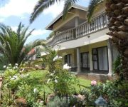
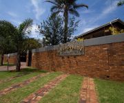
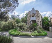
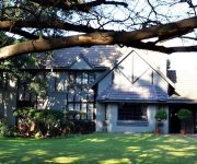
If you need a hotel, we compiled a list of available hotels close to the map centre further down the page.
While being here, you might want to pay a visit to some of the following locations: Germiston, Johannesburg, Heidelberg, Riverlea and Delmas. To further explore this place, just scroll down and browse the available info.
Local weather forecast
Todays Local Weather Conditions & Forecast: 27°C / 81 °F
| Morning Temperature | 18°C / 64 °F |
| Evening Temperature | 20°C / 67 °F |
| Night Temperature | 19°C / 67 °F |
| Chance of rainfall | 2% |
| Air Humidity | 28% |
| Air Pressure | 1014 hPa |
| Wind Speed | Moderate breeze with 11 km/h (7 mph) from East |
| Cloud Conditions | Clear sky, covering 9% of sky |
| General Conditions | Moderate rain |
Tuesday, 19th of November 2024
27°C (81 °F)
17°C (62 °F)
Moderate rain, moderate breeze, broken clouds.
Wednesday, 20th of November 2024
27°C (80 °F)
22°C (71 °F)
Light rain, gentle breeze, clear sky.
Thursday, 21st of November 2024
28°C (82 °F)
18°C (65 °F)
Light rain, moderate breeze, overcast clouds.
Hotels and Places to Stay
Lakeview Boutique Hotel & Conference Center
Homestead Lake Cottage
Europrime Boutique Hotel
Villa Amanzi Boutique Guest House
Afrique Boutique Hotel Oliver Tambo
Afrique Boutique Hotel O.R Tambo
Outlook Lodge Lakefield
Summer Garden Guest House and Self Catering Apartments
Carnival Club Hotel
Europrime Hotels
Videos from this area
These are videos related to the place based on their proximity to this place.
Brakpan (FABB) Touch and Go - Right side
Touch and Go Training from the right side in Brackpan (FABB) during my time Building Training in South Afrika.
CPF encourages community to attend Taegrin's memorial
Trevor Reeby, Reiger Park CPF Secretary, invites the community to attend the memorial for Taegrin Morris. Four-year-old Taegrin was killed after being dragged head down of a moving hijacked...
The Department of Cerrectional Services launches education for prisoners
The Department of Correctional Services (DCS), in partnership with its key stakeholders launched the compulsory education for young prisoners in Gauteng, On Friday, April 4.
Kwikbraai, new and innovative products by Saphire Dawn
Portable Stainless steel braai, comes with zip up carry bag, light, easy to use, ideal for camping, hiking, fishing or just a fun day out on the beach www.kwikbraaisa.co.za www.kwikbraai.wozaonli...
Opening of The Classic India (edited)
By visiting "The Classic India", you will be able to sample the authentic characteristic flavour of North Indian cuisine. It is not about eating out -- but the experience itself. www.theclassicindi...
Wicket Cricket: A closer look at the ICC Cricket World Cup 2015
This week, Malcolm Maifala looks at the teams and players taking part in the ICC Cricket World Cup. We also have Jonty predicting his favourites to win our b...
True Story: Using The Law of Attraction To Manifest Money
D5- True Story: Using The Law of Attraction To Manifest Money This is a true story of a lady named Niki Marshall. She was beyond broke financially and was STUCK. Not knowing what to do...
Videos provided by Youtube are under the copyright of their owners.
Attractions and noteworthy things
Distances are based on the centre of the city/town and sightseeing location. This list contains brief abstracts about monuments, holiday activities, national parcs, museums, organisations and more from the area as well as interesting facts about the region itself. Where available, you'll find the corresponding homepage. Otherwise the related wikipedia article.
East Rand
The East Rand is the name of the urban eastern part of the Witwatersrand that is functionally merged with the Johannesburg conurbation. This area became settled by Europeans after a gold-bearing reef discovered in 1886 and sparked the gold rush that gave rise to the establishment of Johannesburg. The large black townships of the East Rand were the scene of heavy clashes between the African National Congress and the Inkatha Freedom Party before the end of Apartheid.
Potgietersrus Rugby Stadium
Potgietersrus Rugby Stadium is a stadium in Johannesburg, South Africa. It seats around 20,000 people. Previously it was used as home venue by the Katlehong City Football Club, but when the club was relegated from the National First Division in May 2002, they moved their home venue to another place in the Free State Province. Since then, the stadium has mostly been used to host various Rugby games in Johannesburg.
Huntersfield Stadium
Huntersfield Stadium is a multi-use stadium in Katlehong, South Africa. It is currently used mostly for football matches and is the home stadium of Jomo Cosmos.
Willowmoore Park
Willowmoore Park is a multi-purpose stadium in Benoni, South Africa. It is currently used mostly for cricket matches and hosted two matches during the 2003 Cricket World Cup. The stadium holds 20,000 people and opened in 1924. After withdrawing their sponsorship from St George's Park in Port Elizabeth, Sahara started sponsoring Willowmoore Park, thus for sponsorship reasons it is known as "Sahara Willowmoore Park".
PAM Brink Stadium
PAM Brink Stadium is a multi-use stadium in Springs, South Africa. It is currently used mostly for football matches and is the home ground of Benoni Premier United and has long been the lair of the Eastern Transvaal rugby team who plays in the Currie Cup first division. The stadium holds 25,000 people. It takes its name from P.A.M.
Sinaba Stadium
Sinaba Stadium is a multi-use stadium in Benoni, South Africa. It is currently used mostly for football matches and is the home ground of Benoni Premier United. The stadium holds 15,000 people. It underwent a major upgrade during 2009 as it had been chosen as a training facility during the FIFA world cup in 2010 in South Africa.
Germiston Stadium
Germiston Stadium (formerly the Herman Immelman Stadium) is a multi-purpose stadium in Germiston, South Africa. It is currently used mostly for football matches and is the home stadium of Moroka Swallows FC. It is also used for inter-school athletics events and as a training venue for teams such as Bafana Bafana (the South African National Football Team) and the Lions. The stadium holds 18,000 people.
Pholosong Hospital
Pholosong Hospital is located in Tsakane, Gauteng, South Africa. This hospital serves people from Tsakane, Kwa-Thema and Duduza.
Barnard Stadium
Barnard Stadium is a sports stadium situated in Kempton Park, South Africa. It is the home of the Falcons Rugby Union team.
St Catherine's School, Germiston
St Catherine's School is a private, co-educational school, named after Saint Catherine of Siena, located in Germiston, South Africa.
Palmietfontein Airport
Palmietfontein Airport was an airport situated to the south of Johannesburg, South Africa, in the mid-1940s to early 1950s. {{#invoke:Coordinates|coord}}{{#coordinates:26|20|12|S|28|08|48|E| |primary |name= }}
Modderfontein Stadium
Modderfontein Stadium is a multi-use stadium situated in the Modderfontein area of the district Lethabong, which is a part of the Johannesburg municipality, at the Gauteng province in South Africa. Currently it is mostly used to host football matches.


