Safety Score: 3,4 of 5.0 based on data from 9 authorites. Meaning please reconsider your need to travel to South Africa.
Travel warnings are updated daily. Source: Travel Warning South Africa. Last Update: 2024-08-13 08:21:03
Touring Qelane
Qelane in OR Tambo District Municipality (Eastern Cape) is a town located in South Africa about 401 mi (or 645 km) south of Pretoria, the country's capital place.
Time in Qelane is now 12:05 PM (Friday). The local timezone is named Africa / Johannesburg with an UTC offset of 2 hours. We know of 9 airports nearby Qelane, of which one is a larger airport. The closest airport in South Africa is K. D. Matanzima Airport in a distance of 5 mi (or 8 km), West. Besides the airports, there are other travel options available (check left side).
Need some hints on where to stay? We compiled a list of available hotels close to the map centre further down the page.
Being here already, you might want to pay a visit to some of the following locations: Libode, Qumbu, Maclear, Mount Frere and Flagstaff. To further explore this place, just scroll down and browse the available info.
Local weather forecast
Todays Local Weather Conditions & Forecast: 29°C / 84 °F
| Morning Temperature | 16°C / 61 °F |
| Evening Temperature | 25°C / 77 °F |
| Night Temperature | 19°C / 66 °F |
| Chance of rainfall | 0% |
| Air Humidity | 51% |
| Air Pressure | 1009 hPa |
| Wind Speed | Gentle Breeze with 8 km/h (5 mph) from North-West |
| Cloud Conditions | Clear sky, covering 6% of sky |
| General Conditions | Light rain |
Saturday, 23rd of November 2024
21°C (70 °F)
16°C (61 °F)
Light rain, gentle breeze, overcast clouds.
Sunday, 24th of November 2024
27°C (81 °F)
18°C (65 °F)
Scattered clouds, gentle breeze.
Monday, 25th of November 2024
38°C (101 °F)
20°C (68 °F)
Light rain, moderate breeze, clear sky.
Hotels and Places to Stay
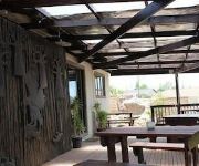
Big Five Guest House
Lodge Bellagio Mthatha
HOTEL SAVOY
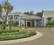
GARDEN COURT MTHATHA
Videos from this area
These are videos related to the place based on their proximity to this place.
Time Lapse - Gopro Hero 3+ Black - Umtata to Port Elizabeth to Riversdal in 10 minutes Via N2
I have done a time lapse on my Gopro Hero 3+ Black. . . Started Outside Umtata (Dan's Place) to Port Elizabeth and ended up in Riversdal Via N2 Highway. . .Was taken from 07:45 to 23:35, 7...
driving mthatha part 2
Some of the worst drivers in South Africa drive in Mthatha, on some of the worst roads in the country.
Driving in Mthatha part 1
Driving in Mthatha (Umtata) can be very challenging. Share my frustrations with me.
Hole in the Wall - Transkei Myjob's photos around Hole in the Wall, South Africa (eastern cape)
Preview of Myjob's blog at TravelPod. Read the full blog here: http://www.travelpod.com/travel-blog-entries/myjob/niagara_falls/1110574200/tpod.html This blog preview was made by TravelPod...
horse eating mcdonalds
we parked at McDonald next to a horse,the guy goes inside and buys a nig mac,chips and a coke he drinks the coke and gives the rest to the horse.
African National Party
African National Party http://www.africannationalparty.org.za will create jobs, eradicate poverty and crime. Oppose land grabbing without compensation and oppose nationalization of mines. Treat...
AFM Graceland Assembly Worship Night Explosion (Extravaganza) @ Mtata
A christian inspired worship night, doing the heart of God. his word says we must worship him in truth and in spirit. inspired by Revelations 5 v 11-14 "Then I looked and heard the voice of...
Temba Documentary - Part 2 - Bringing HopeTo The People - Part2
Focusing on the vital role that Temba AIDS Shelter in Mthatha (Umtata) Eastern Cape, South Africa plays in the local community- Documentary made by Charlotta Lindqvest Karlsson & Lena Carlsson....
Baby It’s 2019 (Project SkyRocket)
Oh yeah! Boom! We made it to 2019 hope you guys had a wonderful holiday while I was gone but now I'm back. This video brings excitement and thrill in the ...
Videos provided by Youtube are under the copyright of their owners.
Attractions and noteworthy things
Distances are based on the centre of the city/town and sightseeing location. This list contains brief abstracts about monuments, holiday activities, national parcs, museums, organisations and more from the area as well as interesting facts about the region itself. Where available, you'll find the corresponding homepage. Otherwise the related wikipedia article.
Mthatha Dam
Mthatha Dam is an earth-fill type dam located on the Mthatha River, near Mthatha, Eastern Cape, South Africa. It was established in 1977 and serves mainly for municipal and industrial purposes. Its hazard potential has been ranked high (3).


