Safety Score: 3,0 of 5.0 based on data from 9 authorites. Meaning we advice caution when travelling to Slovenia.
Travel warnings are updated daily. Source: Travel Warning Slovenia. Last Update: 2024-08-13 08:21:03
Delve into Verd
Verd in Vrhnika with it's 1,891 habitants is located in Slovenia a little south-west of Ljubljana, the country's capital town.
Current time in Verd is now 06:34 AM (Friday). The local timezone is named Europe / Ljubljana with an UTC offset of one hour. We know of 12 airports close to Verd, of which 5 are larger airports. The closest airport in Slovenia is Ljubljana Jože Pučnik Airport in a distance of 20 mi (or 32 km), North. Besides the airports, there are other travel options available (check left side).
There are several Unesco world heritage sites nearby. The closest heritage site in Slovenia is Škocjan Caves in a distance of 25 mi (or 40 km), South-West. If you need a hotel, we compiled a list of available hotels close to the map centre further down the page.
While being here, you might want to pay a visit to some of the following locations: Vrhnika, Horjul, Borovnica, Log pri Brezovici and Logatec. To further explore this place, just scroll down and browse the available info.
Local weather forecast
Todays Local Weather Conditions & Forecast: 5°C / 41 °F
| Morning Temperature | -2°C / 29 °F |
| Evening Temperature | 1°C / 34 °F |
| Night Temperature | -0°C / 32 °F |
| Chance of rainfall | 0% |
| Air Humidity | 59% |
| Air Pressure | 1027 hPa |
| Wind Speed | Light breeze with 4 km/h (2 mph) from South-West |
| Cloud Conditions | Scattered clouds, covering 38% of sky |
| General Conditions | Scattered clouds |
Saturday, 16th of November 2024
7°C (44 °F)
0°C (33 °F)
Sky is clear, light breeze, clear sky.
Sunday, 17th of November 2024
8°C (47 °F)
5°C (42 °F)
Broken clouds, light breeze.
Monday, 18th of November 2024
7°C (44 °F)
4°C (40 °F)
Light rain, light breeze, overcast clouds.
Hotels and Places to Stay
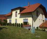
Guesthouse Mesec Zaplana
Videos from this area
These are videos related to the place based on their proximity to this place.
Prvomajska budnica na Vrhniki 2014 - Pihalni orkester Vrhnika
Glasba, ki se predvaja ob slikah: Pihalni orkester Vrhnika - Nauportus (Vinko Štrulc) Pihalni orkester Slovenske vojske - Ponosni nase Julius Fucik - Florentiner Marsch Spletna stran - www.godba...
KK Vrhnika - KK Žiri (člani, 4. SKL - oktober 2012)
KK Vrhnika -- KK Žiri REZULTAT: 56 -- 71 Članska tekma -- 4. SKL, zahod Obiskanost: cca. 60 gledalcev V dvorani O. Š. Ivana Cankarja na Vrhniki so v soboto, člani odigrali 2. kolo v...
Big Band Vrhnika in Aleš Sečnik
Aleš Sečnik je odlično povezoval koncert v Horjulu. To je le en odlomek. Vabljeni na poslušanje glasbe in besednega humorja tudi v nedeljo, 21.12.2014 ob 18h v Cankarjev dom na Vrhniki. Super bo!
25.06.2010 (11:45) slow. Autobahn A1: Anschluss Vrhnika (gen Ljubljana)
Auf der slowenischen Autobahn A1 nach Ljubljana beim Anschluß Vrhnika während der Rückfahrt vom Istrien-Urlaub 2010. Näheres bei http://www.5dim.de/html/GalerieSLO2002.html. Car dive on...
Videos provided by Youtube are under the copyright of their owners.
Attractions and noteworthy things
Distances are based on the centre of the city/town and sightseeing location. This list contains brief abstracts about monuments, holiday activities, national parcs, museums, organisations and more from the area as well as interesting facts about the region itself. Where available, you'll find the corresponding homepage. Otherwise the related wikipedia article.
Ljubljanica
The Ljubljanica, known in the Middle Ages as Ljubija, is a river in the southern part of the Ljubljana Basin in Slovenia. The capital of Slovenia, Ljubljana, is situated on the river. The Ljubljanica rises to the south of the town Vrhnika and outflows in the Sava River about 10 kilometres downstream from Ljubljana. Its largest affluent is Mali graben. Including the source affluent Mala Ljubljanica, the river is 41 km in length.
Nauportus
Nauportus (Navport, Navportus), ancient Roman town in Pannonia Superior (later 10th Italian region) on road from Aquileia to Emona with port at Nauportus river what is now Ljubljanica River. According to historian Pliny the Elder the name was derived from the legendary landing of the Argonauts at river, where they are said to have founded the town. Tacitus reports that in year 14 town was plundered by mutinous roman forces that has been sent to build roads and bridges.
26 October Barracks
26 October Barracks is a barracks of the Slovenian Armed Forces at Vrhnika. It falls under the 25th military-territorial Vrhnika Slovenian Armed Forces Command.


