Safety Score: 3,0 of 5.0 based on data from 9 authorites. Meaning we advice caution when travelling to Slovenia.
Travel warnings are updated daily. Source: Travel Warning Slovenia. Last Update: 2024-08-13 08:21:03
Explore Viški
Viški in Kranjska Gora is located in Slovenia about 40 mi (or 64 km) north-west of Ljubljana, the country's capital.
Local time in Viški is now 06:59 AM (Friday). The local timezone is named Europe / Ljubljana with an UTC offset of one hour. We know of 12 airports in the wider vicinity of Viški, of which 5 are larger airports. The closest is airport we know is Klagenfurt Airport in Austria in a distance of 25 mi (or 41 km). The closest airport in Slovenia is Ljubljana Jože Pučnik Airport in a distance of 31 mi (or 41 km), North-East. Besides the airports, there are other travel options available (check left side).
There are several Unesco world heritage sites nearby. The closest heritage site is Longobards in Italy. Places of the Power (568-774 A.D.) in Italy at a distance of 33 mi (or 52 km). The closest in Slovenia is Škocjan Caves in a distance of 54 mi (or 52 km), South-West. We found 1 points of interest in the vicinity of this place. If you need a place to sleep, we compiled a list of available hotels close to the map centre further down the page.
Depending on your travel schedule, you might want to pay a visit to some of the following locations: Illitsch, Kranjska Gora, Finkenstein am Faaker See, Jesenice and Villach. To further explore this place, just scroll down and browse the available info.
Local weather forecast
Todays Local Weather Conditions & Forecast: 6°C / 43 °F
| Morning Temperature | 0°C / 33 °F |
| Evening Temperature | 3°C / 37 °F |
| Night Temperature | 2°C / 35 °F |
| Chance of rainfall | 0% |
| Air Humidity | 59% |
| Air Pressure | 1027 hPa |
| Wind Speed | Calm with 2 km/h (1 mph) from East |
| Cloud Conditions | Broken clouds, covering 64% of sky |
| General Conditions | Broken clouds |
Saturday, 16th of November 2024
9°C (49 °F)
3°C (38 °F)
Sky is clear, calm, clear sky.
Sunday, 17th of November 2024
10°C (50 °F)
2°C (36 °F)
Broken clouds, light breeze.
Monday, 18th of November 2024
6°C (43 °F)
2°C (36 °F)
Overcast clouds, calm.
Hotels and Places to Stay
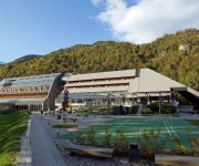
Alpine Welness Resort Spik
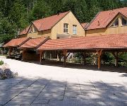
Apartmaji Jezerci
Videos from this area
These are videos related to the place based on their proximity to this place.
Voluntary Fire Department Mojstrana 120th anniversary fire drill
Vaja ob 120 letnici PGD Mojstrana 22.6.2013 s sodelovanjem 15. Helikopterskega bataljona Slovenske Vojske. Voluntary Fire Department Mojstrana 120th anniversary fire drill.
Von Aljazev Dom zum Triglavski Dom und weiter nach Mojstrana
Erster Tag: Vom Aljazev Dom (Aljaz-Haus) zunächst in den Talschluß des Vratatals. Dort nach Südosten und am Pragweg steil über Bänder, Schrofen und einige gesicherte Stellen hinauf bis...
Videos provided by Youtube are under the copyright of their owners.
Attractions and noteworthy things
Distances are based on the centre of the city/town and sightseeing location. This list contains brief abstracts about monuments, holiday activities, national parcs, museums, organisations and more from the area as well as interesting facts about the region itself. Where available, you'll find the corresponding homepage. Otherwise the related wikipedia article.
Upper Sava Valley
The Upper Sava Valley is an alpine valley in the Upper Carniola region of Slovenia. The Sava Dolinka River flows along it. It begins in Rateče at an elevation of 870 m and ends at Moste at 560 m. It is the geographical border between the Julian Alps and the Karavanke Alps. It was created on a tectonic fault that runs down the middle of the valley. Its geomorphological forms are a result of the actions of the river and glaciers. A number of smaller valleys lead into it from both sides.
Radovna Valley
The Radovna Valley is an alpine valley in the Julian Alps in the Upper Carniola region of Slovenia. Radovna Creek, created by smaller tributaries from the glacial valleys of the Krma and Kot valleys, flows through it. It is surrounded by the northern extensions of the Pokljuka Plateau, the foothills of the Triglav range, and the highest peak of the Mežakla Plateau, Jerebikovec (1593 m).
Krma
Krma is an alpine valley in the Julian Alps in the Upper Carniola region of Slovenia. Krma is the longest and eastern most of the glacial valleys near Mojstrana. It is the starting point for many routes through the Triglav National Park area. It leads into the Radovna Valley. Approximately two thirds up the valley is the Kovinar alpine hut (892 m) with 15 berths, a popular stop off point for mountaineers. This hut was originally adapted from a shepherd's hut and opened in 1948.
Kot (valley)
Kot is an alpine valley in the Julian Alps in the Upper Carniola region of Slovenia. Kot is one of three glacial alpine valleys near Mojstrana, the others being Vrata and Krma. It is the starting point for many routes through the Triglav National Park area and one of the easier and faster routes up Mount Triglav. It leads into the Radovna Valley.
Slovenian Alpine Museum
Slovenian Alpine Museum (Slovene: Slovenski planinski muzej), also Slovenian Mountaineering Museum, is a mountaineering museum in Mojstrana, Slovenia. It was opened on 7 August 2010 by Danilo Türk, the incumbent president of Slovenia.


