Safety Score: 3,0 of 5.0 based on data from 9 authorites. Meaning we advice caution when travelling to Slovenia.
Travel warnings are updated daily. Source: Travel Warning Slovenia. Last Update: 2024-08-13 08:21:03
Explore Praproče
Praproče in Koper with it's 27 inhabitants is a city in Slovenia about 46 mi (or 74 km) south-west of Ljubljana, the country's capital.
Local time in Praproče is now 04:37 AM (Friday). The local timezone is named Europe / Ljubljana with an UTC offset of one hour. We know of 10 airports in the vicinity of Praproče, of which 4 are larger airports. The closest airport in Slovenia is Portoroz Airport in a distance of 15 mi (or 24 km), West. Besides the airports, there are other travel options available (check left side).
There are several Unesco world heritage sites nearby. The closest heritage site in Slovenia is Škocjan Caves in a distance of 10 mi (or 16 km), North-East. We found 5 points of interest in the vicinity of this place. If you need a place to sleep, we compiled a list of available hotels close to the map centre further down the page.
Depending on your travel schedule, you might want to pay a visit to some of the following locations: Kozina, Dolina, Buzet, Divaca and Muggia. To further explore this place, just scroll down and browse the available info.
Local weather forecast
Todays Local Weather Conditions & Forecast: 10°C / 51 °F
| Morning Temperature | 2°C / 36 °F |
| Evening Temperature | 7°C / 44 °F |
| Night Temperature | 4°C / 39 °F |
| Chance of rainfall | 0% |
| Air Humidity | 49% |
| Air Pressure | 1025 hPa |
| Wind Speed | Light breeze with 5 km/h (3 mph) from South-West |
| Cloud Conditions | Few clouds, covering 21% of sky |
| General Conditions | Few clouds |
Saturday, 16th of November 2024
12°C (53 °F)
6°C (42 °F)
Sky is clear, light breeze, clear sky.
Sunday, 17th of November 2024
11°C (53 °F)
10°C (50 °F)
Broken clouds, light breeze.
Monday, 18th of November 2024
12°C (53 °F)
9°C (48 °F)
Light rain, light breeze, overcast clouds.
Hotels and Places to Stay
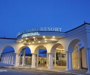
Hotel & Casino Resort Admiral
Videos from this area
These are videos related to the place based on their proximity to this place.
S Črnega Kala v Strunjan
Svetlana in otroka so me pustili na začetku črnokalskega klanca, da sem lahko pribajkal za njimi na plažo v Strunjanu. trp: 36.16 km / rid: 1:56:04 (neto) / avg: 18.60 km/h / trip alti:...
Crni kal, Slovenia
Gita in Slovenia, alle porte di Trieste. Crni Kal e il ciglione carsico dei climbers. Parte del testo è tratto dal libro di Ettore Tomasi. Video di Dario Gasparo.
Az út Zazid környékén
Az út Zazidtól a főútig, avagy a "hegyi hányatós". The road from Zazid to the main road aka. the "retching range"
Motovun
Motovun is a medieval town that grew up on the site of an ancient city called KastelijerIn the 10th and 11th centuries: it belonged to the Bishop of Porec. From 1278 it was taken over by Venice...
BREŽEC 2010
A spring day in Brežec, a little charming village in Slovenia. located between Kras and Adriatic sea. Spomladansko deževno-sočni dan v Brežcu, majhni vasici, pod kraškim robom in s pogledom...
Hrastovlje Horseshoe 1
Hrastovlje is a siding on the so-called Koper line, a 30 miles long single track line which connects the Slovenian Port of Koper on the Adriatic Sea with the double track "Southern Line" that...
2011-06-20 Slavnik - spust v Podgorje
MTB-log = http://84.255.253.145/sites/mtblog/default.aspx Slavnik spust v Podgorje.
Slovenian Railways, Cabin View of Koper Line
Going down the big loop line to Hrastolvlje station on Koper line, cabin view from SZ363.
XAXID - Stojin Na Kantunu (Cover) - Utrinek
1.3.2014 - Pustovanje Hrastovlje Neno Belan/Djavoli - Stojin Na Kantunu (XAXID Cover) Kratek utrinek iz Pustovanja v Hrastovljah.
Videos provided by Youtube are under the copyright of their owners.
Attractions and noteworthy things
Distances are based on the centre of the city/town and sightseeing location. This list contains brief abstracts about monuments, holiday activities, national parcs, museums, organisations and more from the area as well as interesting facts about the region itself. Where available, you'll find the corresponding homepage. Otherwise the related wikipedia article.
Holy Trinity Church, Hrastovlje
The Church of the Holy Trinity (Slovene: Cerkev Svete Trojice) is a historical building in Hrastovlje, Slovenia. There are two hypotheses about its origin. According to the first, it is a Romanesque church from the 12th century. According to the second, it is an example of the Istrian variant of Early Venetian Renaissance architecture from the 15th century. The church stands behind a wall that the local population built to protect itself from Turkish attacks in the 16th century.
Slovenian Istria
Slovenian Istria is a region in southwest of Slovenia. It comprises the northern part of the Istrian peninsula, and it is part of the wider geographical-historical region known as the Slovenian Littoral (Primorska). Its largest urban center is Koper. Other larger settlements are Izola, Piran and Portorož. The whole region has around 120 settlements. In its coastal area, both the Slovene and Italian language are official.


