Safety Score: 3,0 of 5.0 based on data from 9 authorites. Meaning we advice caution when travelling to Slovenia.
Travel warnings are updated daily. Source: Travel Warning Slovenia. Last Update: 2024-08-13 08:21:03
Explore Veliki Hrib
Veliki Hrib in Kamnik with it's 78 inhabitants is a city in Slovenia about 17 mi (or 28 km) north-east of Ljubljana, the country's capital.
Local time in Veliki Hrib is now 05:45 PM (Friday). The local timezone is named Europe / Ljubljana with an UTC offset of one hour. We know of 11 airports in the vicinity of Veliki Hrib, of which 5 are larger airports. The closest airport in Slovenia is Ljubljana Jože Pučnik Airport in a distance of 15 mi (or 25 km), West. Besides the airports, there are other travel options available (check left side).
There are several Unesco world heritage sites nearby. The closest heritage site in Slovenia is Škocjan Caves in a distance of 53 mi (or 85 km), South-West. If you need a place to sleep, we compiled a list of available hotels close to the map centre further down the page.
Depending on your travel schedule, you might want to pay a visit to some of the following locations: Moravce, Gornji Grad, Lukovica pri Domzalah, Ljubno ob Savinji and Luce. To further explore this place, just scroll down and browse the available info.
Local weather forecast
Todays Local Weather Conditions & Forecast: 3°C / 38 °F
| Morning Temperature | 3°C / 37 °F |
| Evening Temperature | 2°C / 35 °F |
| Night Temperature | -3°C / 26 °F |
| Chance of rainfall | 20% |
| Air Humidity | 99% |
| Air Pressure | 1000 hPa |
| Wind Speed | Light breeze with 4 km/h (3 mph) from South |
| Cloud Conditions | Overcast clouds, covering 100% of sky |
| General Conditions | Rain and snow |
Saturday, 23rd of November 2024
3°C (37 °F)
-1°C (31 °F)
Scattered clouds, light breeze.
Sunday, 24th of November 2024
5°C (40 °F)
-1°C (31 °F)
Scattered clouds, light breeze, broken clouds.
Monday, 25th of November 2024
5°C (41 °F)
4°C (38 °F)
Few clouds, light breeze.
Hotels and Places to Stay
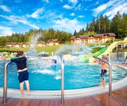
Terme Snovik
Videos from this area
These are videos related to the place based on their proximity to this place.
Cvetje v jeseni - Godba Lukovica
Cvetje v jeseni - Godba Lukovica solo citre: Nataša Meglič dirigent: Peter Šala.
Rženova Tinka ansambla Štirje Kovači v izvedbi Godbe Lukovica
Skladba Rženova Tinka ansambla Štirje Kovači v izvedbi Godbe Lukovica na novoletnem koncertu 26. 12. 2012.
More Blagovica folk group
Folk singers from Blagovica, a little village in the middle of Slovenia. Here singing at an event hosted by the Igor Velepic and the Lukovica male voice choir.
Godba Moravče, Sveti Mohor (Bela nedelja 2013)
Ena izmed skladb, ki jih je zaigrala moravška godba po sveti maši na Belo nedeljo pri Svetem Mohorju (7. 4. 2013)
Rudarji bodo stavko speljali do konca
Obrazi rudarjev so utrujeni in zaskrbljeni, a jasen cilj in trma jih držita pokonci. "Stavko bomo speljali do konca," pravijo. Tudi zaradi družin, ki jih čakajo zunaj. Ekipa oddaje Danes...
36. RALLY SATURNUS
Some vido shots from 36th Rally Saturnus Slovenia. In my opinion the best part is at 4:27. Nekaj posnetkov iz 36. Rally-ja Saturnus. Po mojem mnenju je najlepši del ob 4:27.
27.04.2013 - Gradiško jezero | Gradiško Lake
Naključje je prineslo, da sem obiskal to prelepo jezero, s čudovito okolico ter tistim mirom, ki je čedalje bolj zgodovina.
Zastoj pri Lukovici, 8.8.2008
Na štajerski avtocesti pri Lukovici v smeri proti Ljubljani sta se zaletela dva tovornjaka... Razbita pločevina... Raztresene palete... Doooooolge kolone....
Freekicks-Knuckle-Amazing Goalkeeping-Volume 3
Beckham, Ronaldo, Roberto Carlos Knuckle, Bend it like beckham, Korean Ametuer, Slovenia, Spain World Cup like Shots join us for the journey to become better. a work and progress is beginning...
Videos provided by Youtube are under the copyright of their owners.
Attractions and noteworthy things
Distances are based on the centre of the city/town and sightseeing location. This list contains brief abstracts about monuments, holiday activities, national parcs, museums, organisations and more from the area as well as interesting facts about the region itself. Where available, you'll find the corresponding homepage. Otherwise the related wikipedia article.
Tuhinj Valley
The Tuhinj Valley is a valley in Slovenia linking the Celje Basin with the Ljubljana Basin in an east-west direction along the courses of the Nevljica and Motnišnica rivers. The western part of the valley was formed by the watershed of the Nevljica, flowing into the Kamnik Bistrica, and the narrower, eastern part by the Motnišnica, a tributary of the Savinja River. Their drainage divide is at the Kozjak Pass at an elevation of 655 m between Cirkuše v Tuhinju and Špitalič.


