Safety Score: 3,0 of 5.0 based on data from 9 authorites. Meaning we advice caution when travelling to Slovakia.
Travel warnings are updated daily. Source: Travel Warning Slovakia. Last Update: 2024-08-13 08:21:03
Touring Tejke
Tejke in Trnava is a town located in Slovakia about 27 mi (or 44 km) south-east of Bratislava, the country's capital place.
Time in Tejke is now 06:07 PM (Thursday). The local timezone is named Europe / Bratislava with an UTC offset of one hour. We know of 11 airports nearby Tejke, of which 5 are larger airports. The closest is airport we know is Győr-Pér International Airport in Hungary in a distance of 22 mi (or 35 km). The closest airport in Slovakia is M. R. Štefánik Airport in a distance of 25 mi (or 35 km), South-East. Besides the airports, there are other travel options available (check left side).
There are several Unesco world heritage sites nearby. The closest heritage site is Millenary Benedictine Abbey of Pannonhalma and its Natural Environment in Hungary at a distance of 25 mi (or 40 km). The closest in Slovakia is Historic Town of Banská Štiavnica and the Technical Monuments in its Vicinity in a distance of 74 mi (or 40 km), South-East. Need some hints on where to stay? We compiled a list of available hotels close to the map centre further down the page.
Being here already, you might want to pay a visit to some of the following locations: Gyor, Mosonmagyarovar, Tet, Senec and Pannonhalma. To further explore this place, just scroll down and browse the available info.
Local weather forecast
Todays Local Weather Conditions & Forecast: 5°C / 42 °F
| Morning Temperature | -0°C / 32 °F |
| Evening Temperature | 6°C / 43 °F |
| Night Temperature | 5°C / 41 °F |
| Chance of rainfall | 0% |
| Air Humidity | 62% |
| Air Pressure | 1027 hPa |
| Wind Speed | Gentle Breeze with 9 km/h (5 mph) from South-East |
| Cloud Conditions | Few clouds, covering 13% of sky |
| General Conditions | Few clouds |
Friday, 15th of November 2024
9°C (48 °F)
4°C (40 °F)
Overcast clouds, moderate breeze.
Saturday, 16th of November 2024
8°C (46 °F)
3°C (38 °F)
Sky is clear, gentle breeze, clear sky.
Sunday, 17th of November 2024
7°C (45 °F)
4°C (39 °F)
Broken clouds, gentle breeze.
Hotels and Places to Stay
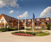
Orchidea Hotel****Lipót
Videos from this area
These are videos related to the place based on their proximity to this place.
WINDOW GLASS, s.r.o. 2013 Dunajská Streda
izolačné sklo • izolačné dvojsklo • izolačné trojsklo • tabuľové sklo • stavebné sklo • • sklenené dvere • sklenené priečky • sprchové kúty • nábytkové...
Amade Château Hotel***** Vrakúň - Travel TV
Amade Château je očarujúci vidiecky luxusný hotel, ktorý ponúka svojim hosťom neopakovateľný zážitok s nádychom histórie a jedinečnej atmosféry. Hotel má výnimočnú polohu....
Treningsleir i Ungarn - Lipot Football Centrum
Fantastiske baner, et meget behagelig Spa hotell, god mat og mulighet for topp matching er noen av de ingrediensene som gjør Ungarn til en optimal destinasjon for treningsleir. Vi hadde med...
Danube River, 1822 river kilometer, Hungary
Öreg-Duna meder 1822 folyamkilométer környéke, Magyarország 2012.03.07.
595 Hédervár Árpád fa tölgy. Old oak tree
(magyarul lásd lent) This oak tree (Quercus robur), known as the Árpád-fa, is one of the oldest trees of Hungary and has many legends attached to it. Unfortunately, in the recent past a...
Lipóti horgászverseny 2012
I created this video with the YouTube Video Editor (http://www.youtube.com/editor)
Timelapse | Ásványráró 2014.07.26.
Ásványráró, Duna part. Timelapse videó a grillezésről. Camera: SJ400.
Videos provided by Youtube are under the copyright of their owners.
Attractions and noteworthy things
Distances are based on the centre of the city/town and sightseeing location. This list contains brief abstracts about monuments, holiday activities, national parcs, museums, organisations and more from the area as well as interesting facts about the region itself. Where available, you'll find the corresponding homepage. Otherwise the related wikipedia article.
Gabčíkovo–Nagymaros Dams
The Gabčíkovo–Nagymaros Dams is a large barrage project on the Danube. It was initiated by the Budapest Treaty of 16 September 1977 between the Czechoslovak Socialist Republic and the People's Republic of Hungary. The project aimed at preventing catastrophic floods, improving river navigability and producing clean electricity.


