Safety Score: 3,0 of 5.0 based on data from 9 authorites. Meaning we advice caution when travelling to Slovakia.
Travel warnings are updated daily. Source: Travel Warning Slovakia. Last Update: 2024-08-13 08:21:03
Discover Dvor Maria
Dvor Maria in Nitra is a city in Slovakia about 71 mi (or 115 km) east of Bratislava, the country's capital city.
Local time in Dvor Maria is now 12:34 AM (Friday). The local timezone is named Europe / Bratislava with an UTC offset of one hour. We know of 11 airports in the vicinity of Dvor Maria, of which 5 are larger airports. The closest is airport we know is Győr-Pér International Airport in Hungary in a distance of 38 mi (or 62 km). The closest airport in Slovakia is Sliač Airport in a distance of 61 mi (or 62 km), South-West. Besides the airports, there are other travel options available (check left side).
There are several Unesco world heritage sites nearby. The closest heritage site is Budapest, including the Banks of the Danube, the Buda Castle Quarter and Andrássy Avenue in Hungary at a distance of 33 mi (or 54 km). The closest in Slovakia is Historic Town of Banská Štiavnica and the Technical Monuments in its Vicinity in a distance of 46 mi (or 54 km), South-East. Looking for a place to stay? we compiled a list of available hotels close to the map centre further down the page.
When in this area, you might want to pay a visit to some of the following locations: Esztergom, Szob, Tatabanya, Tata and Bicske. To further explore this place, just scroll down and browse the available info.
Local weather forecast
Todays Local Weather Conditions & Forecast: 3°C / 38 °F
| Morning Temperature | -2°C / 28 °F |
| Evening Temperature | 2°C / 36 °F |
| Night Temperature | 3°C / 37 °F |
| Chance of rainfall | 0% |
| Air Humidity | 63% |
| Air Pressure | 1027 hPa |
| Wind Speed | Light breeze with 4 km/h (3 mph) from South-East |
| Cloud Conditions | Few clouds, covering 12% of sky |
| General Conditions | Few clouds |
Friday, 15th of November 2024
8°C (46 °F)
3°C (38 °F)
Overcast clouds, gentle breeze.
Saturday, 16th of November 2024
8°C (46 °F)
3°C (37 °F)
Sky is clear, light breeze, clear sky.
Sunday, 17th of November 2024
7°C (44 °F)
4°C (39 °F)
Broken clouds, light breeze.
Hotels and Places to Stay
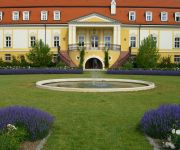
Chateau Bela
Videos from this area
These are videos related to the place based on their proximity to this place.
Végh Zsuzsi népdalénekes október 6-án | Nyergesújfalu
2014. október 6-án csendes gyertyagyújtással tisztelegtünk a 13. vértanú emléke előtt Nyergesújfalun.
Végh Zsuzsi éneke június 4-én a Nemzeti Összetartozás Napján
Június 4-én megemlékezést tartott Nyergesújfalu Város Önkormányzata a Pro Patria Emlékműnél a trianoni békediktátum évfordulóján, a Nemzeti Összetartozás Napján. Végh Zsuzsi...
Monszun szeptember 12-én is Sárisápon
A szeszélyes időjárás a nyár után szeptemberben is folytatódik. Nyár alig volt, szép ősz egyelőre nincs. Eső, még nagyobb eső csak az van...
CÉCÓ együttes | 25 éves a város
Június 15-én vasárnap este a CÉCÓ együttes muzsikált az esemény zárásaként a színpadon.
Videos provided by Youtube are under the copyright of their owners.
Attractions and noteworthy things
Distances are based on the centre of the city/town and sightseeing location. This list contains brief abstracts about monuments, holiday activities, national parcs, museums, organisations and more from the area as well as interesting facts about the region itself. Where available, you'll find the corresponding homepage. Otherwise the related wikipedia article.
Ľubá
Ľubá is a village and municipality in the Nové Zámky District in the Nitra Region of south-west Slovakia.
Šarkan
Šarkan is a village and municipality in the Nové Zámky District in the Nitra Region of south-west Slovakia.


